


Specification
Features
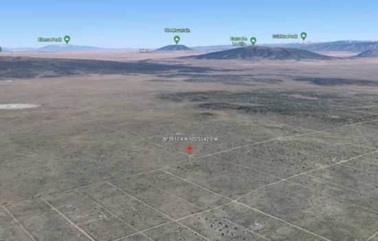
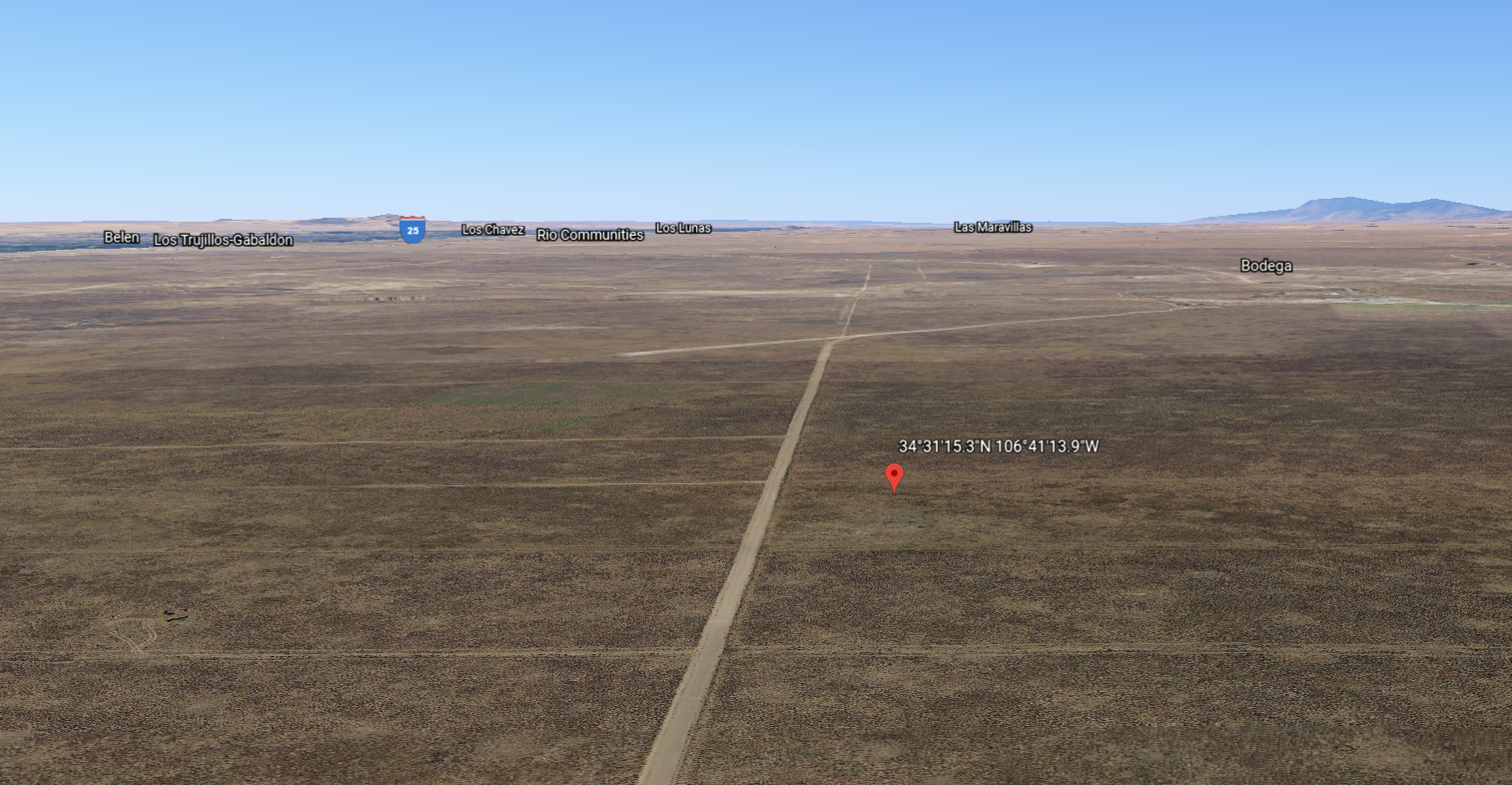
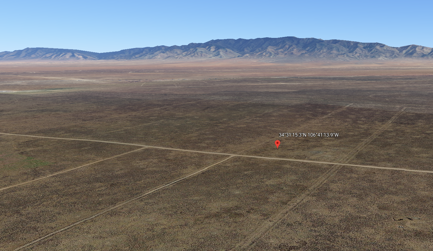
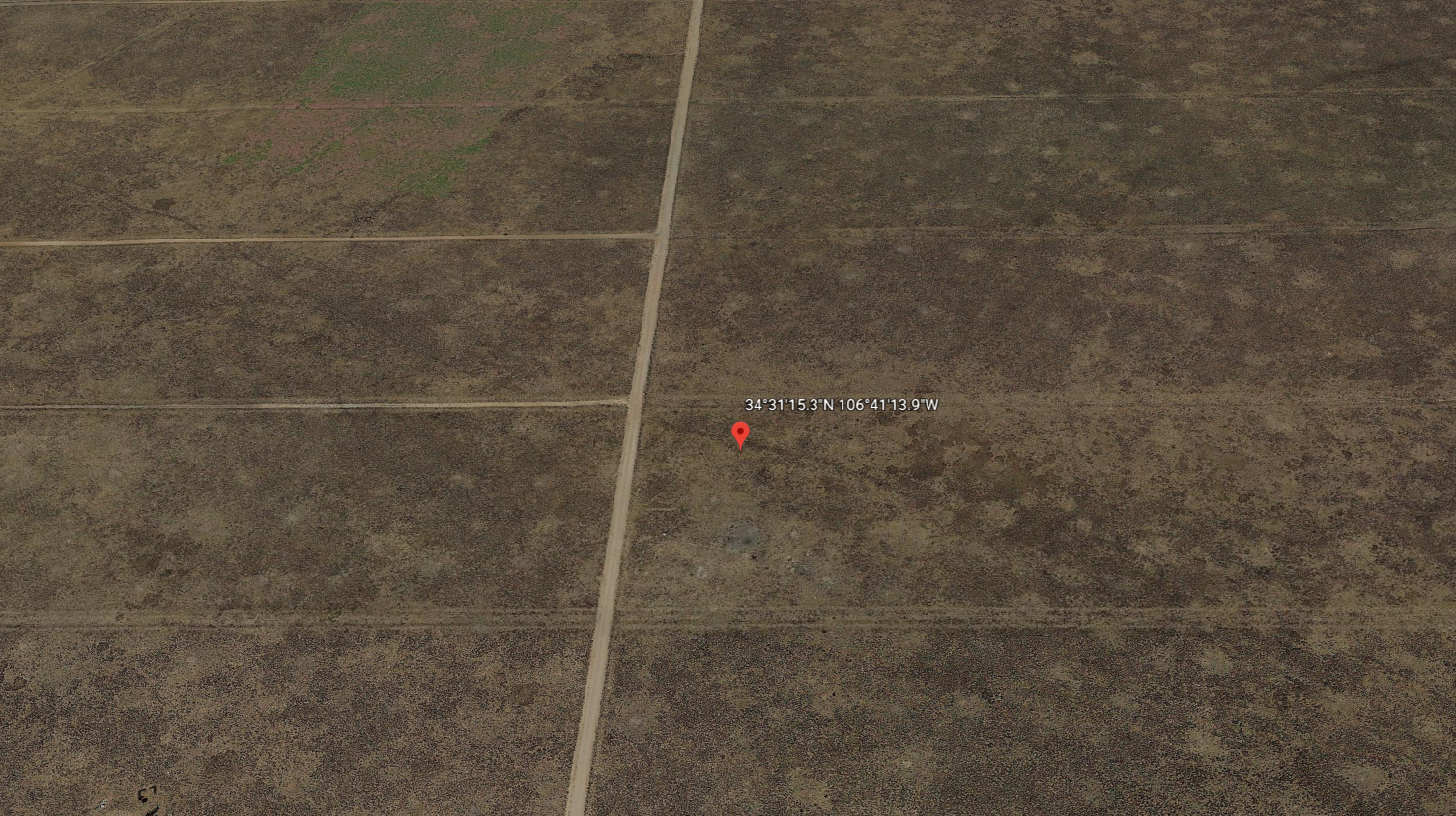
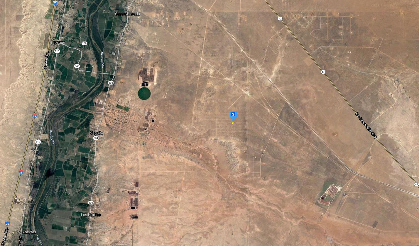
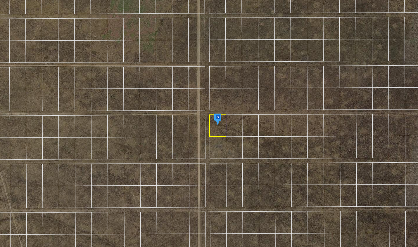
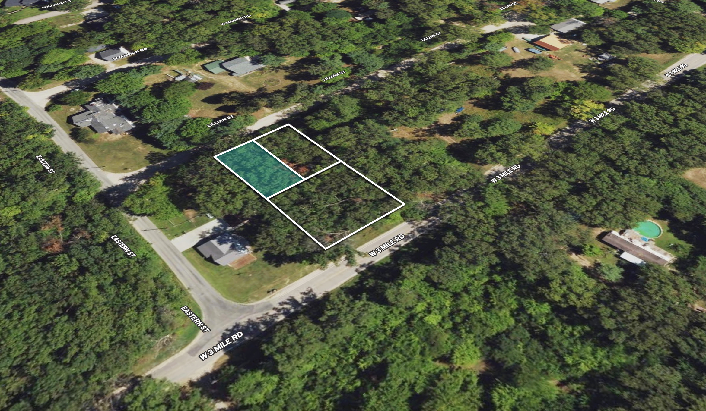
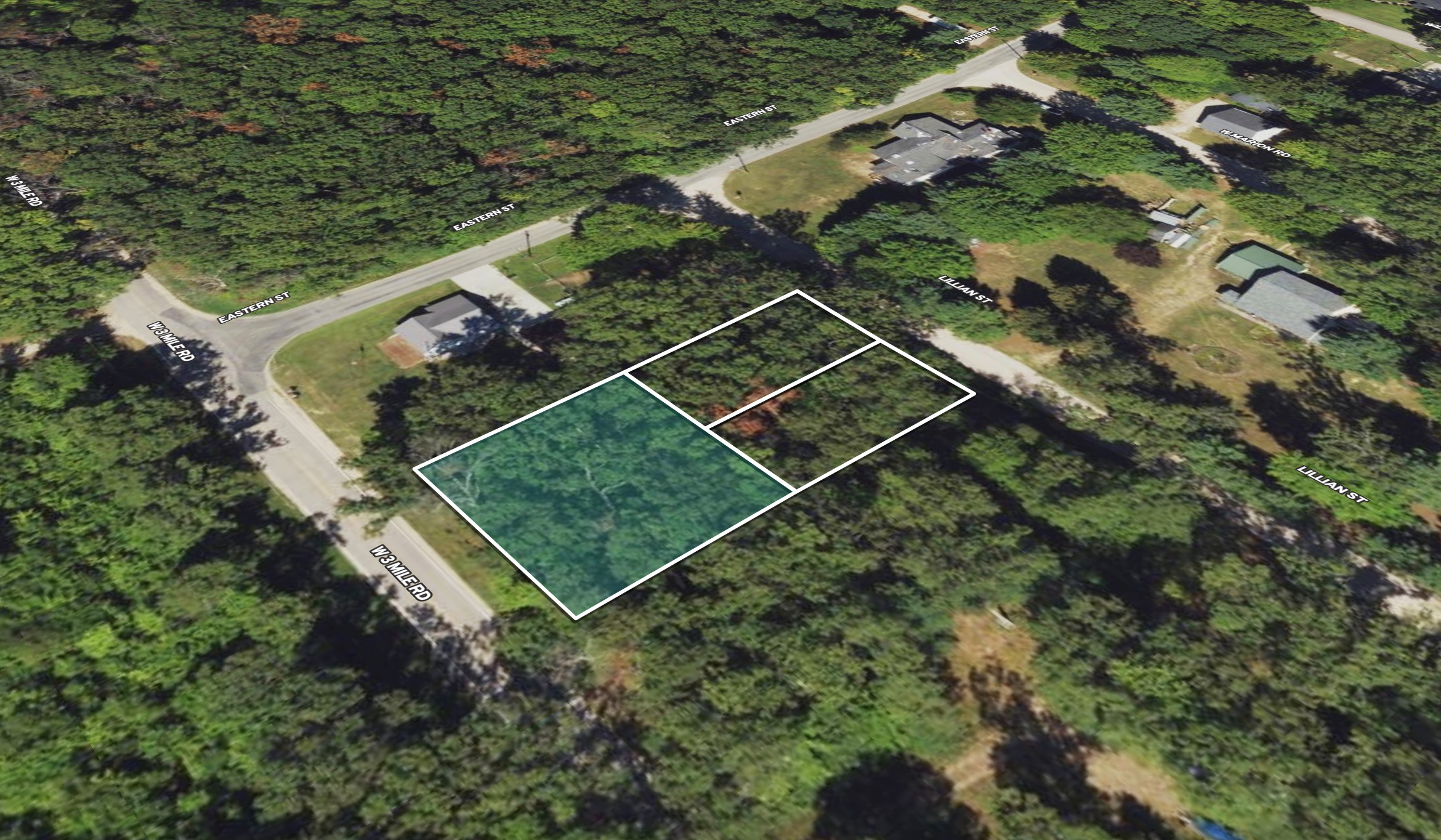
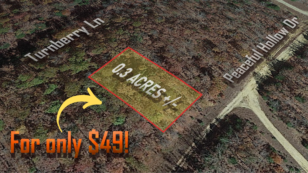
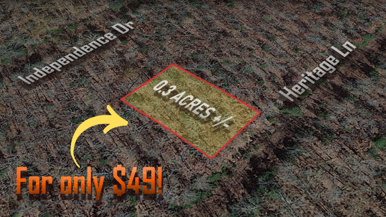
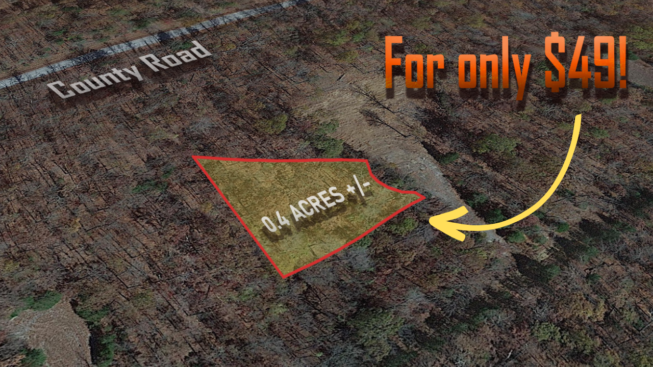
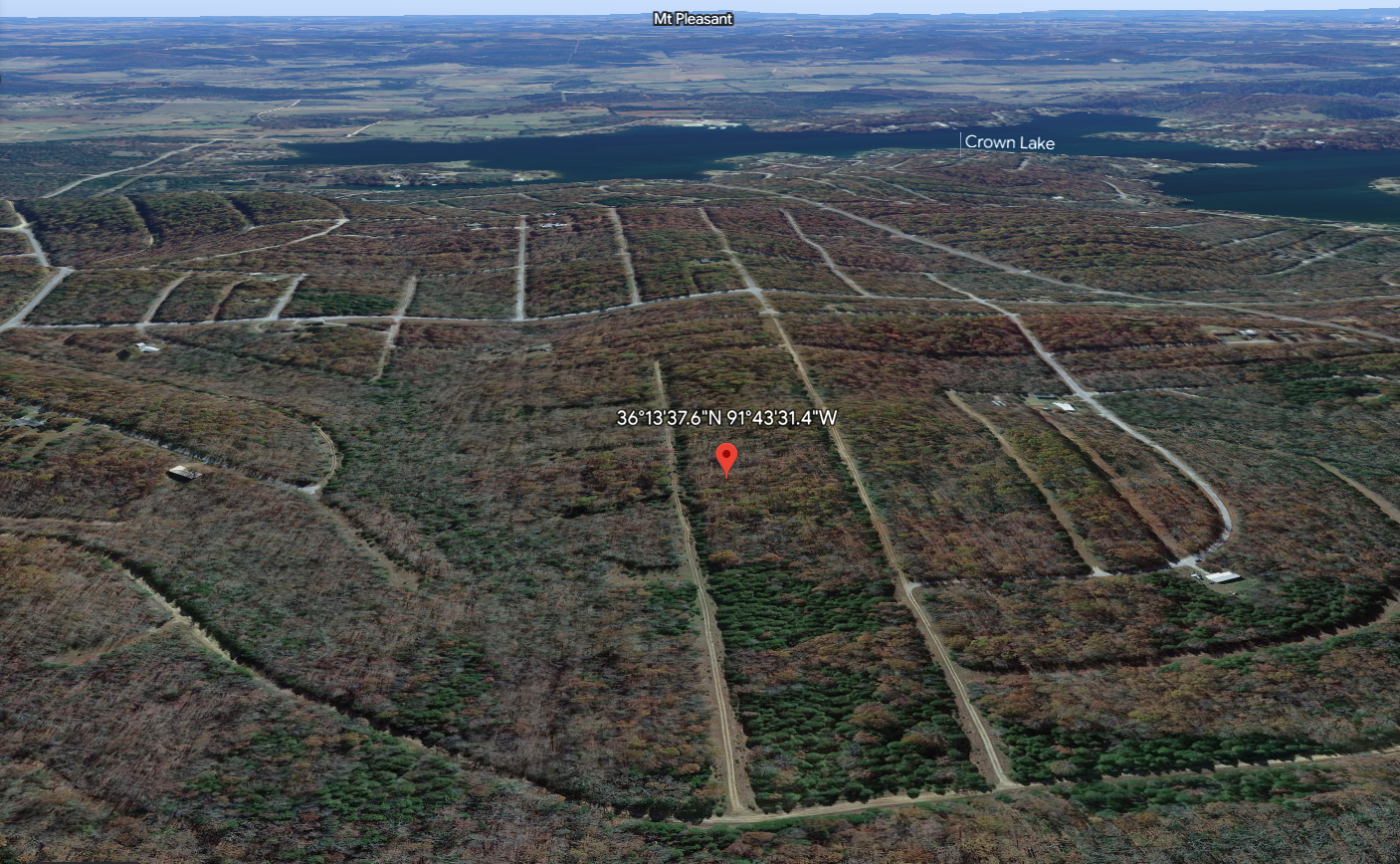
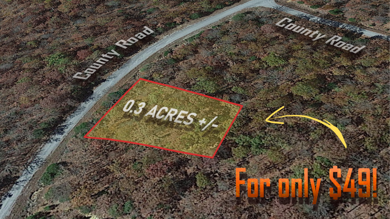
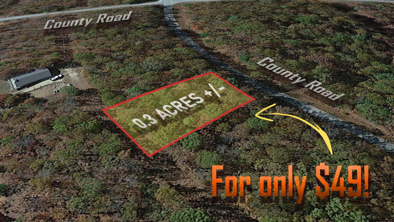
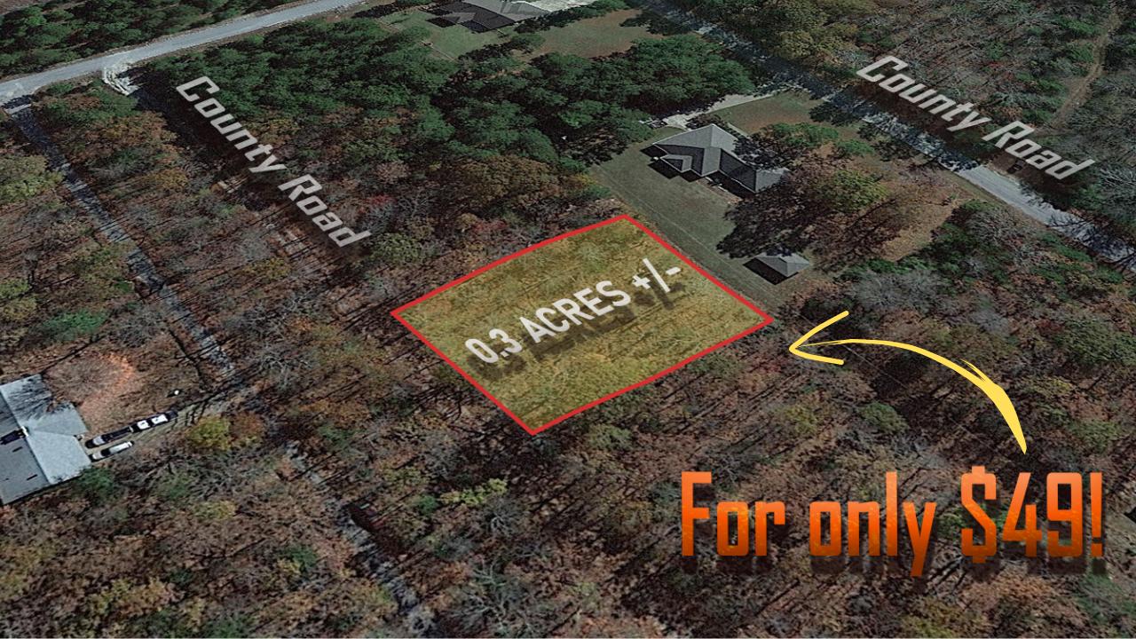
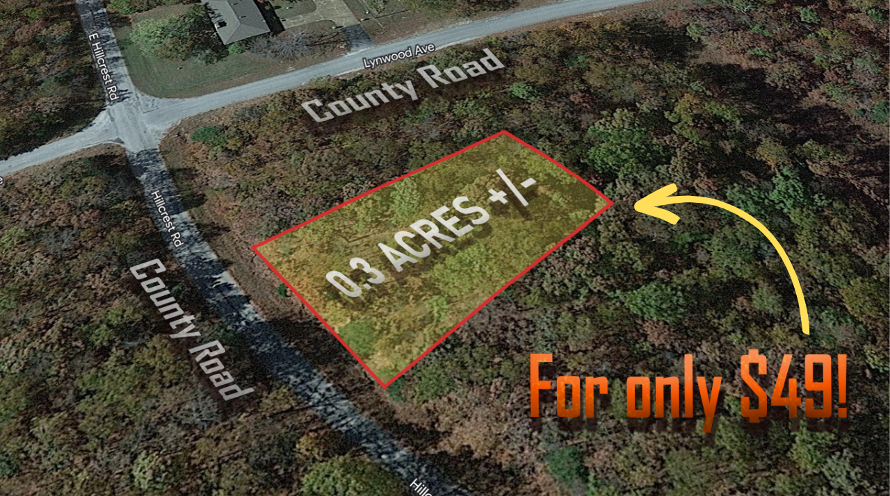
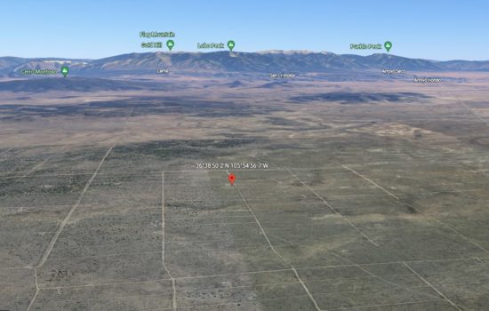
Location
Description
PAYMENT NOTE(S)
$49 down and $125/mo for 30months + $249 Doc Prep Fee
DESCRIPTION
How To Buy This Property:
Click the “Reserve Now” button above to pay the down payment and document preparation fee on this property.
During the “check out” procedure, you will be prompted to provide your name as you want it on the paperwork as well as your address, etc.
Within two business days you will receive a Purchase Agreement, Contract for Deed (Land Contract), and Promissory Note in your email via SignNow, an online document signing service. You can “sign” electronically on your computer or phone.
Any questions of what you can or cannot build, can or cannot do on the property should be directed to the county Planning and Zoning Department.
Everything I know about the property is listed here. The information provided is deemed reliable but not guaranteed. Please do your own due diligence. All property is sold as-is, where-is.
The down payment and document fee is non-refundable, so please be certain the property and terms will suit your needs BEFORE making your payment.
For more information, you can read our FAQ’s here.
My company, The Land Pioneer is family owned and operated. We are proud to have a 4.7/5 Star Rating, you can read our customer reviews here.
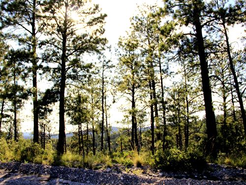
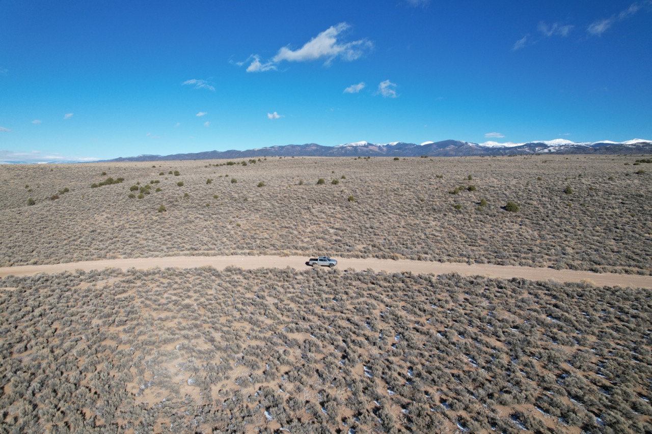
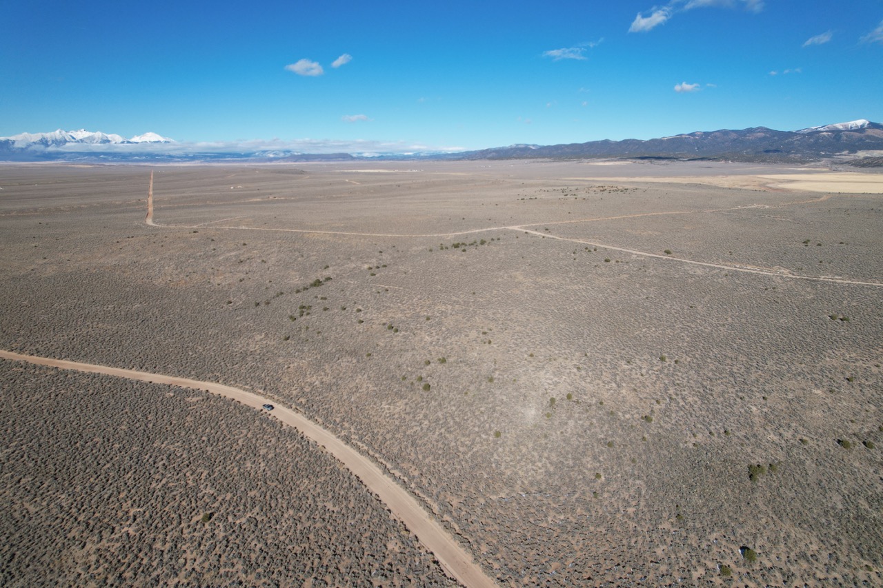
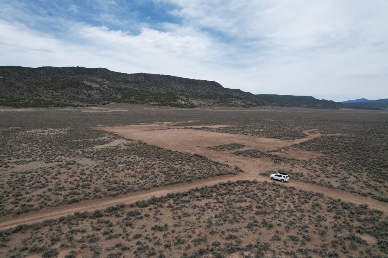
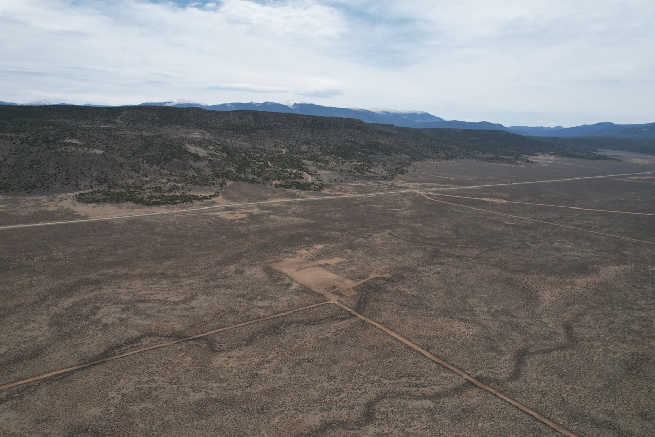
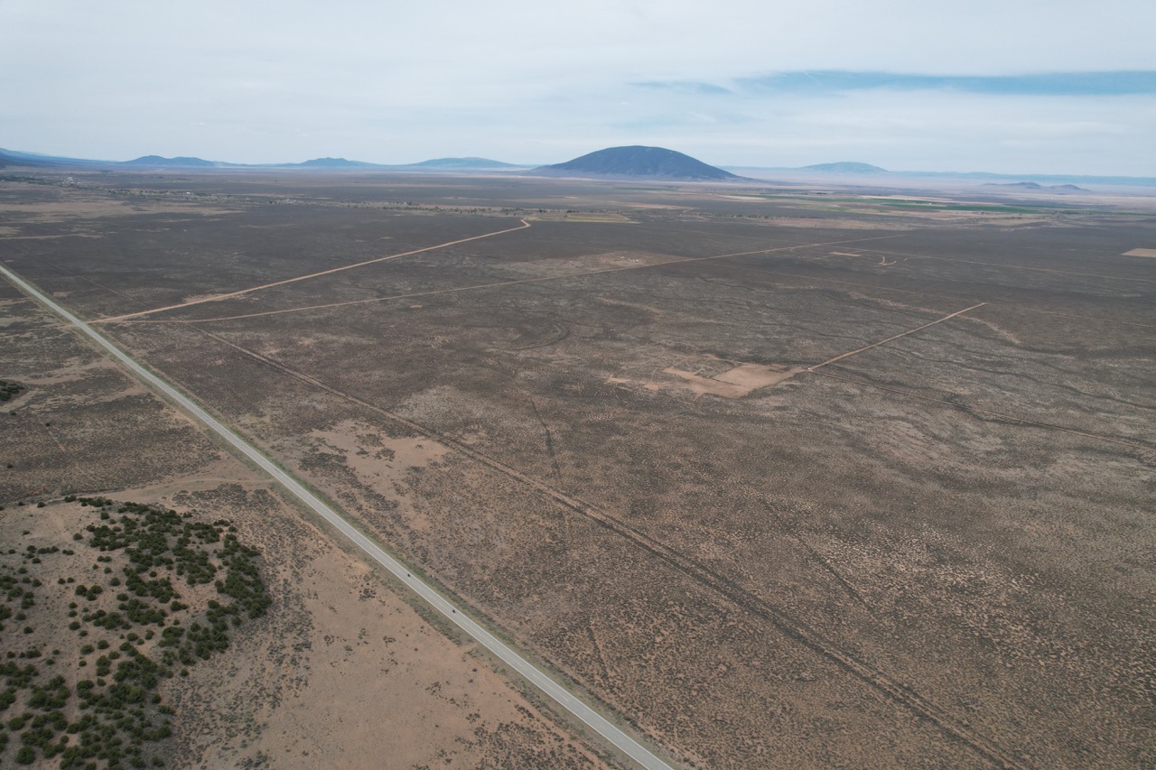
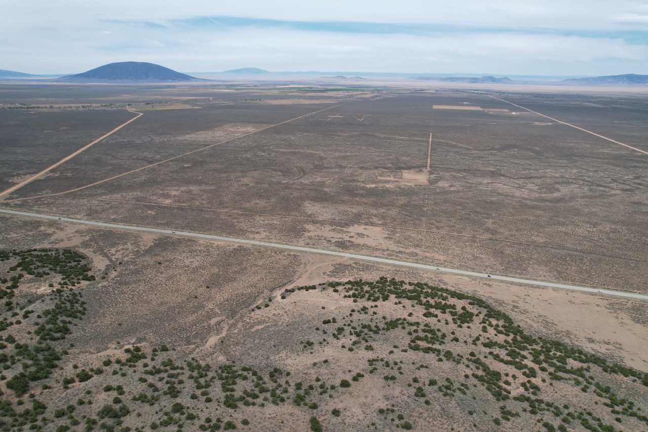
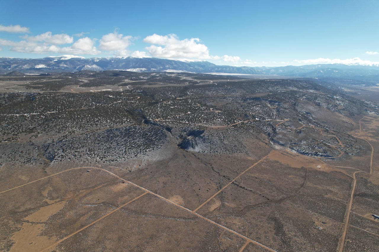
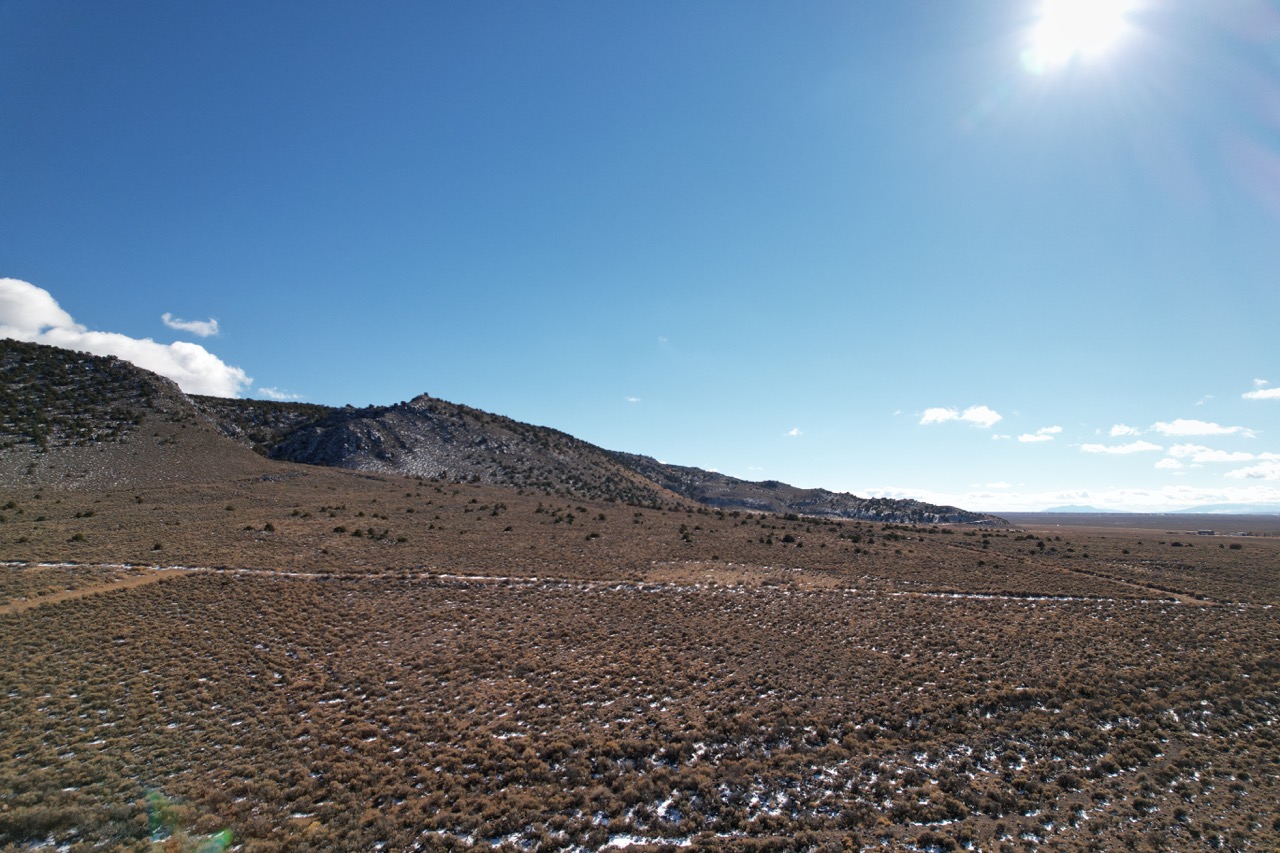
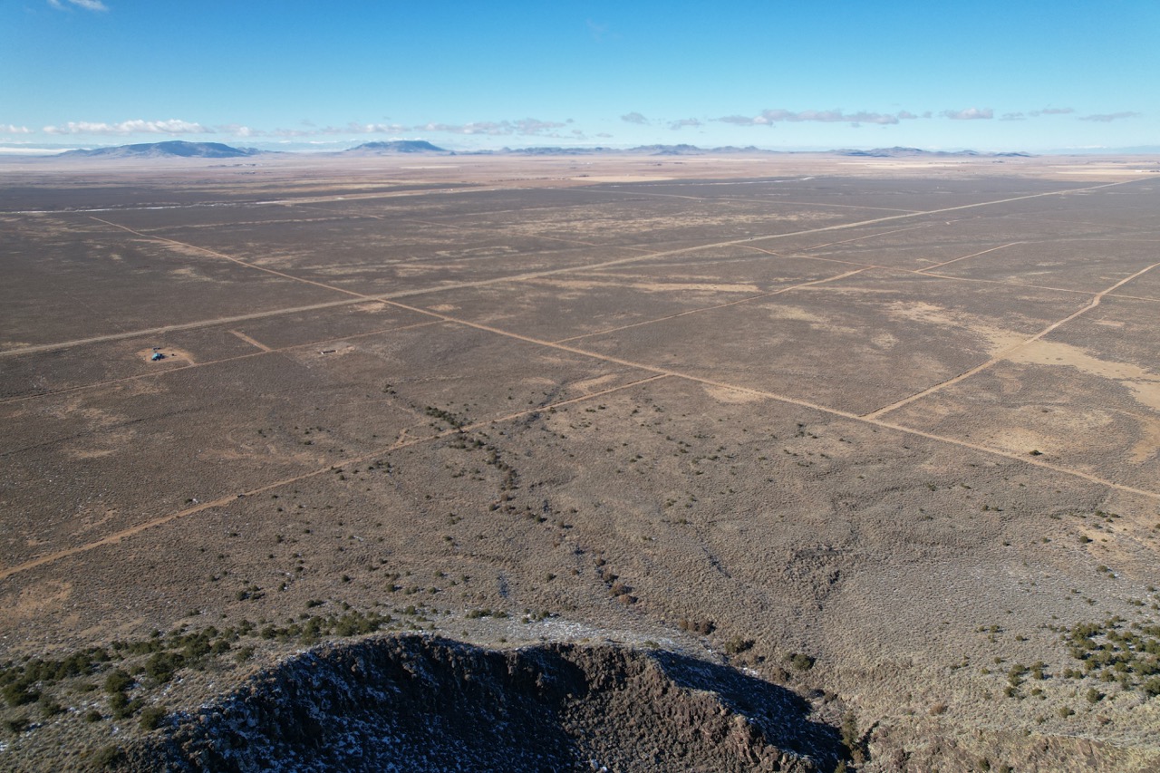
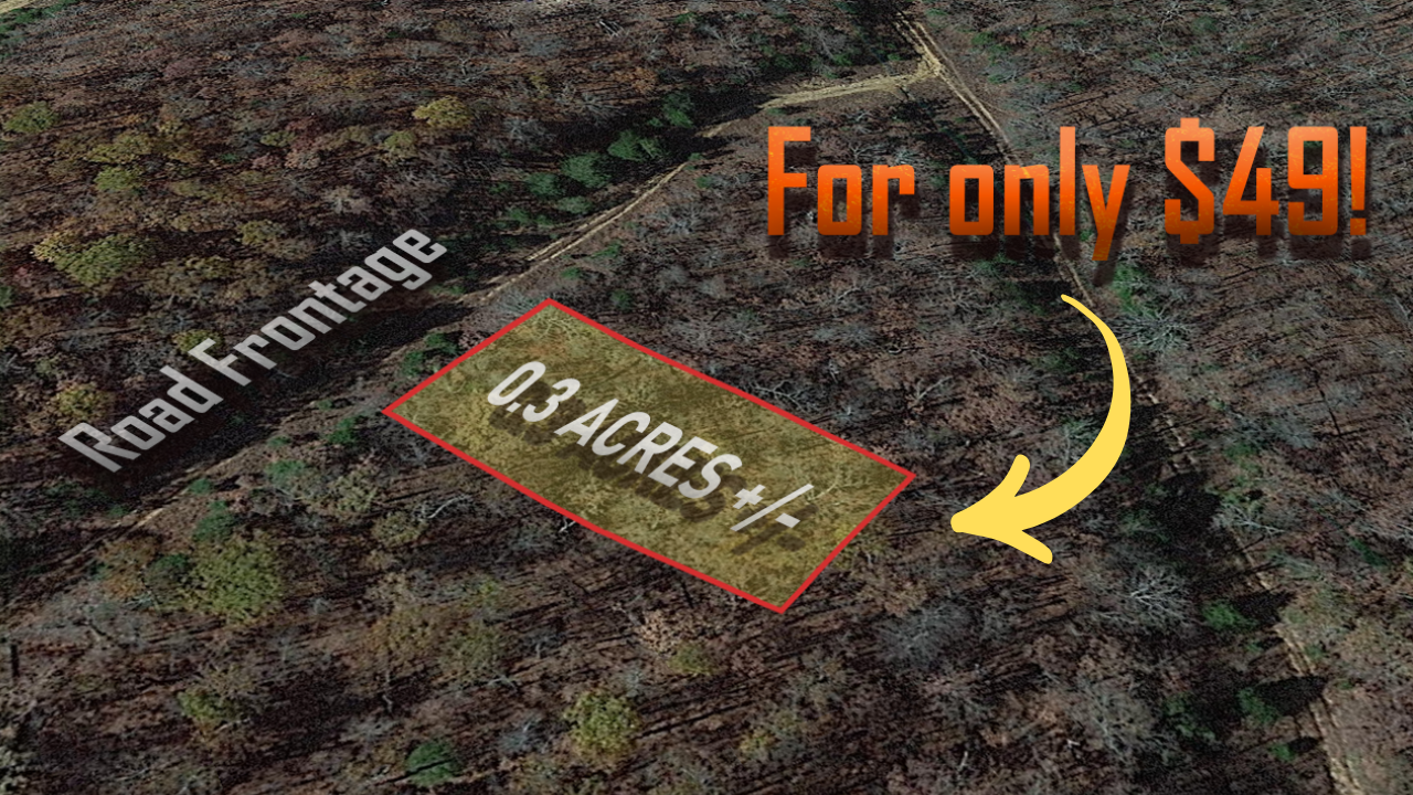
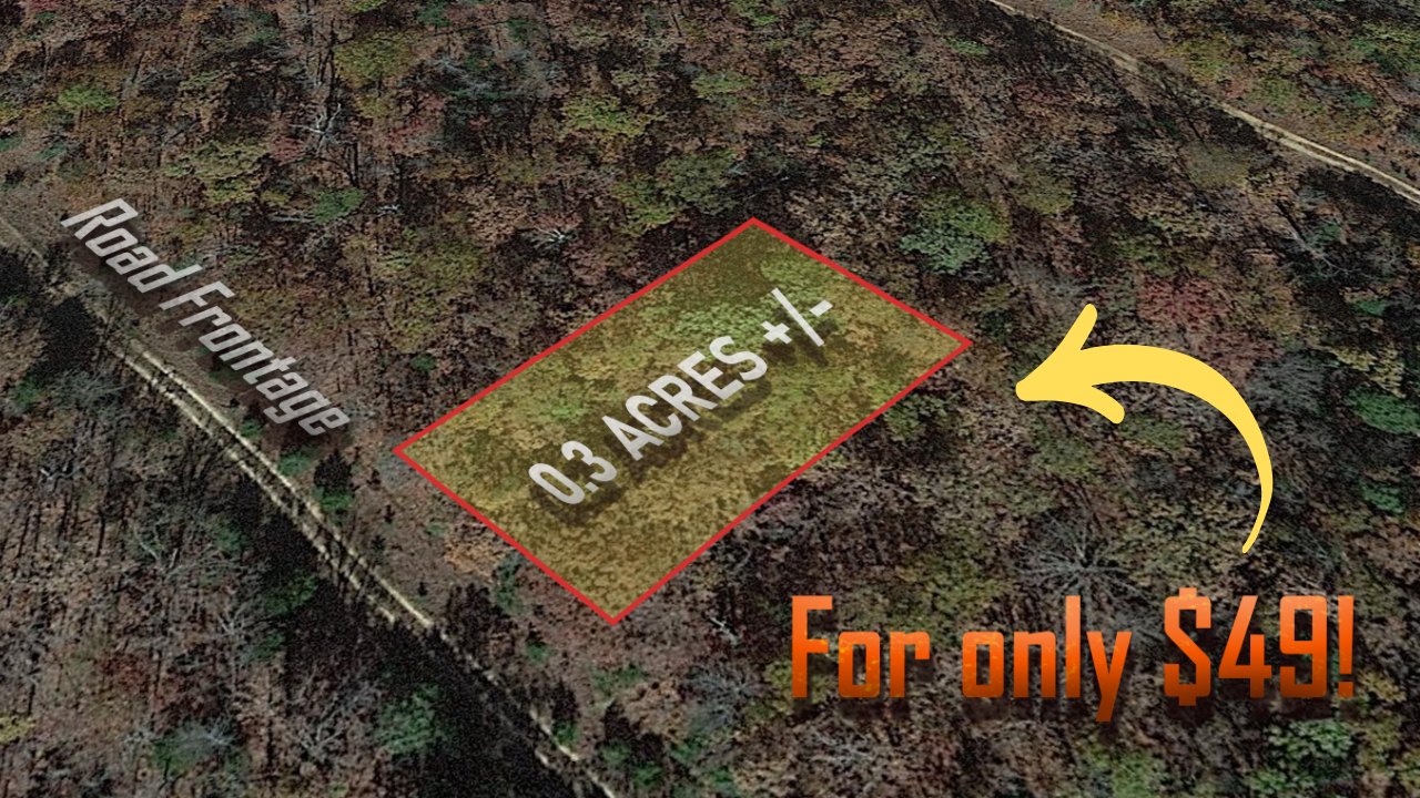
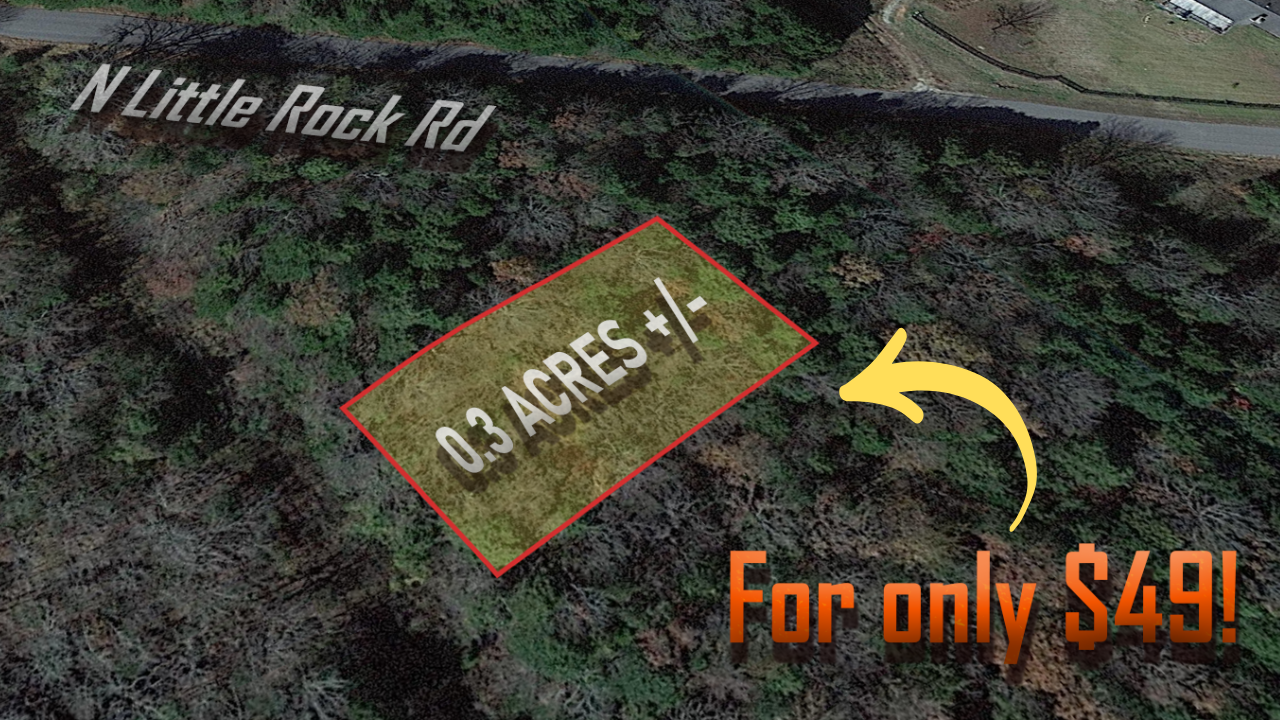
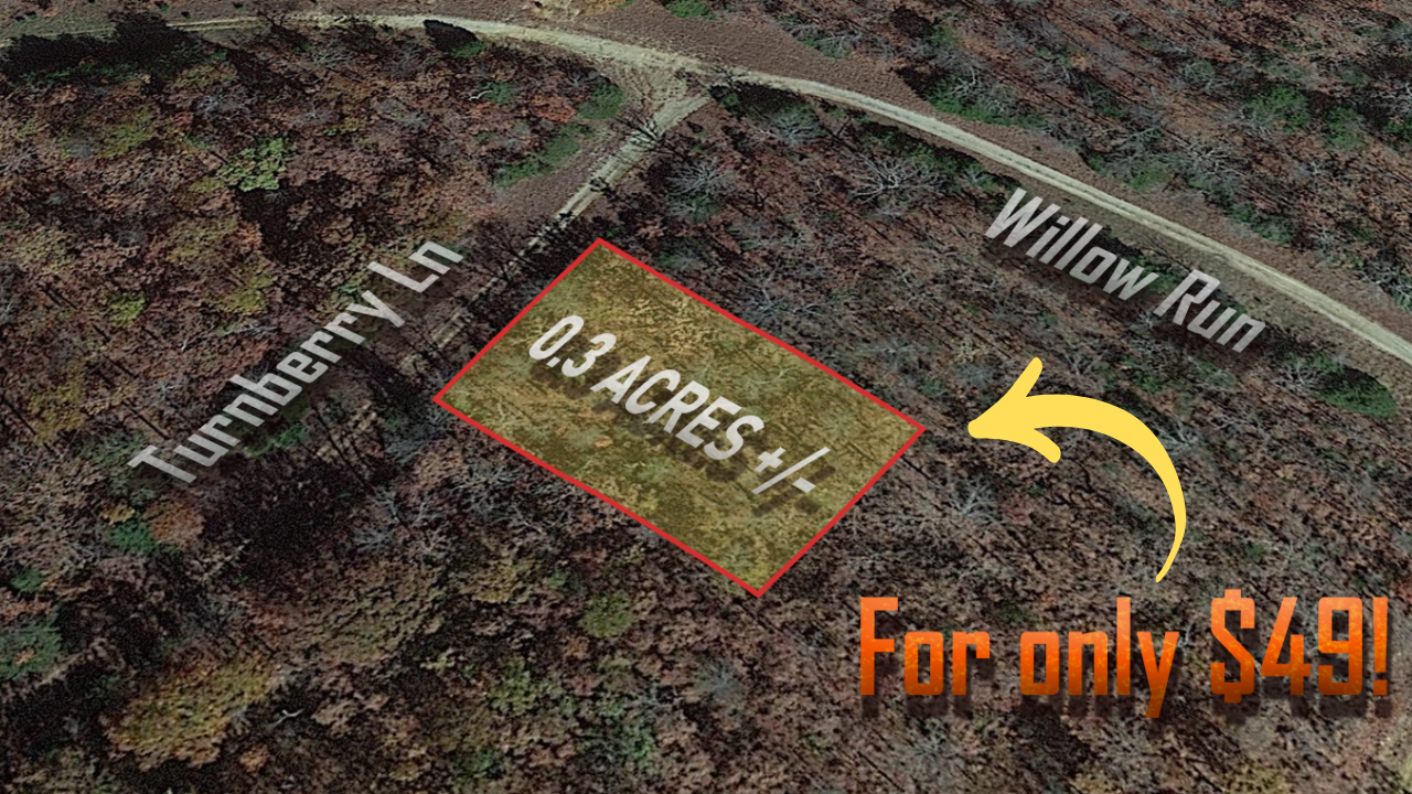
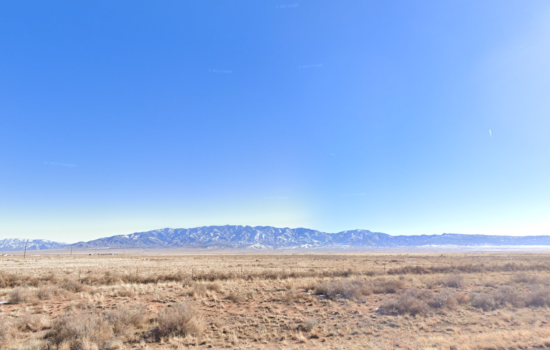
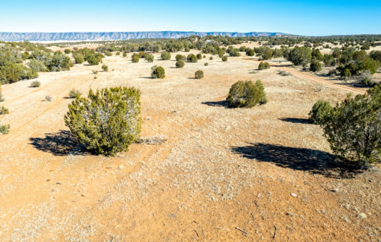
This fantastic 1-acre property is in Valencia County, NM, close to the town of Belen. To build, you need a full acre, this makes this parcel an incredible investment, as most lots are less than 1 acre in the area.
Best part is, you can own this lot for $49 down and $125/mo for 30 months, or you can buy it outright for $2,500.(+ $249 Doc Prep Fee)
We’ve also temporarily waived our $249 document prep fee on this property…
Watch more details here at: https://youtu.be/76hlkZCu_rM
Belen and Valencia County are expanding rapidly. Valencia County’s population has grown an incredible 46% in the last 10 years alone, and this area is rapidly growing in value and popularity.
The Rio Communities are currently the last large vacant tract of land in the area and have easy access. Inevitably, growth is coming this way! Earlier this year, Facebook began operations in the first building for its newest tech facility. By 2023, five other buildings will complete the campus, along with bringing hundreds of new jobs to the area.This area is described as “a small community with big possibilities”. Besides FB’s new campus, another alluring institution in the area is the University of New Mexico- Valencia Campus.
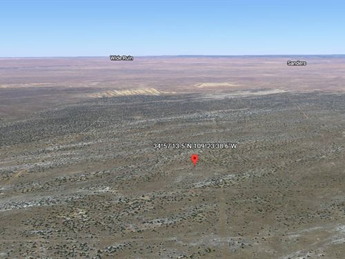
Coordinates: 34.5209175,-106.6872003
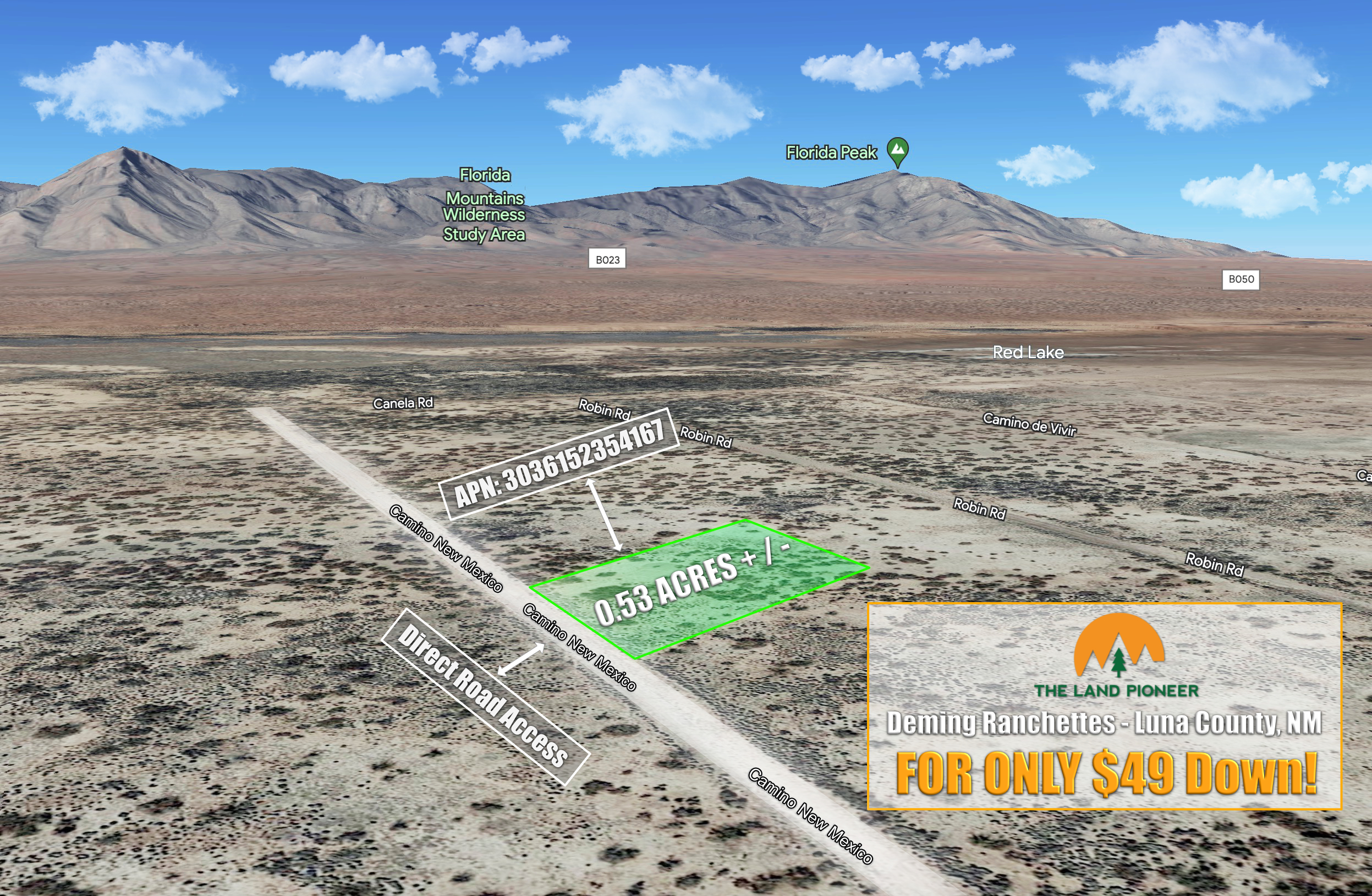
APN: 1-012-018-347-503-100110
Legal Description: Subd: RIO GRANDE ESTATES Lot: 1 Block: 323 Unit: 14 1.00 AC.
Taxes $4.80.
Lot Size: 1 Acre
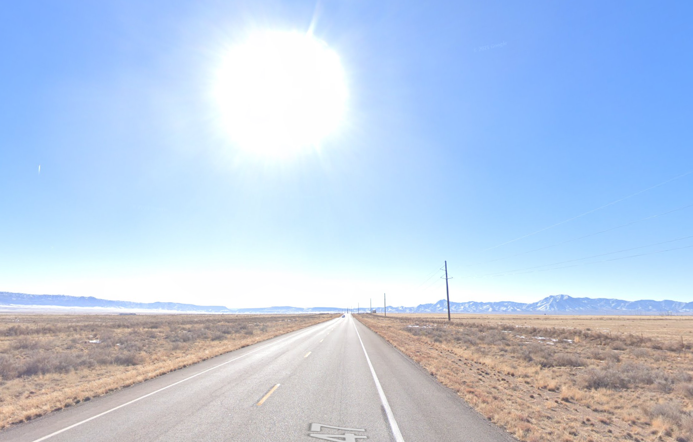
Road Type: Dirt
Electric: Solar Off Grid
Water: Needs Well
Sewer or Septic? Needs Septic
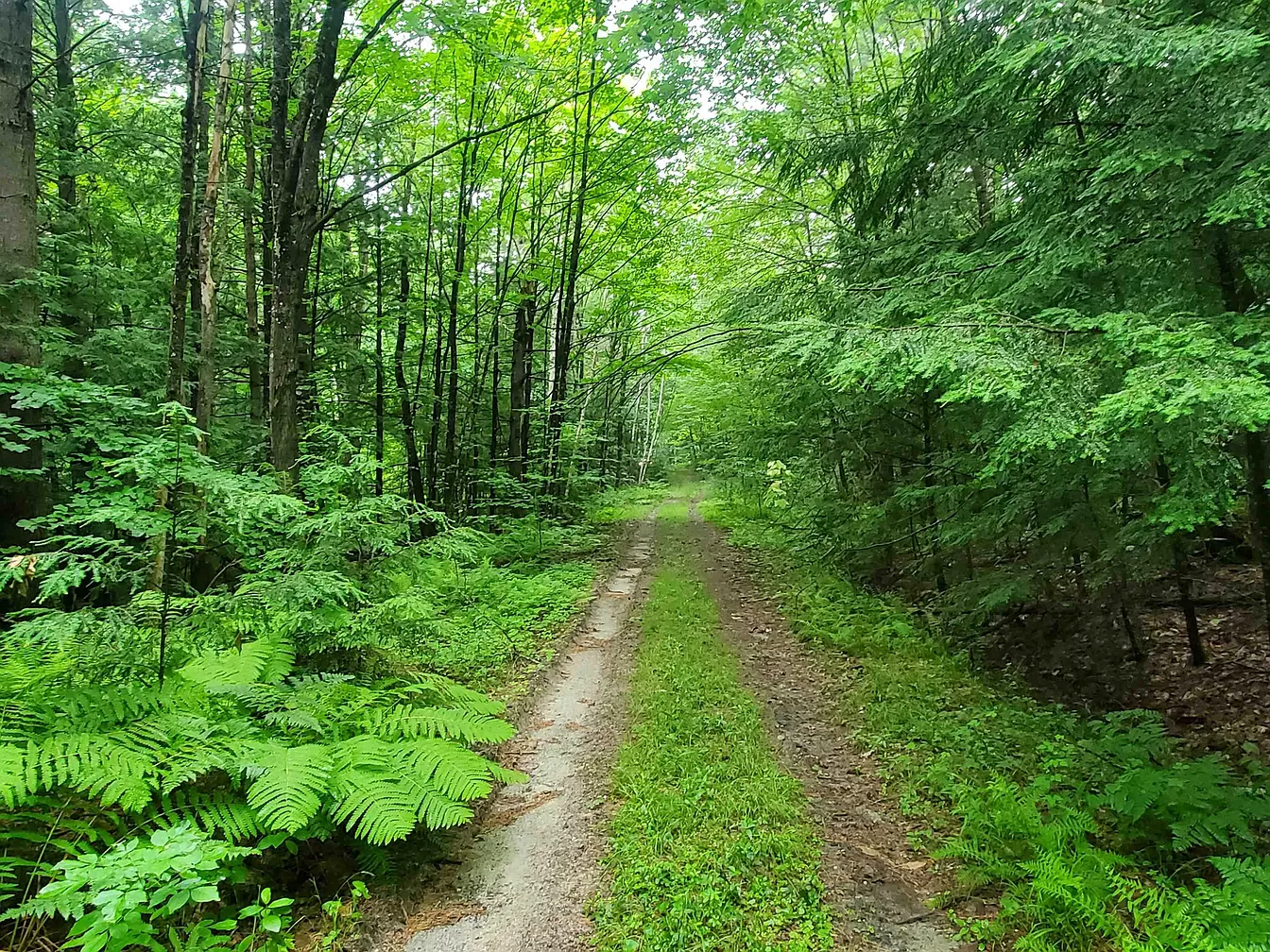
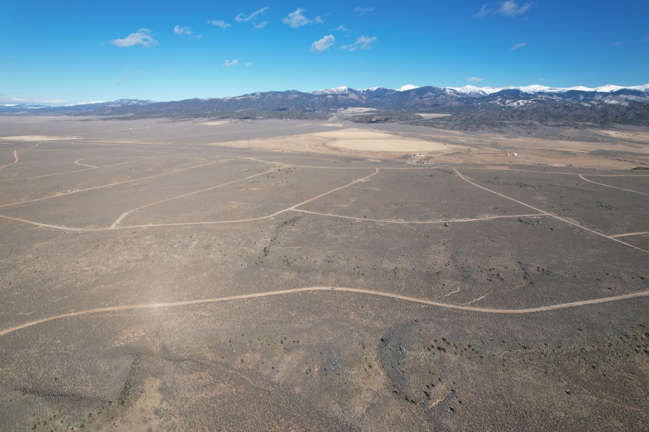
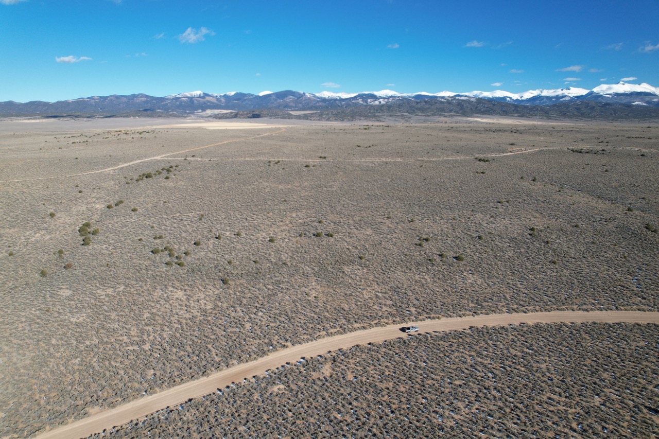
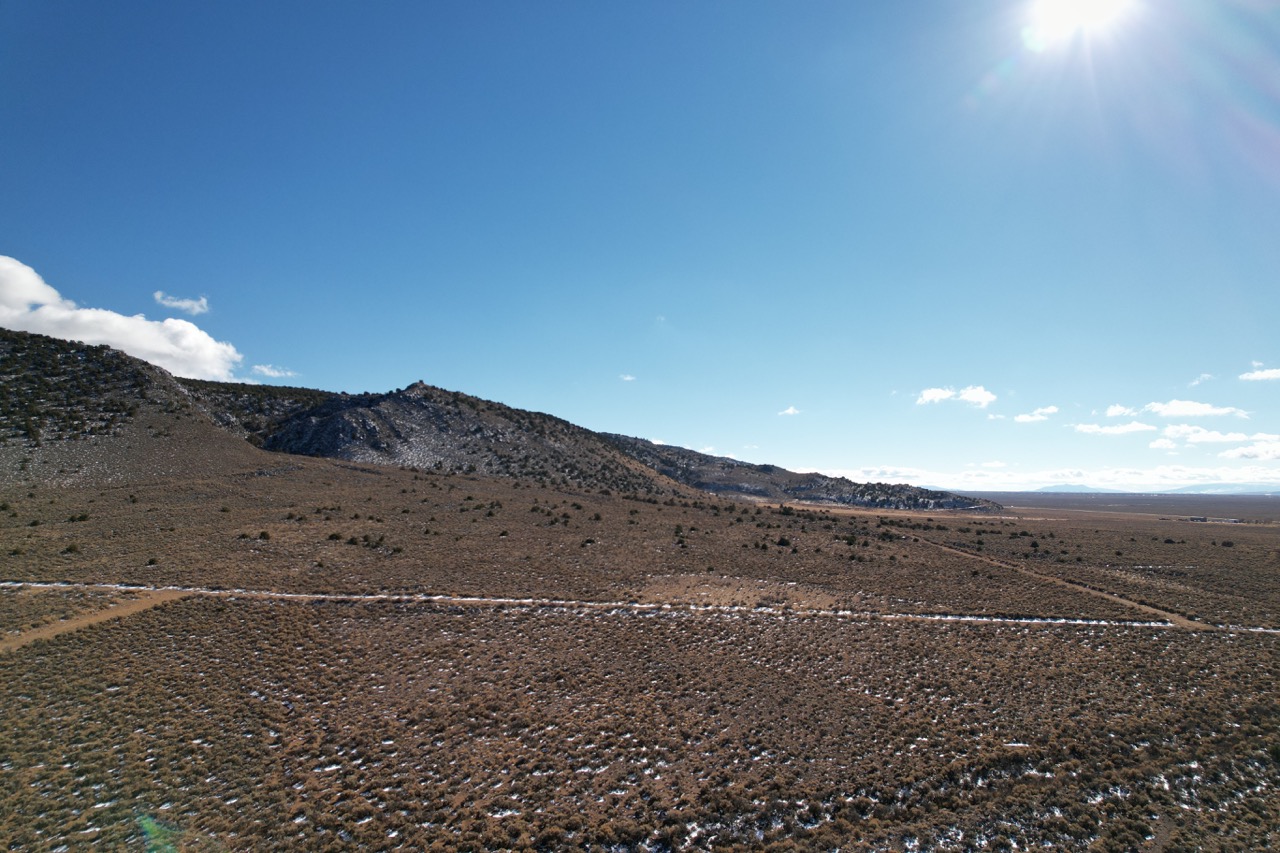
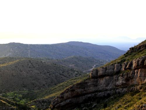
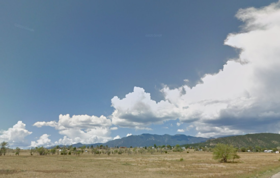
Some of these photos are from the surrounding area
DISCLAIMER: Any information provided in this communication is believed to be accurate, but in no way guaranteed. Buyer is responsible for verifying all information with the County as to what can and can’t be done with the property. Buyer will need to work with the County to obtain the proper permits if needed. Buyer will also need to confirm the availability of any utilities needed or serviced on the property. Seller makes no warranties or representations about the land, its condition, or what can be built on the property. If/when you visit any of our properties, you are visiting at your own risk and release TLP – The Land Pioneer (and anyone associated) from any and all claims or liabilities.
Virtual Tour
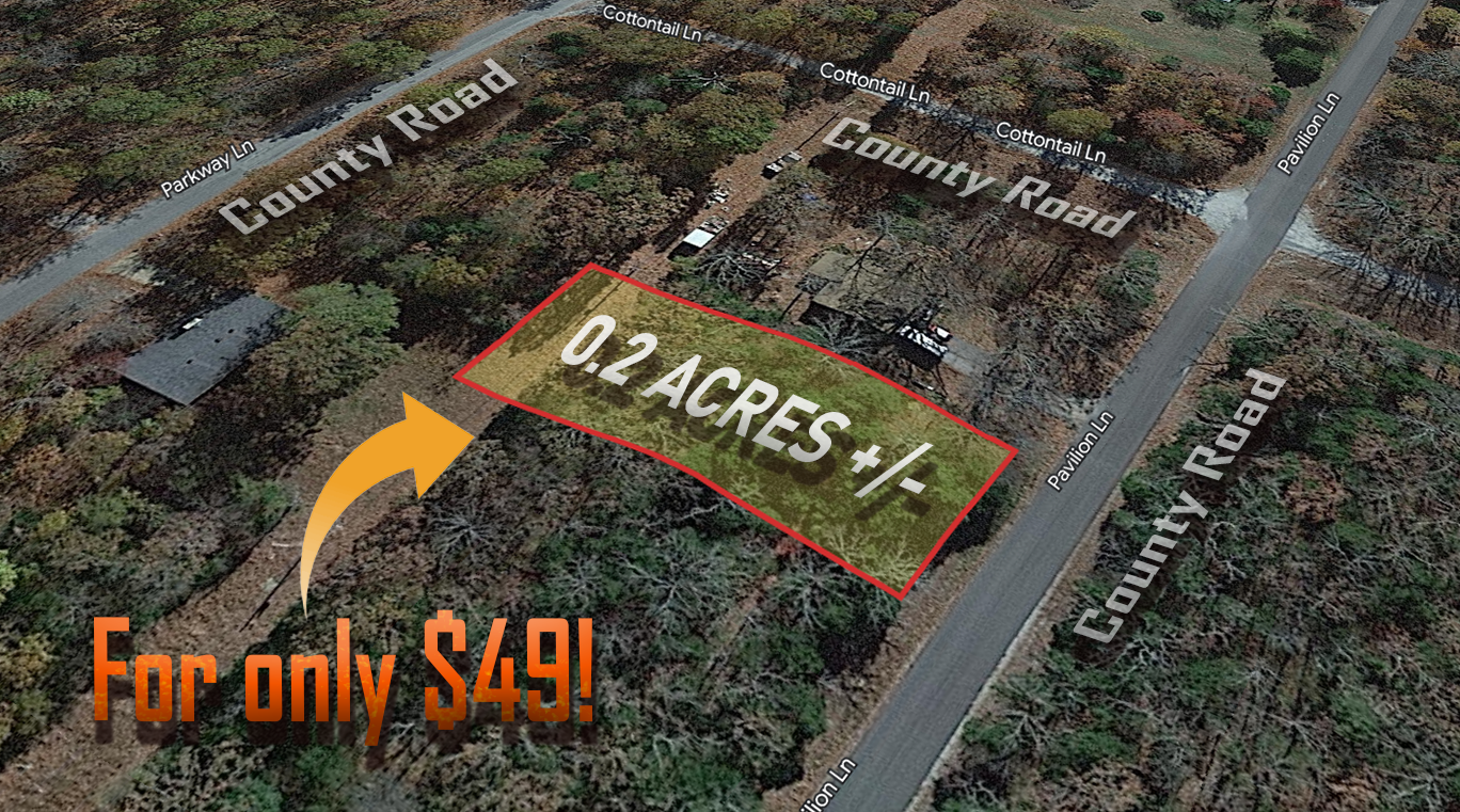
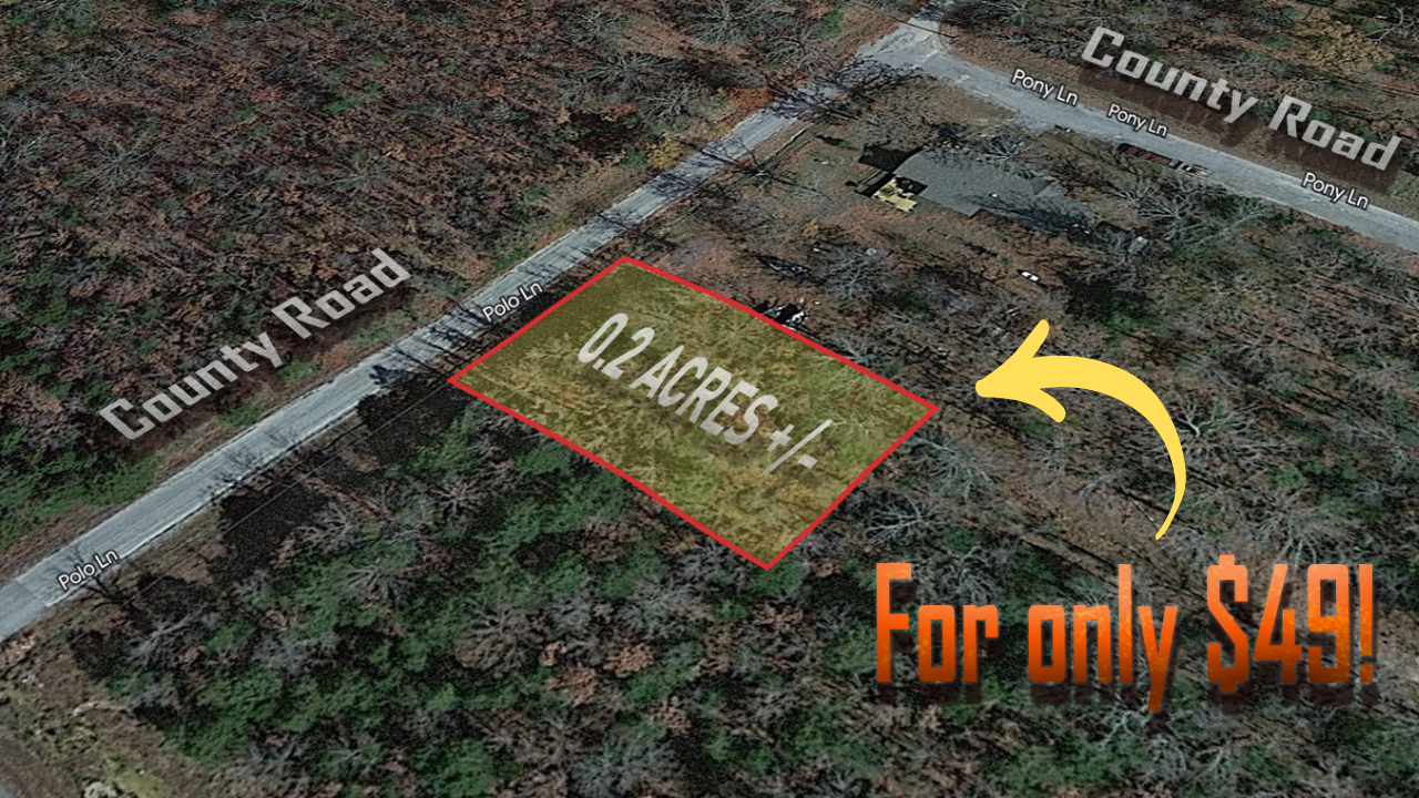
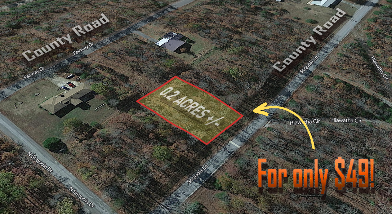
0.21 Acres in the Growing Community of Rayburn Country, Brookeland, TX

0.2 Acres in the Growing Community of Rayburn Country, Brookeland, TX
Discover Your Slice of Northern Michigan: 0.45-Acre Wooded Lot in Frederic, MI
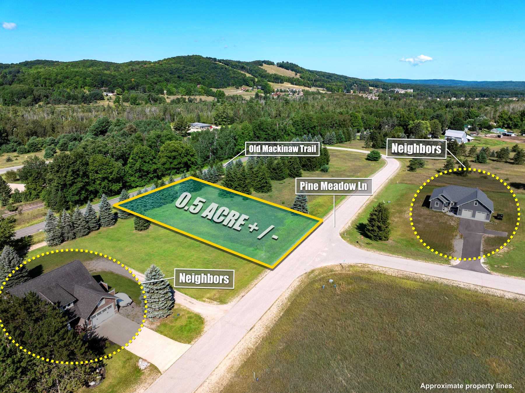
0.5-Acre Residential Lot in Boyne Falls, MI: Enjoy Natural Beauty and Recreation
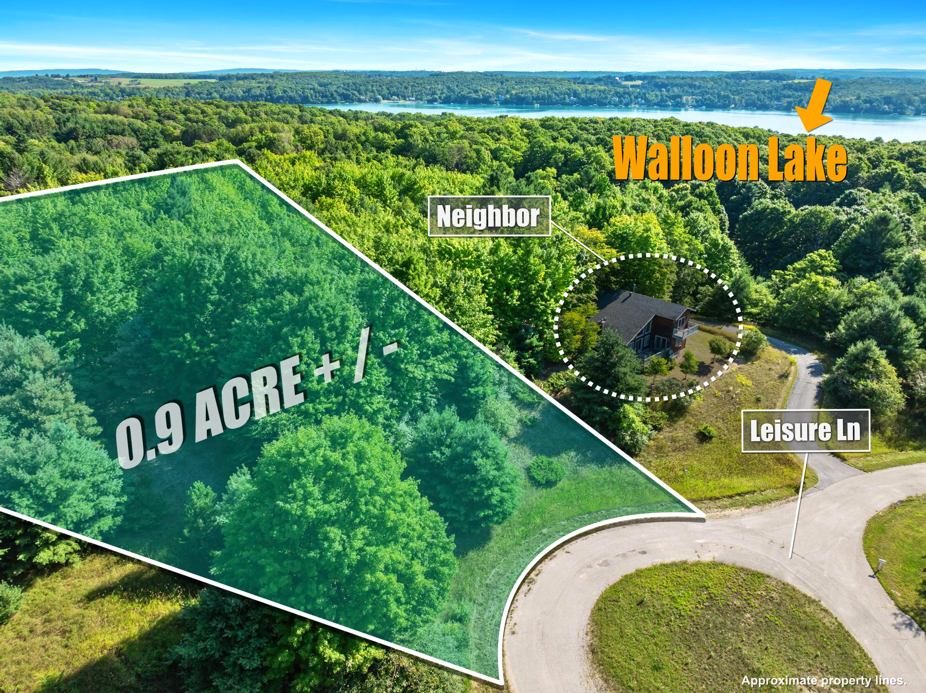
0.9-Acre Residential Lot in Boyne City, MI: Private Wooded Retreat with Lake Access
Lot 105 Off Fish Hatchery Road, Richmond, NH 03470
Don’t wait to buy this 0.251 acres land in New Mexico – these parcels sells quickly – reserve yours today by just putting $49 down
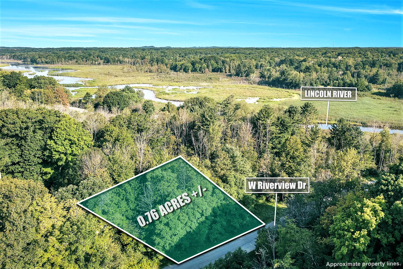
0.76-Acre Lot in Ludington, MI: Build Your Dream Home Minutes from Downtown
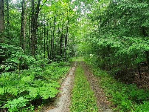
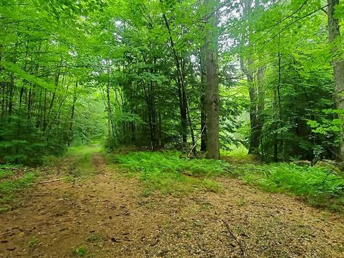
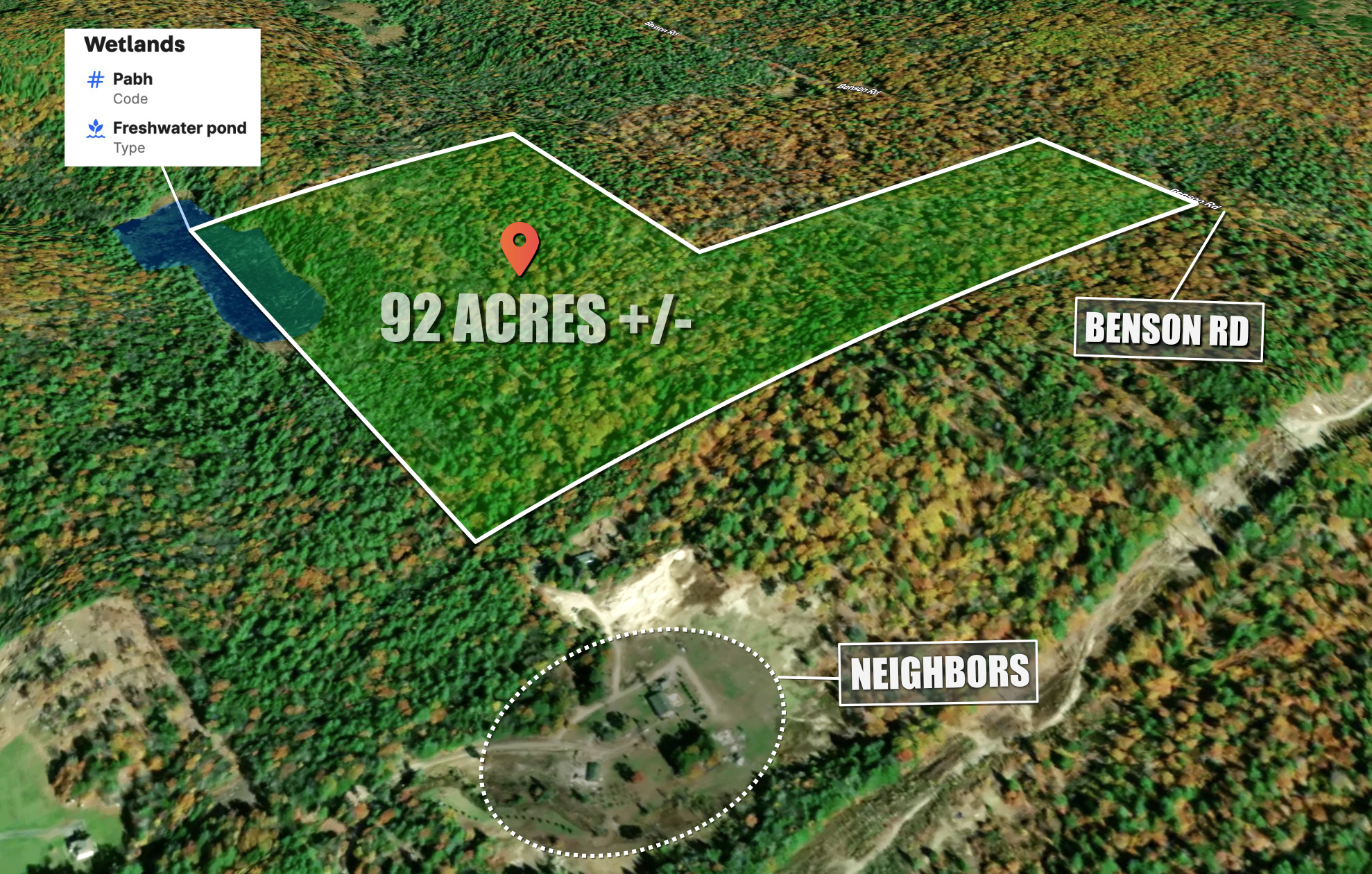
Blackberry (aka Benson) Road, Richmond, NH 03470
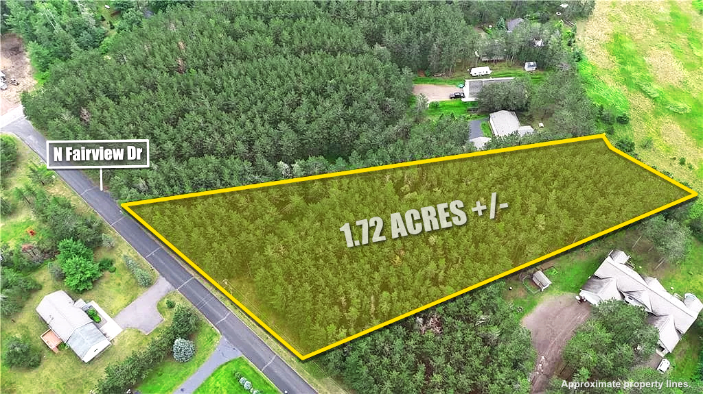
Discover Your Dream Home Site: Prime 1.72-Acre Lot in Hayward, Wisconsin
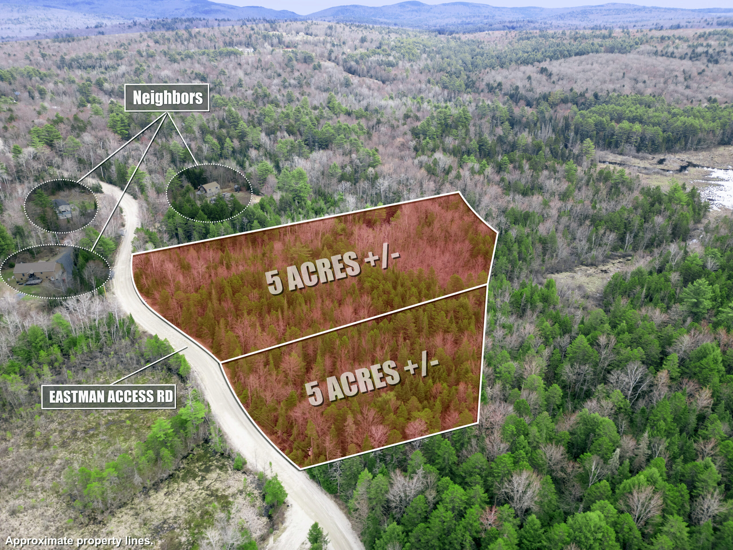
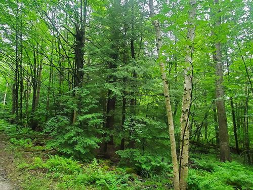
10 acre Lot Eastman Access Road, Sullivan, NH

1.25 acre parcel located in Sun Valley, Arizona for just $49 down.
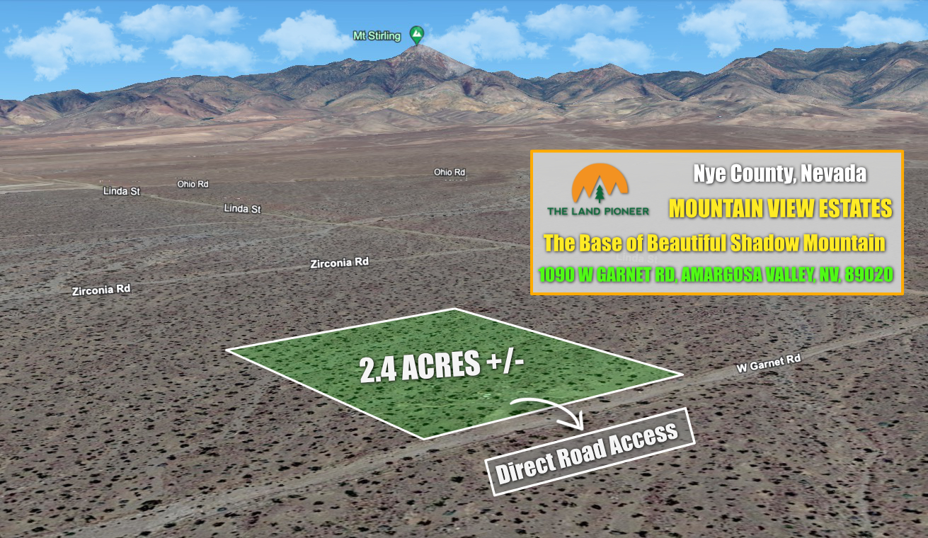
2.4 Acre Investment Property Right Outside of Pahrump For Just $997 Down
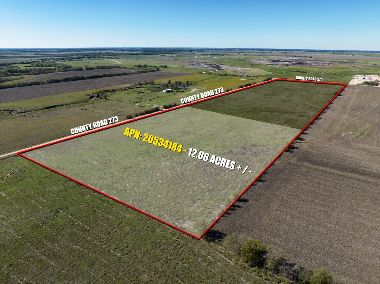
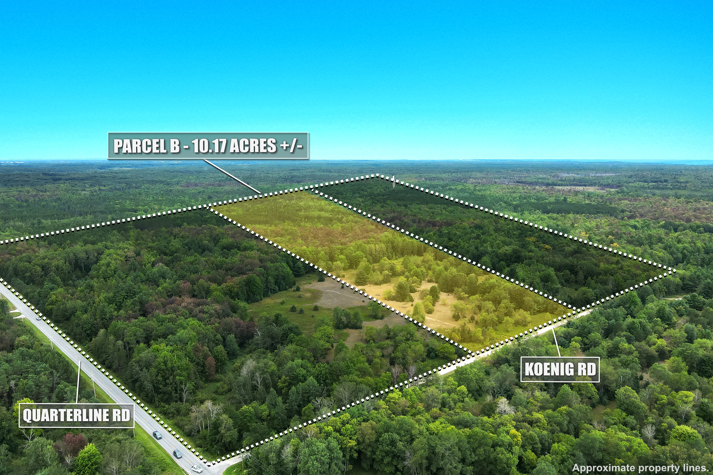
Own This 12.06 Acre Ranchette in Burlington, TX With Just 20% Down
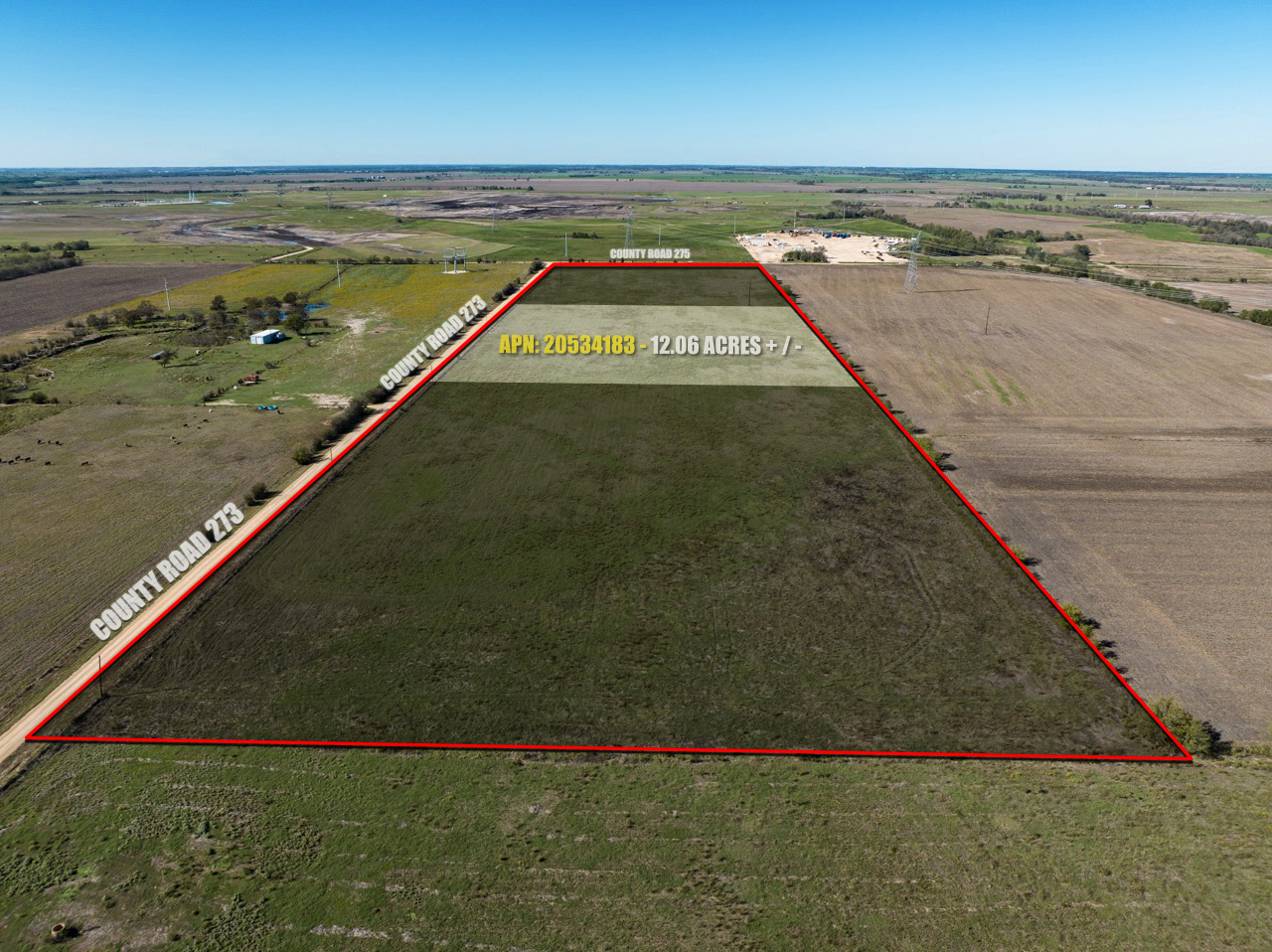
Own This 12.06 Acre Ranchette in Burlington, TX With Just 20% Down
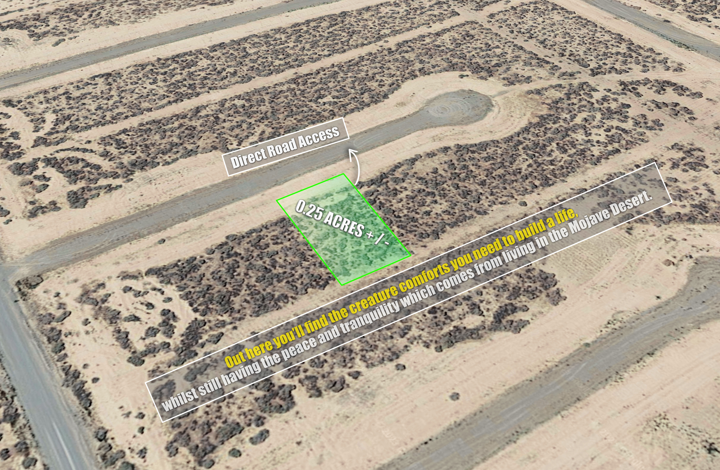
Own This 0.25 Acre Lot in Pahrump, NV For Just $499 Down…
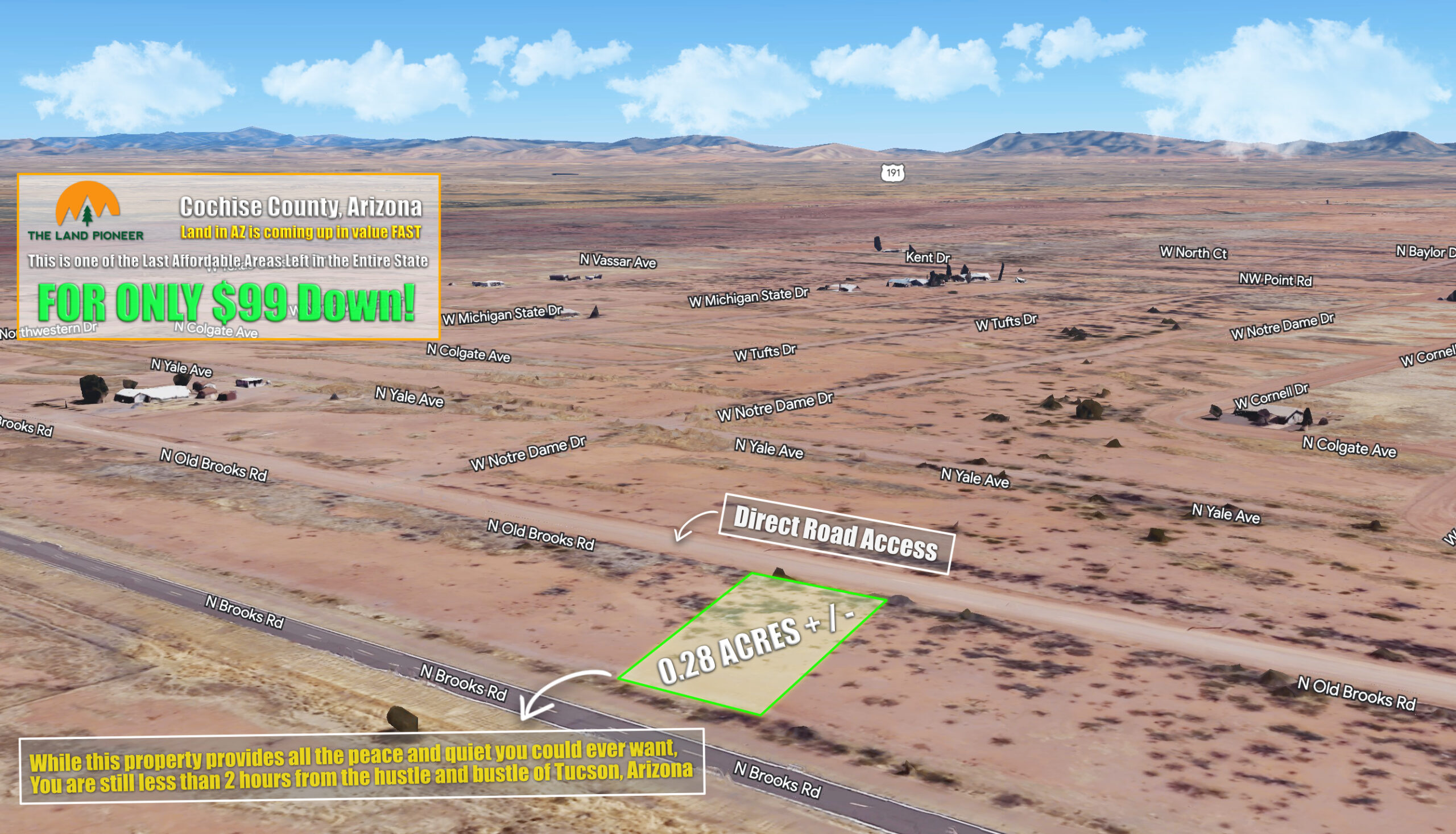
Own this 0.28 Acre Arizona Investment Parcel For Just $99/mo…
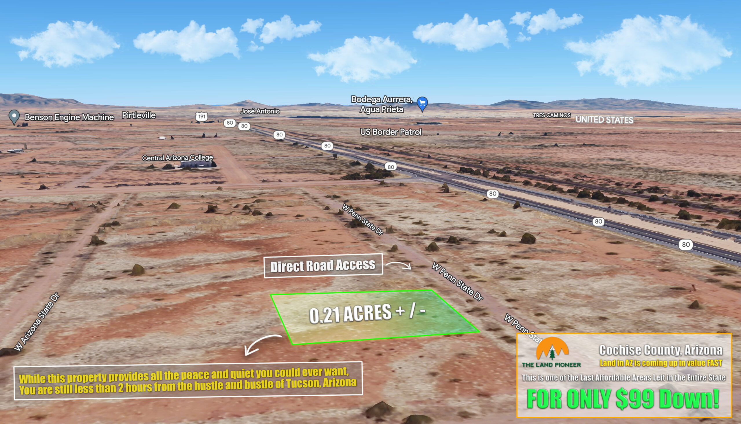
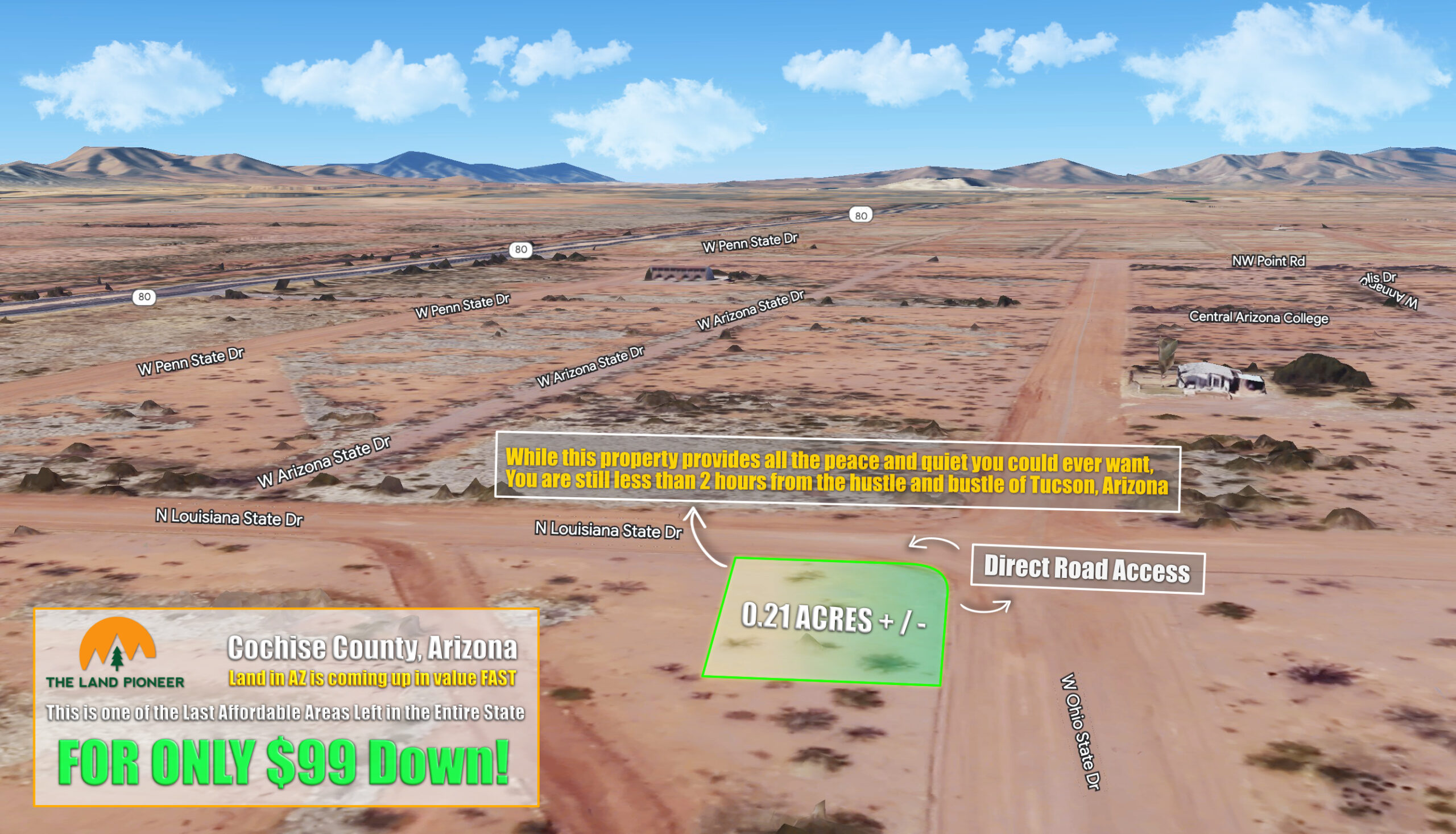
Own this 0.21 Acre Arizona Investment Parcel For Just $99/mo…
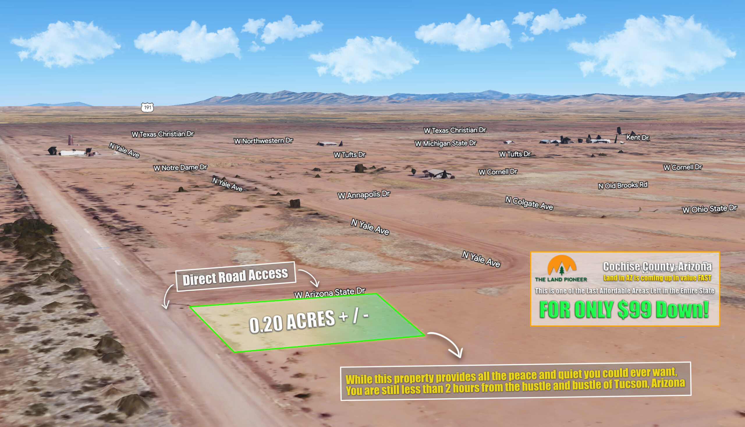
Own this 0.20 Acre Arizona Investment Parcel For Just $99/mo…
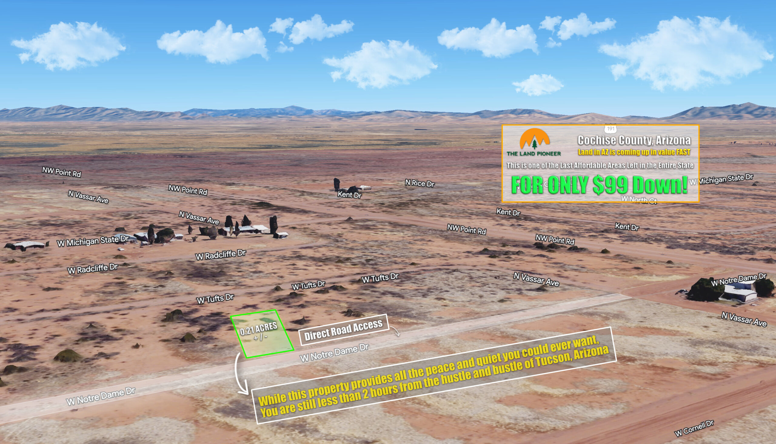
Own this 0.21 Acre Arizona Investment Parcel For Just $99/mo…
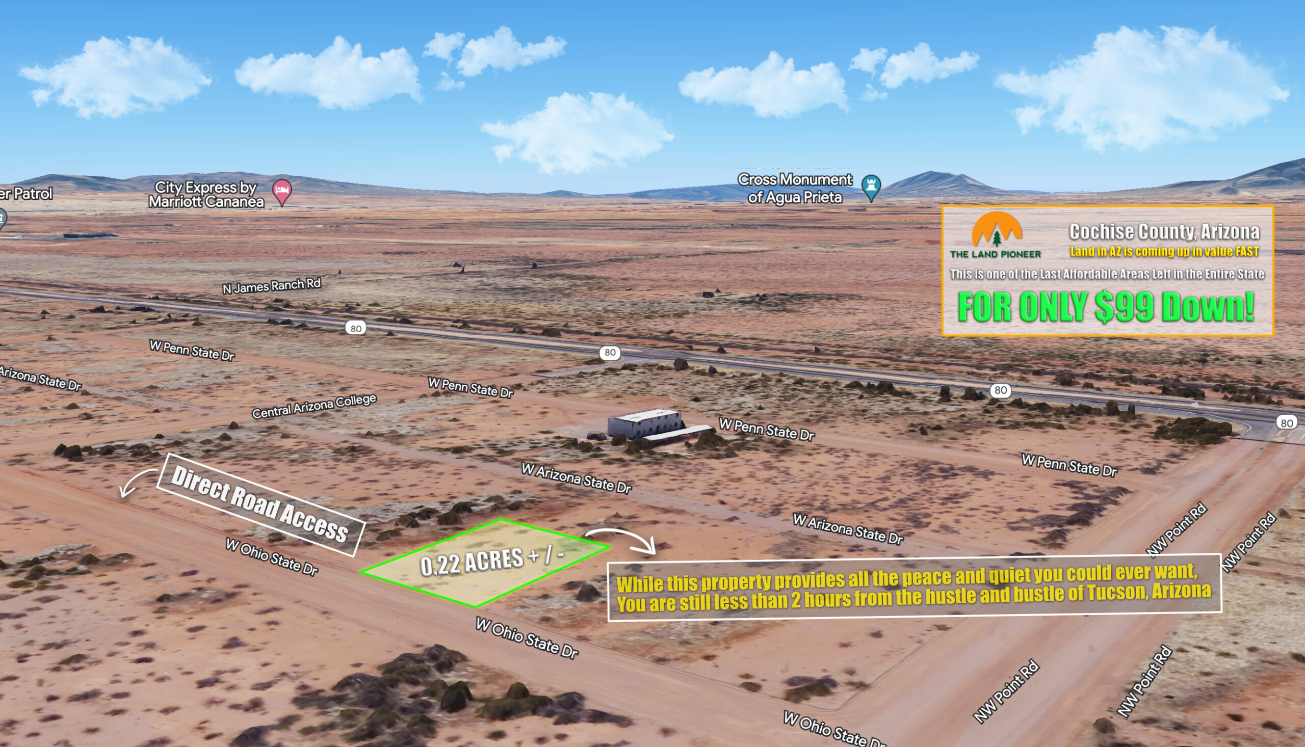
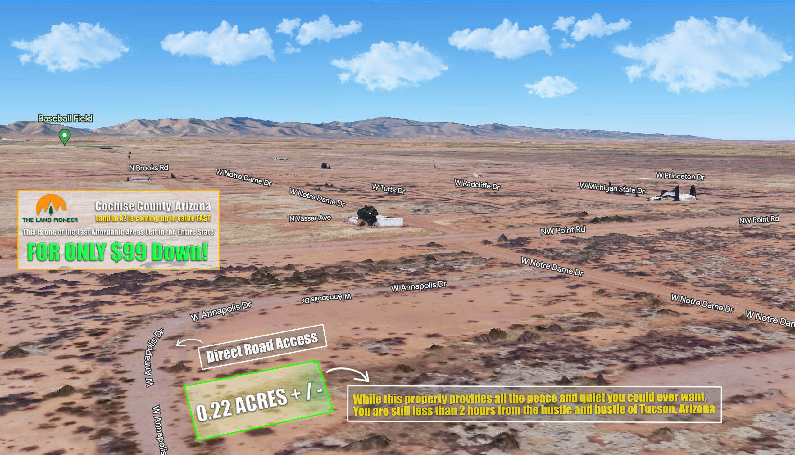
Own this 0.22 Acre Arizona Investment Parcel For Just $99/mo…
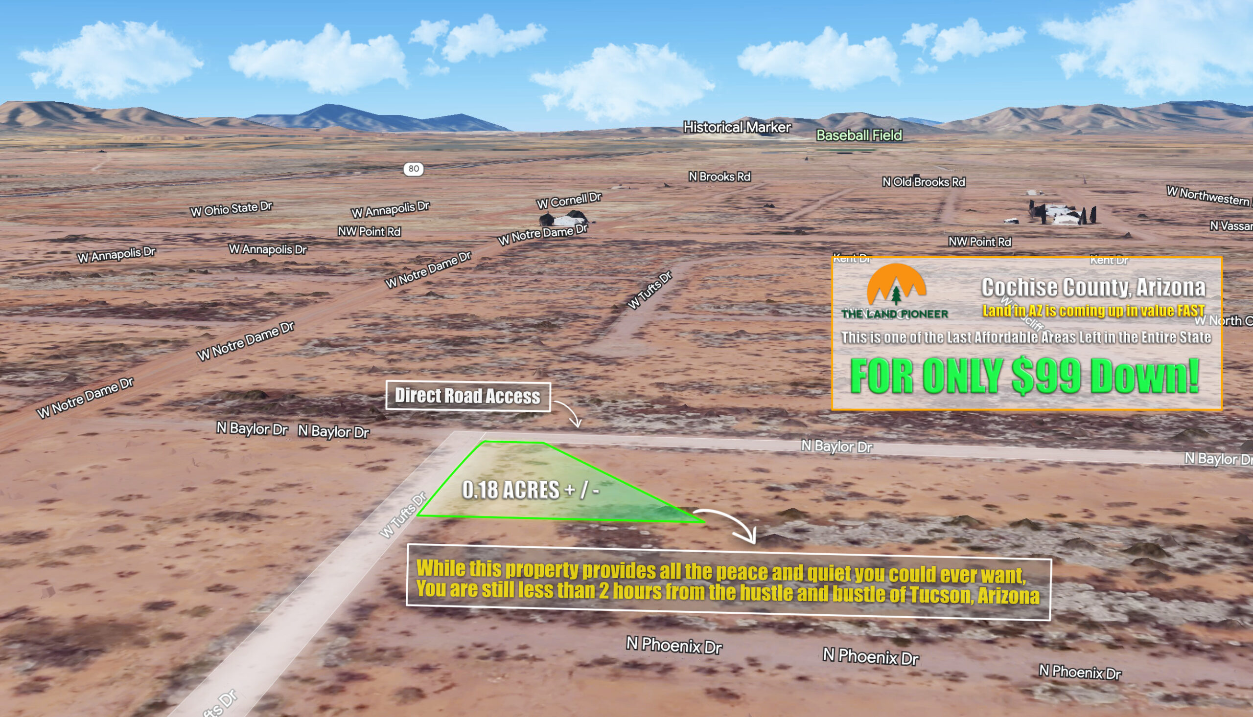
Own this 0.18 Acre Arizona Investment Parcel For Just $99/mo…
Own this 0.21 Acre Arizona Investment Parcel For Just $99/mo…
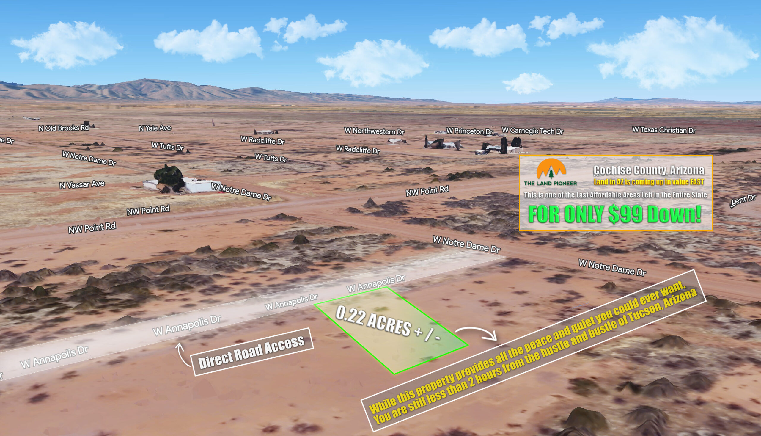
Own this 0.22 Acre Arizona Investment Parcel For Just $99/mo…
Own this 0.22 Acre Arizona Investment Parcel For Just $99/mo…
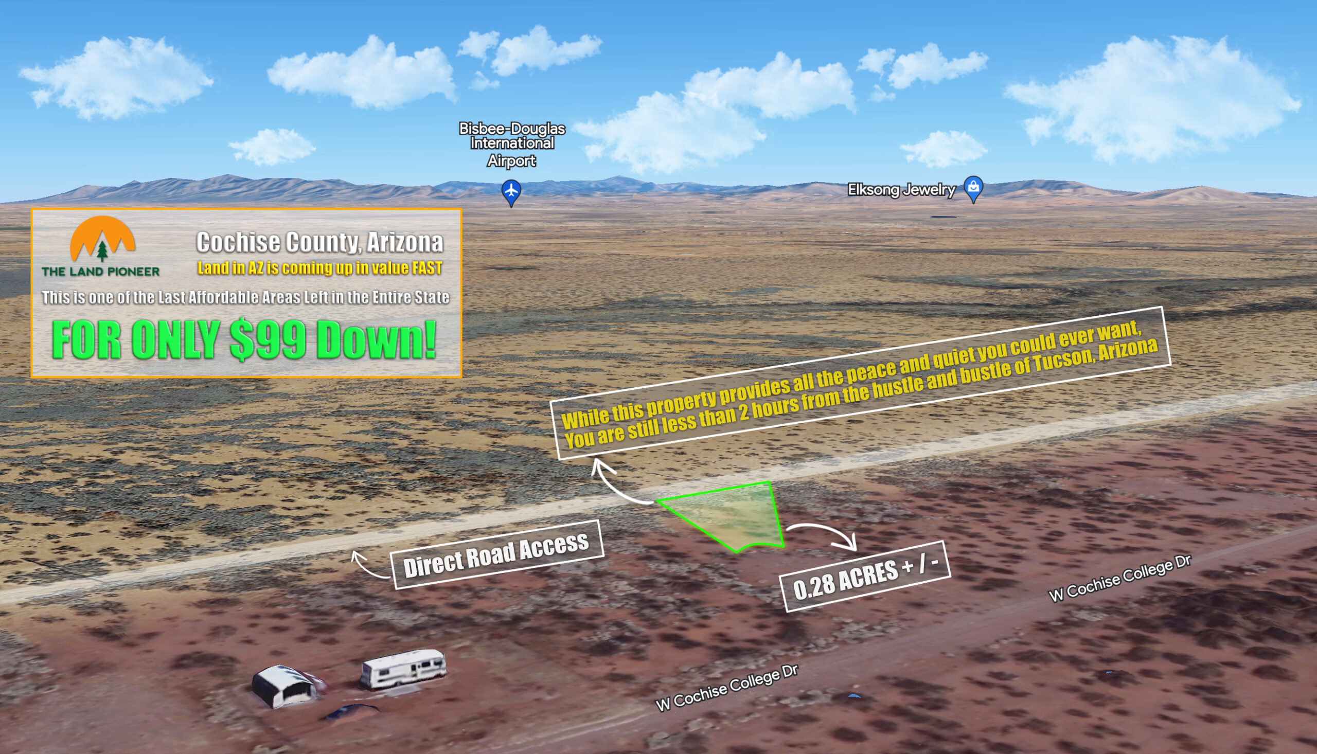
Own this 0.28 Acre Arizona Investment Parcel For Just $99/mo…
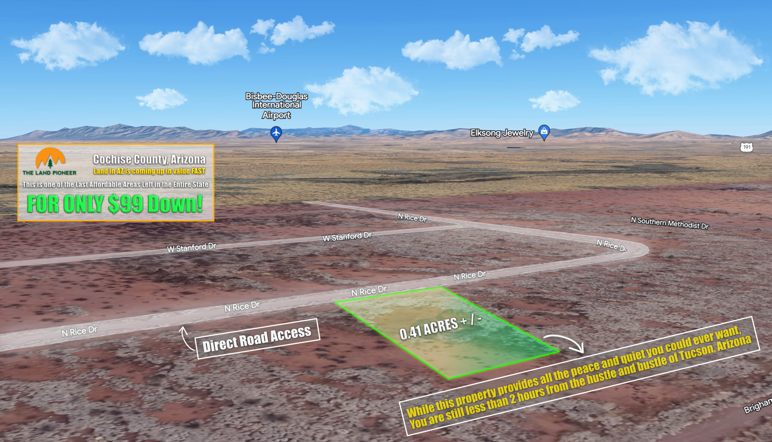
Own this 0.41 Acre Arizona Investment Parcel For Just $99/mo…
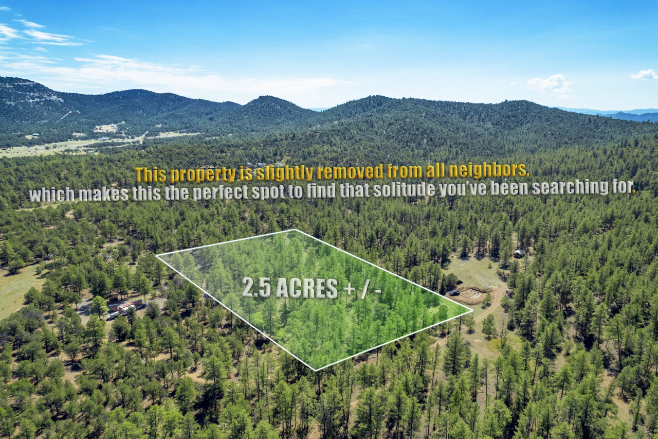
2.5 Wooded Acres in Texas Creek, CO For Just $499 Down
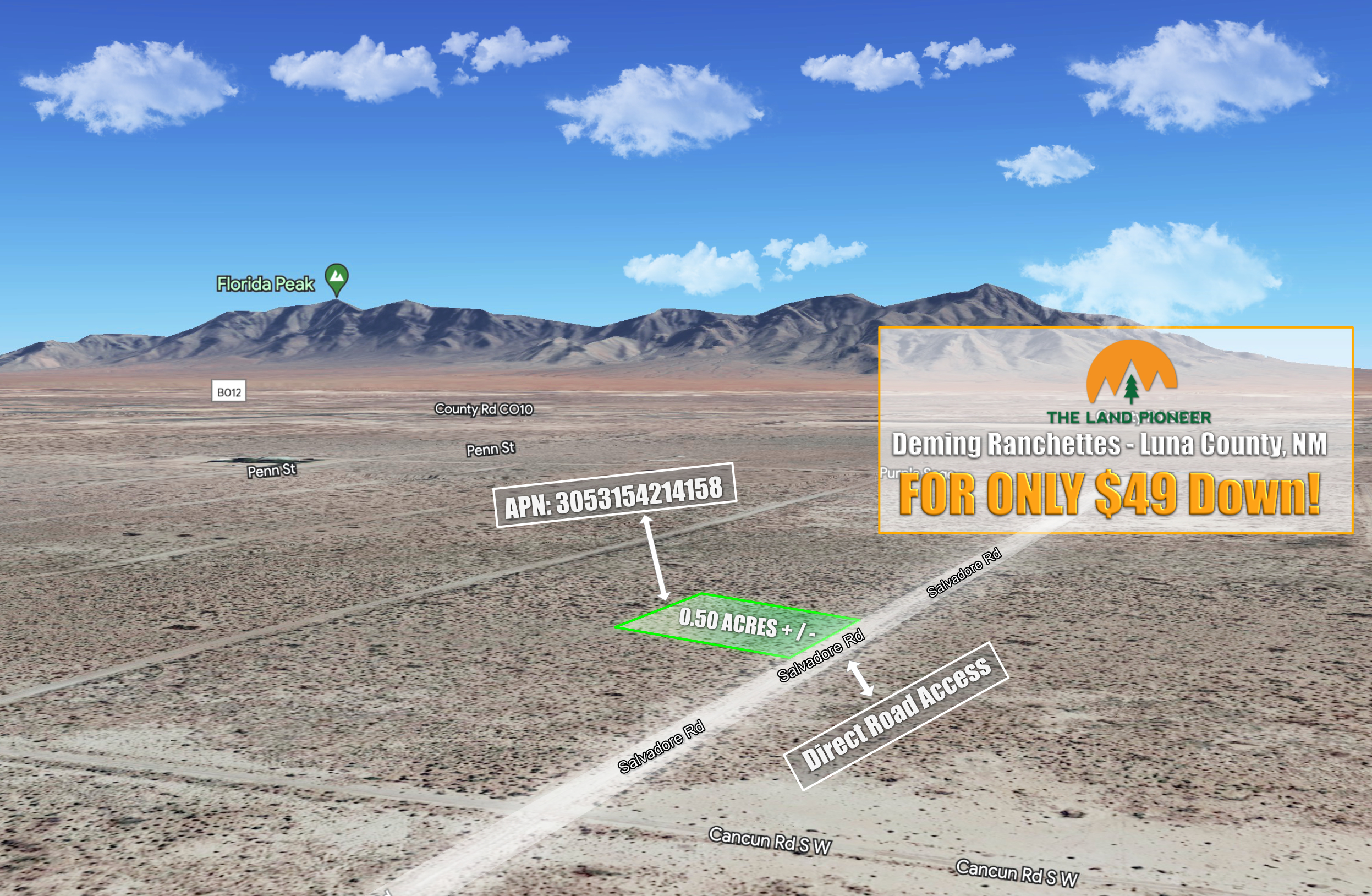
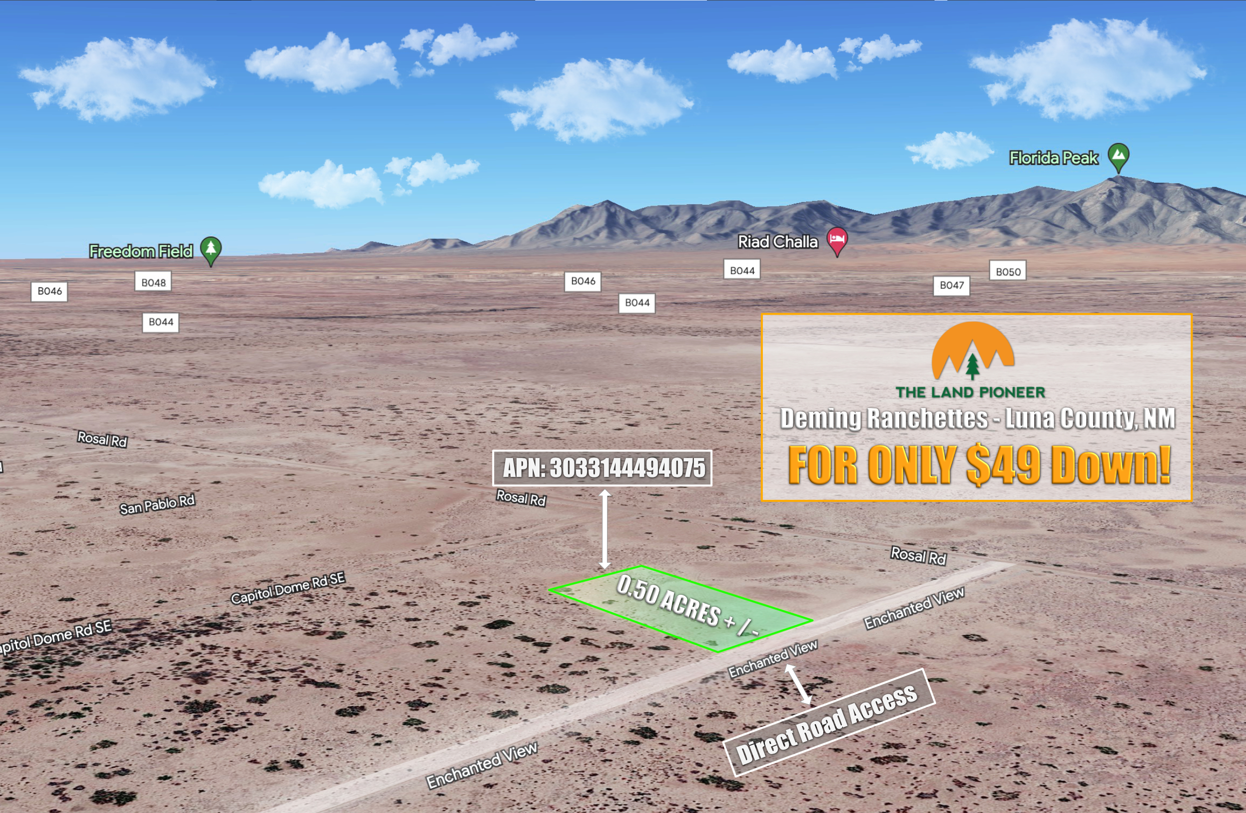
Own this 0.55 acre homestead property in Luna County for just $49 down!
Own this 0.55 acre homestead property in Luna County for just $49 down!
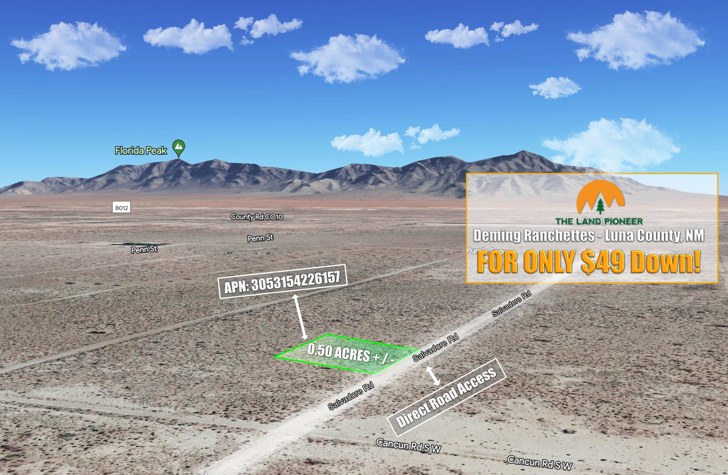
Own this 0.55 acre homestead property in Luna County for just $49 down!
Own this 0.55 acre homestead property in Luna County for just $49 down!
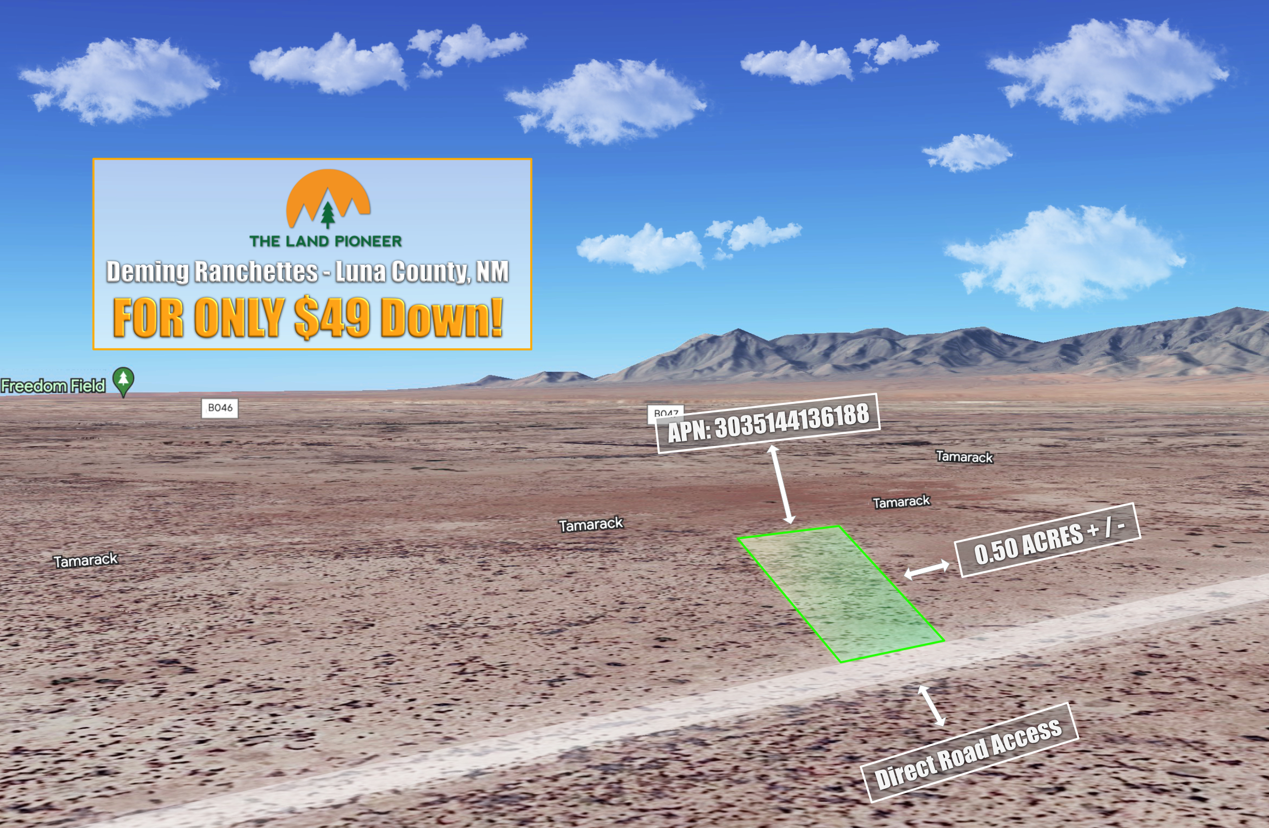
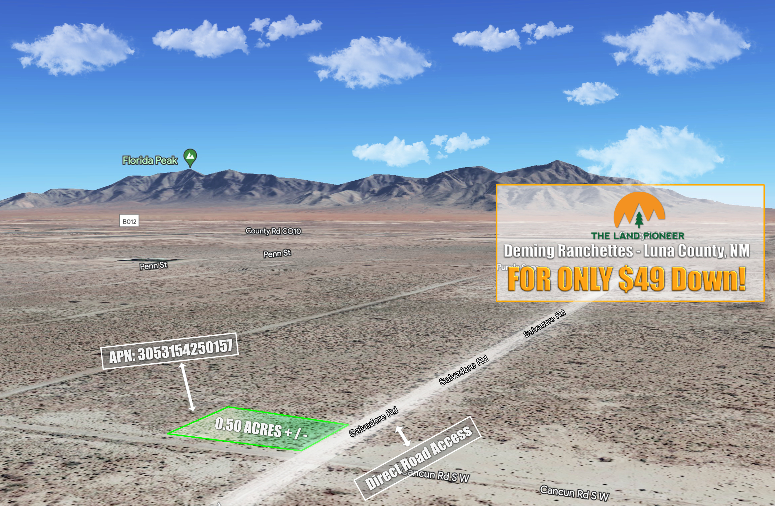
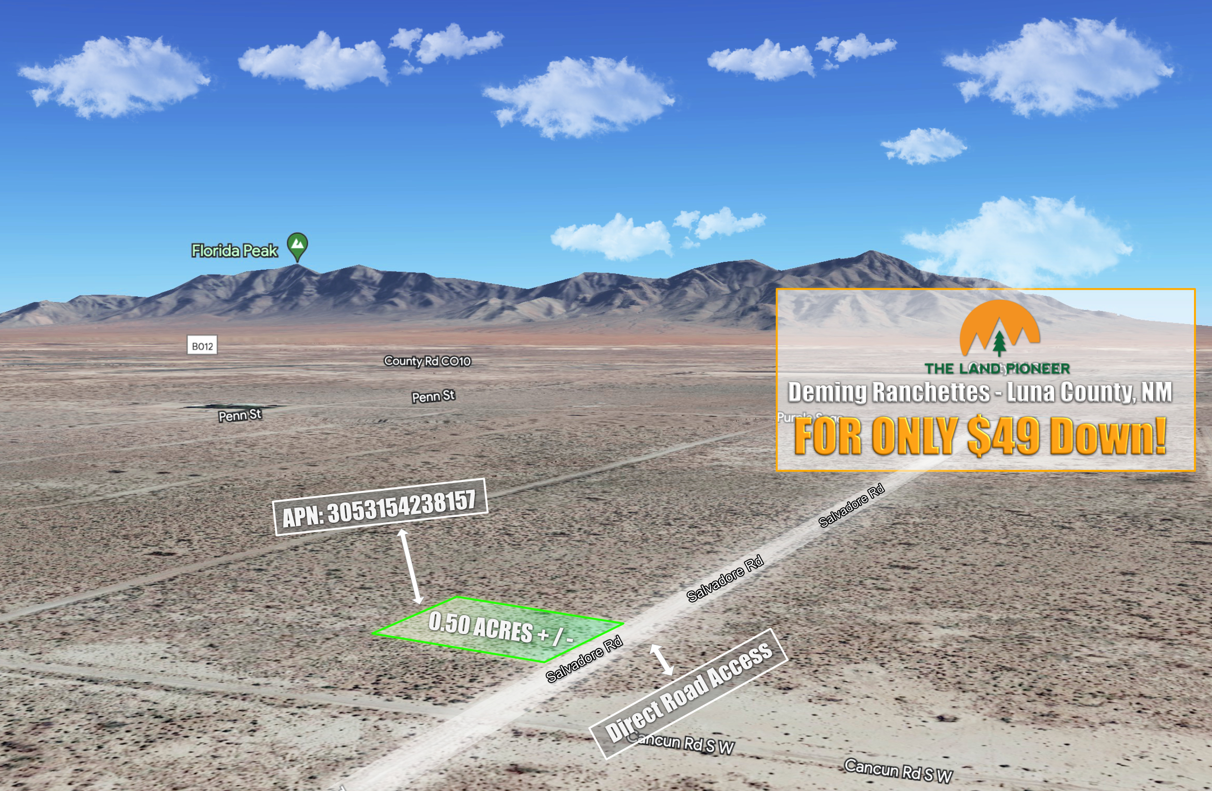
Own this 0.5 acre homestead property in Luna County for just $49 down!
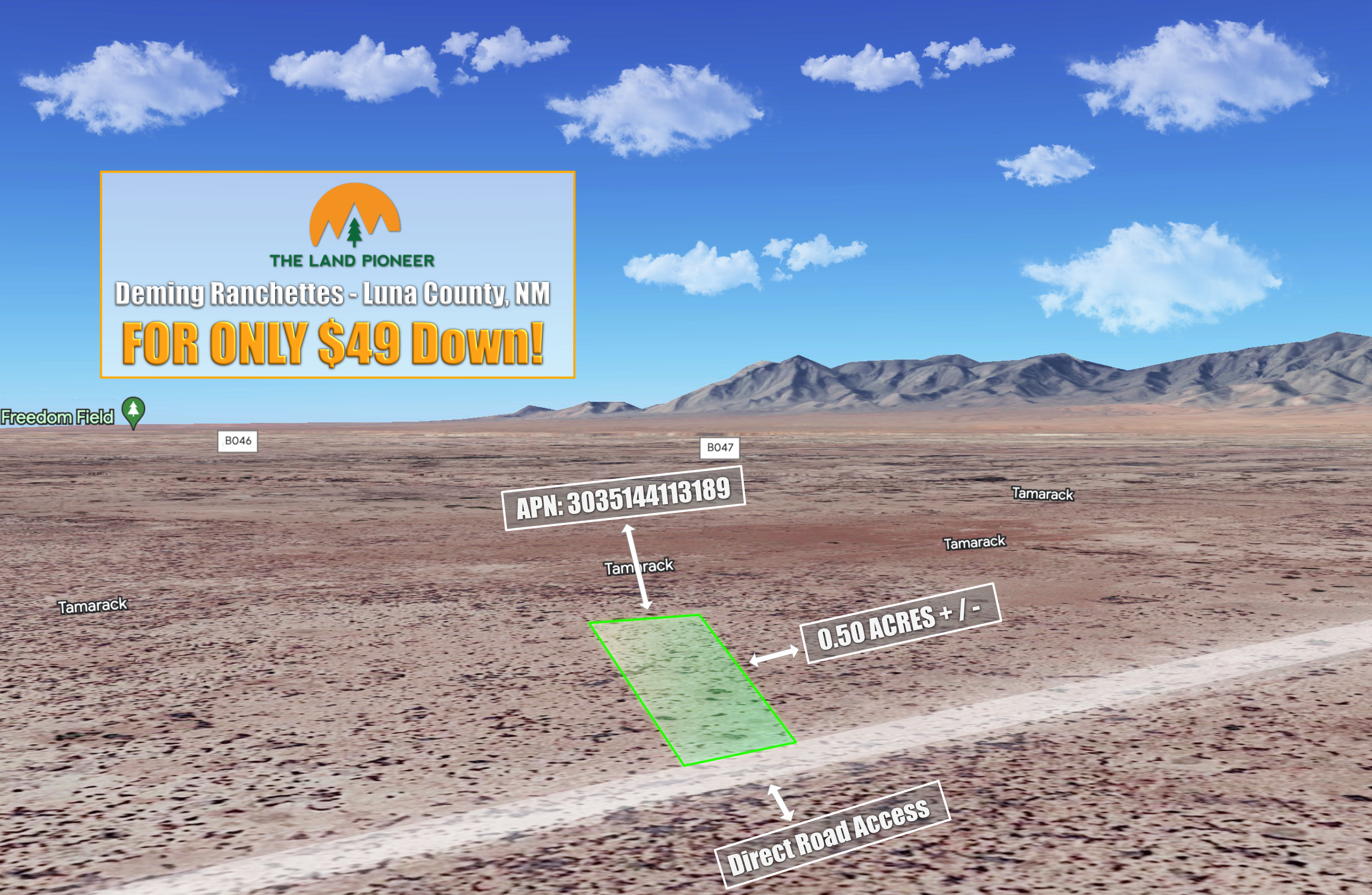
Own this 0.5 acre homestead property in Luna County for just $49 down!
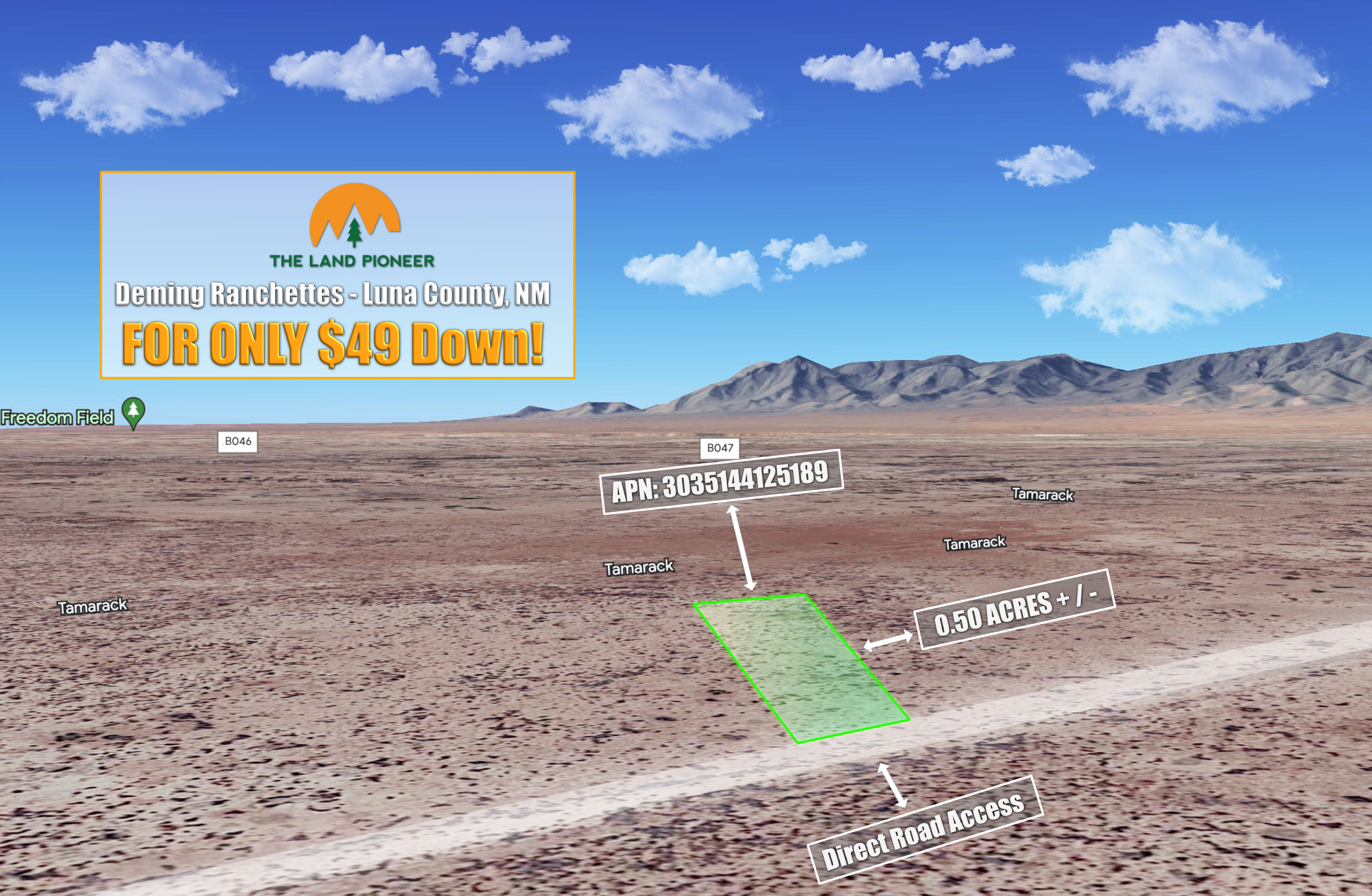
Own this 0.5 acre homestead property in Luna County for just $49 down!
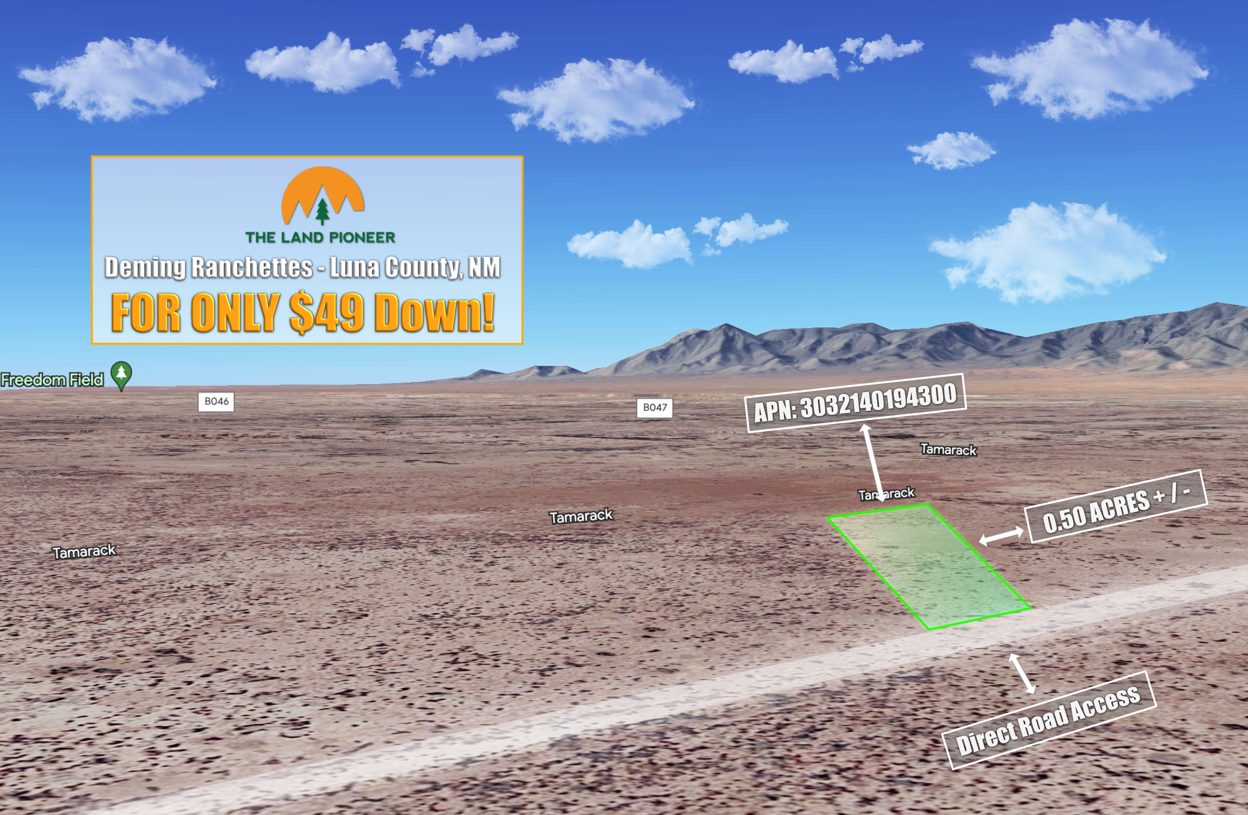
Own this 0.5 acre homestead property in Luna County for just $49 down!
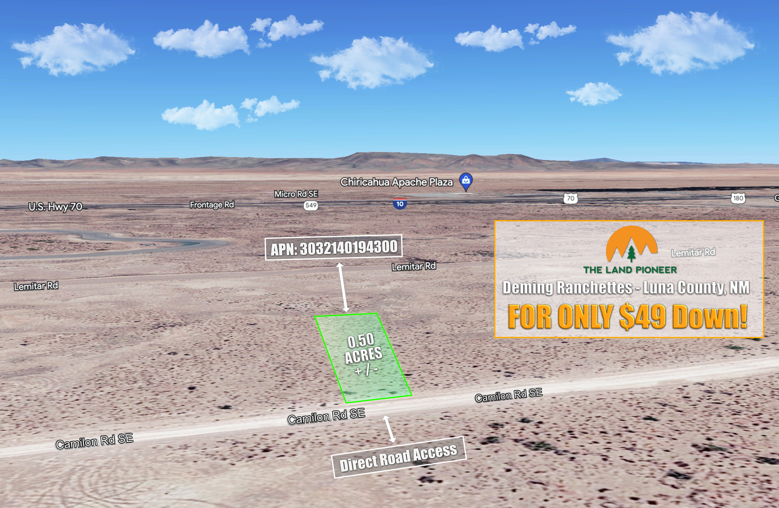
Own this 0.5 acre homestead property in Luna County for just $49 down!
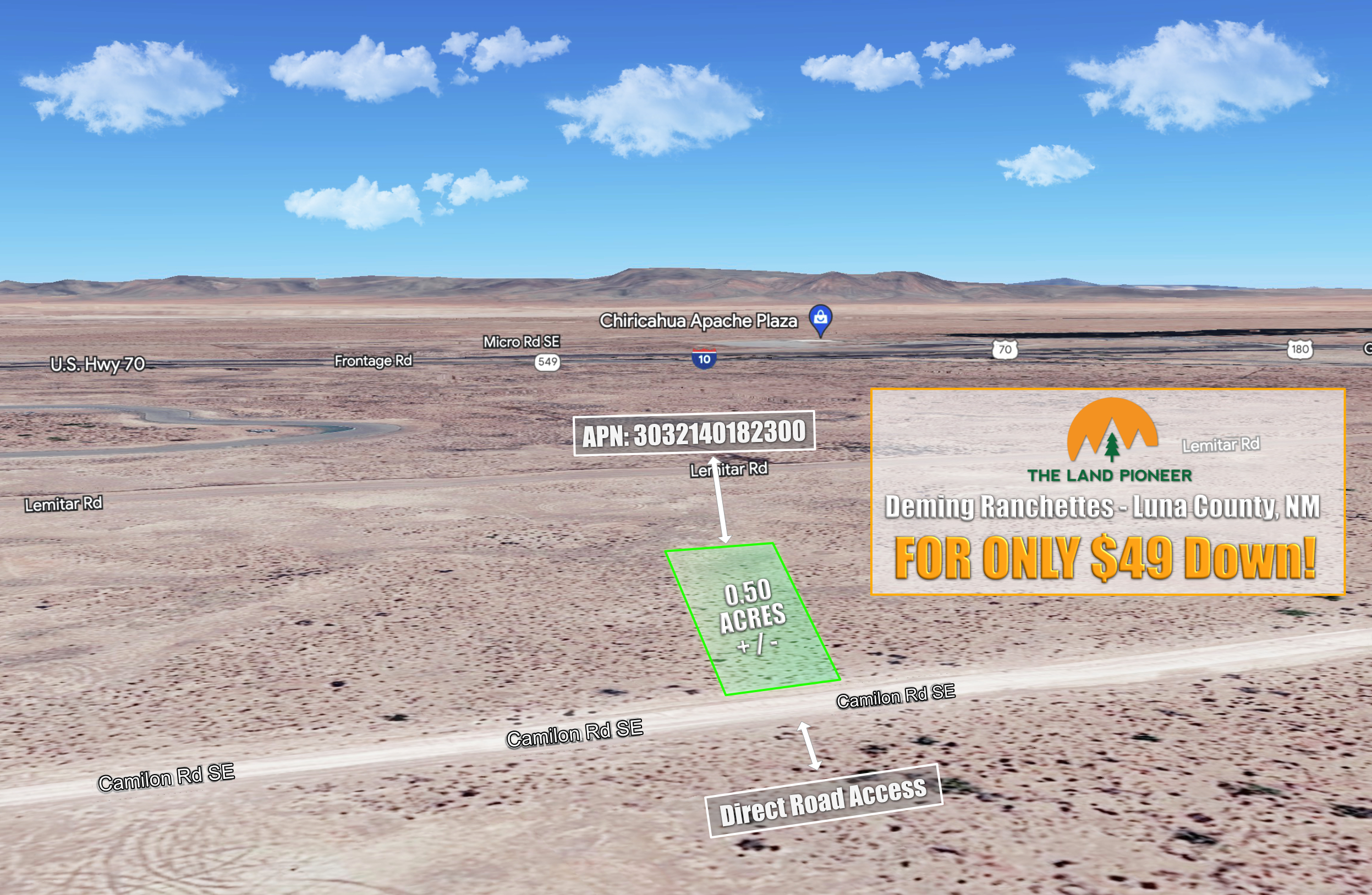
Own this 0.5 acre homestead property in Luna County for just $49 down!

Own this 0.5 acre homestead property in Luna County for just $49 down!
Own this 0.5 acre homestead property in Luna County for just $49 down!
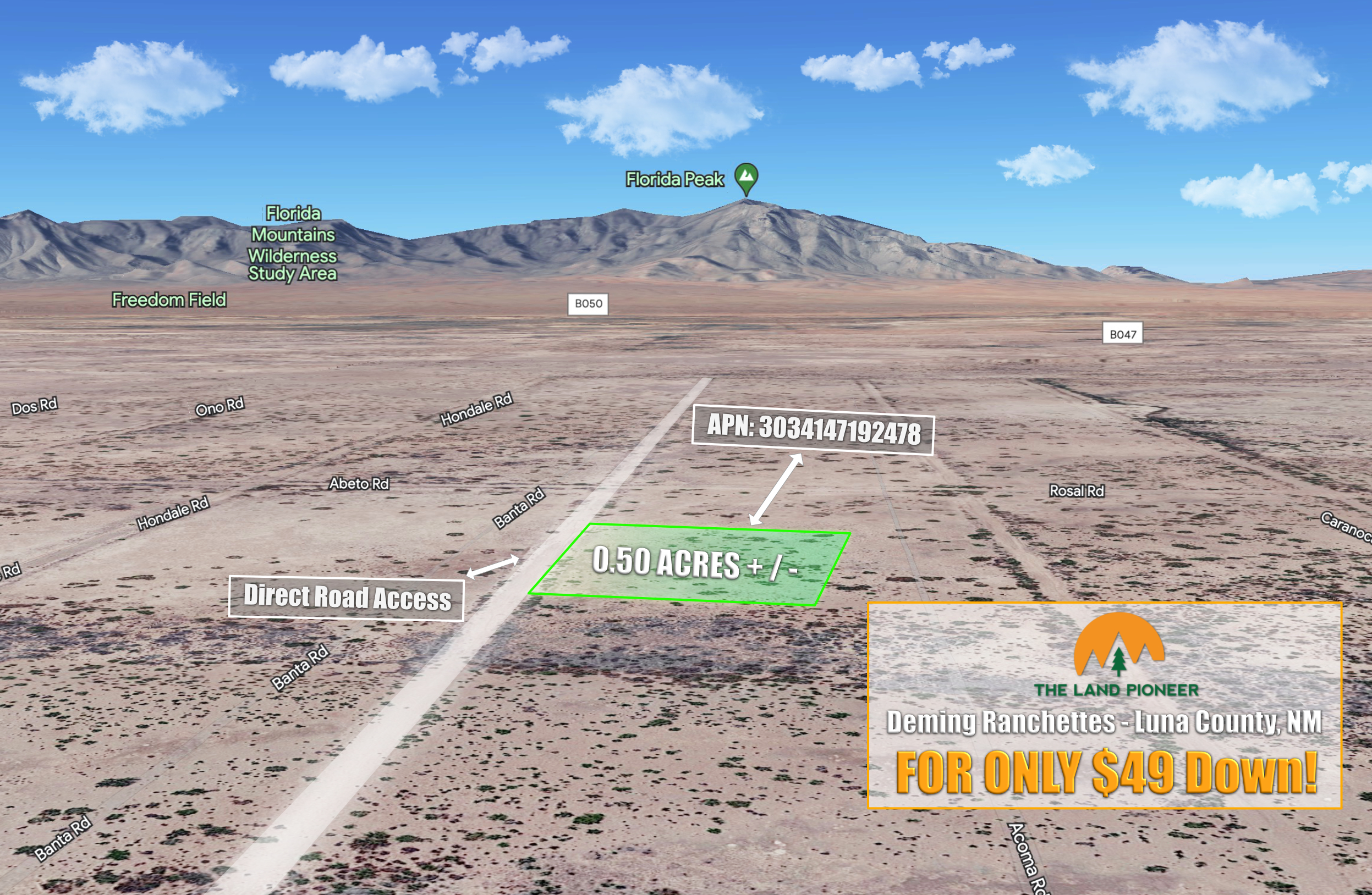
Own this 0.5 acre homestead property in Luna County for just $49 down!
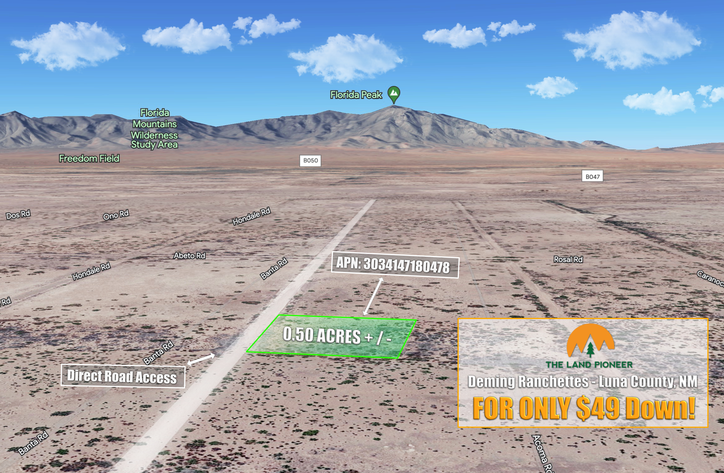
Own this 0.5 acre homestead property in Luna County for just $49 down!
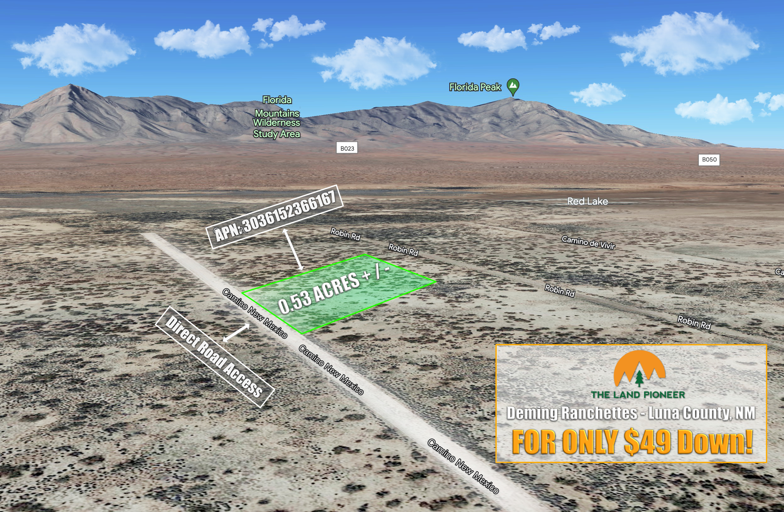
Own this 0.53 acre homestead property in Luna County for just $49 down!
Own this 0.53 acre homestead property in Luna County for just $49 down!
Own this 0.23 acre property in Colorado for just $49 down
Own this 0.23 acre property in Colorado for just $49 down

Own this 0.23 acre property in Colorado for just $49 down
Own this 0.23 acre property in Colorado for just $49 down
Own this 0.23 acre property in Colorado for just $49 down
Own this 0.23 acre property in Colorado for just $49 down

Own this 0.23 acre property in Colorado for just $49 down
Own this 0.23 acre property in Colorado for just $49 down
Own this 0.23 acre property in Colorado for just $49 down
Own this 0.23 acre property in Colorado for just $49 down
Own this 0.23 acre property in Colorado for just $49 down
Own this 0.23 acre property in Colorado for just $49 down
Own this 0.23 acre property in Colorado for just $49 down
Own this 0.23 acre property in Colorado for just $49 down
Own this 0.23 acre property in Colorado for just $49 down
Own this 0.23 acre property in Colorado for just $49 down
Own this 0.23 acre property in Colorado for just $49 down

Own this 0.23 acre property in Colorado for just $49 down
Own this 0.23 acre property in Colorado for just $49 down
Own this 0.23 acre property in Colorado for just $49 down

Own this 0.23 acre property in Colorado for just $49 down
Own this 0.23 acre property in Colorado for just $49 down
0.27 Acres Parcel in Horseshoe Bend For just $49 Down
0.32 Acres Parcel in Horseshoe Bend For just $49 Down
0.32 Acres Parcel in Horseshoe Bend For just $49 Down
0.31 Acres Parcel in Horseshoe Bend For just $49 Down
0.31 Acres Parcel in Horseshoe Bend For just $49 Down
0.31 Acres Parcel in Horseshoe Bend For just $49 Down
0.3 Acres Parcel in Horseshoe Bend For just $49 Down
0.45 Acres Parcel in Horseshoe Bend For just $49 Down
0.32 Acres Parcel in Horseshoe Bend For just $49 Down
0.38 Acres Parcel in Horseshoe Bend For just $49 Down
0.38 Acres Parcel in Horseshoe Bend For just $49 Down
0.38 Acres Parcel in Horseshoe Bend For just $49 Down
0.37 Acres Parcel in Horseshoe Bend For just $49 Down
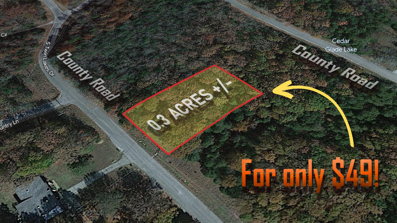
0.37 Acres Parcel in Horseshoe Bend For just $49 Down
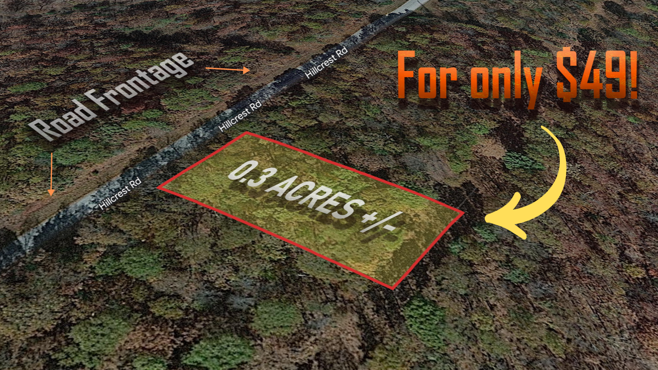
0.36 Acres Parcel in Horseshoe Bend For just $49 Down
0.28 Acres Parcel in Horseshoe Bend For just $49 Down
0.26 Acres Parcel in Horseshoe Bend For just $49 Down
0.26 Acres Parcel in Horseshoe Bend For just $49 Down
0.42 Acres Parcel in Horseshoe Bend For just $49 Down
0.31 Acres Parcel in Horseshoe Bend For just $49 Down

0.3 Acres Parcel in Horseshoe Bend For just $49 Down
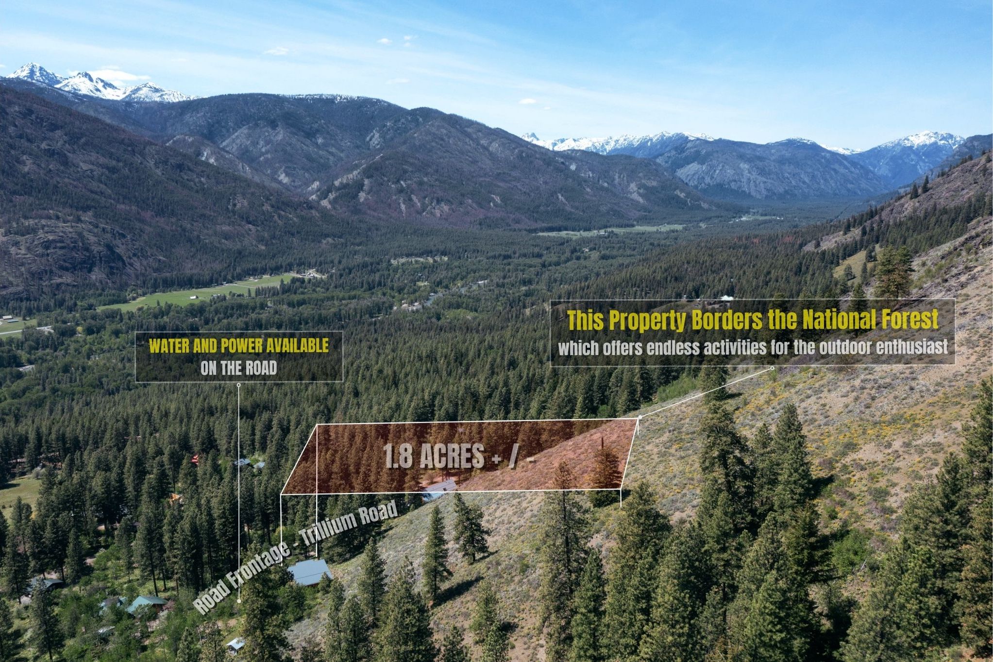
1.8 Acres W/ Water & Power Just Minutes From The Methow River
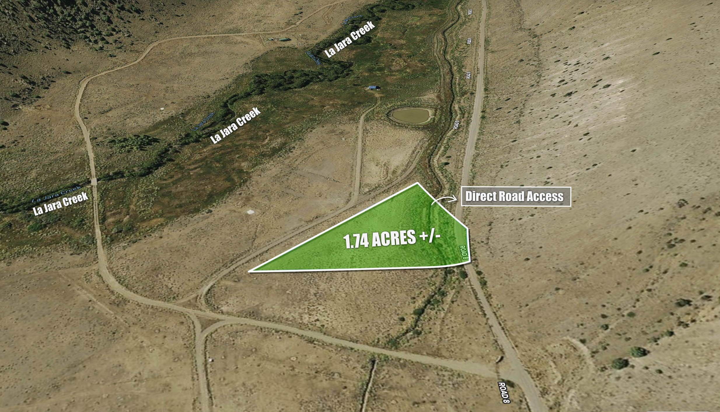
1.74 Acre Lot with La Jara Creek River Views
Get this amazing 1.25 acre property in Navajo for limited time offer of $49 down!
Get this fantastic 1-acre property in Valencia County, NM for just $49 down today!
Perched on a hill with endless canyon views for just $99 down
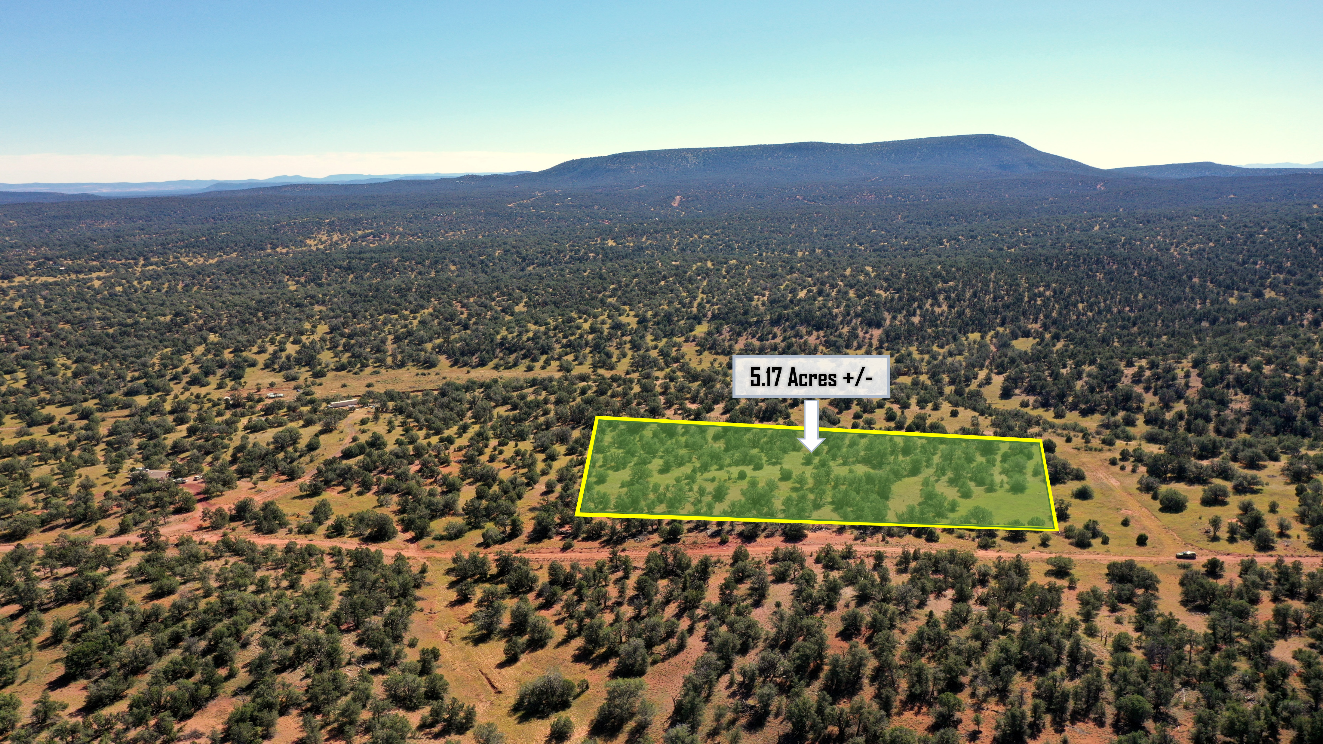
Wooded 10 Acre Parcel Just Outside of Saint Johns, AZ For Just $49 Down
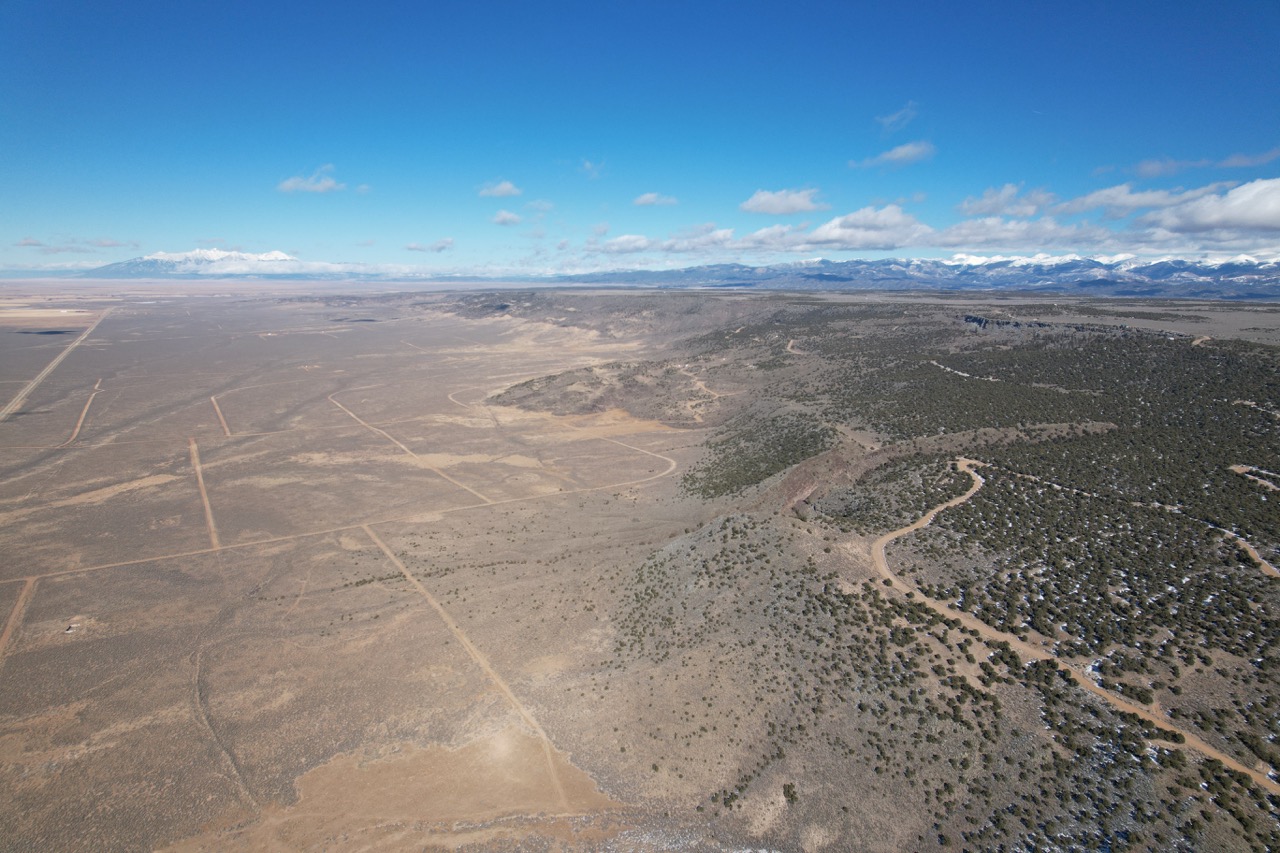
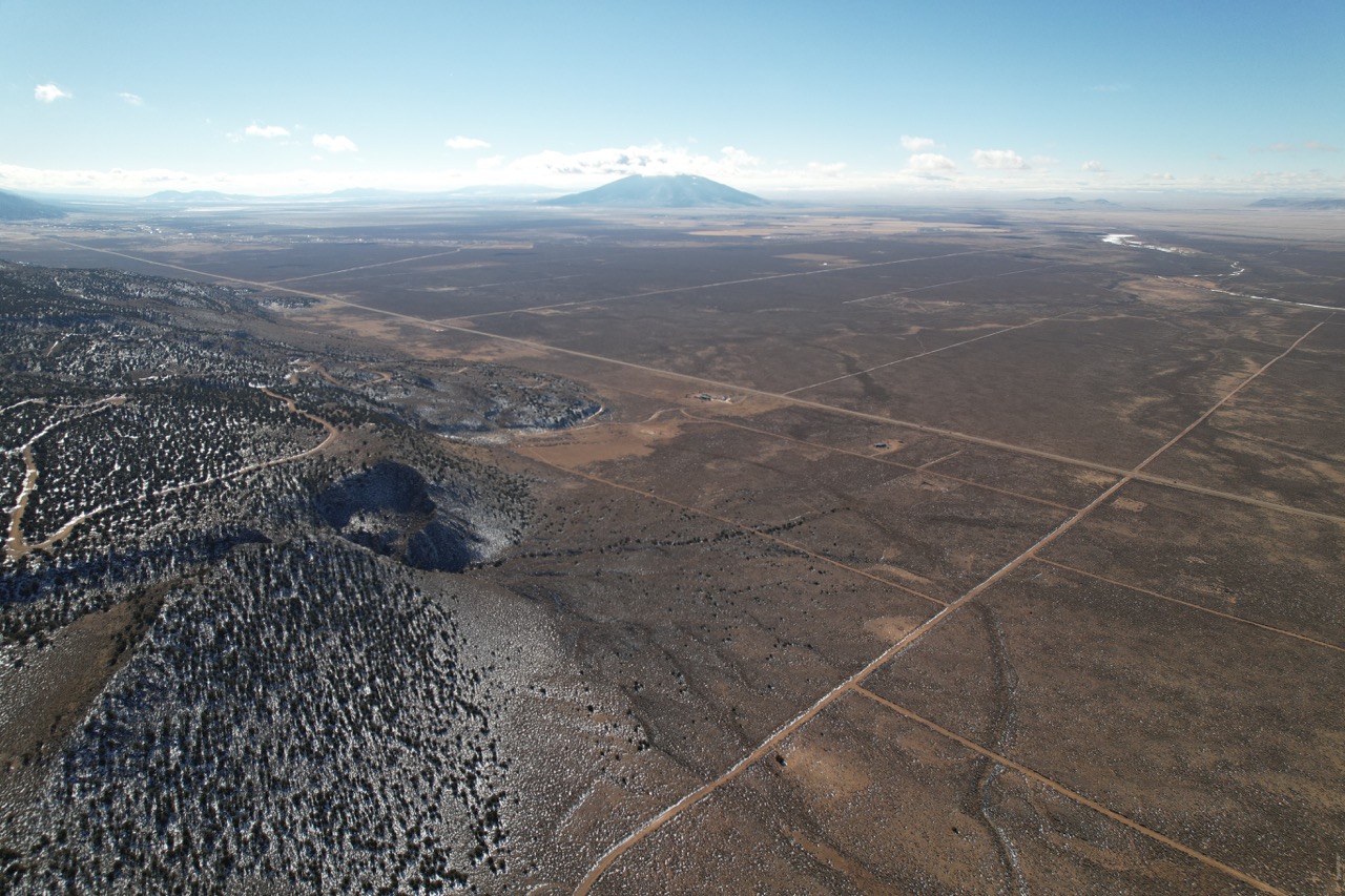
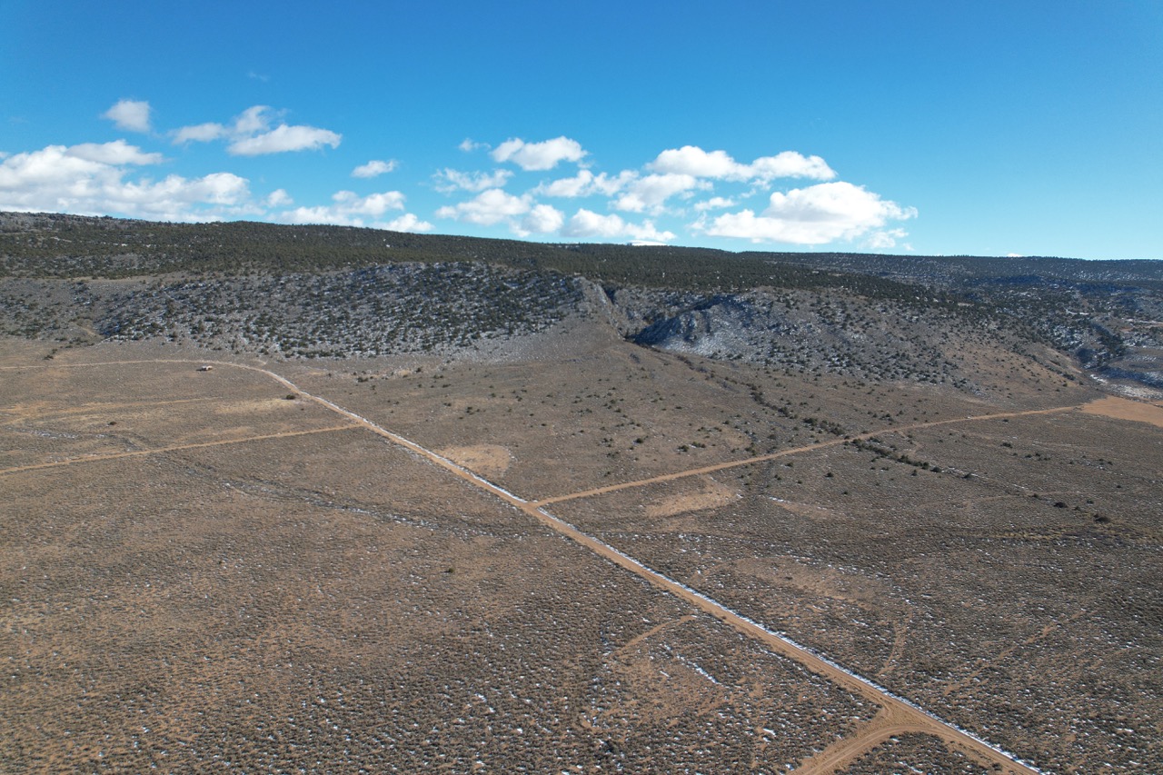
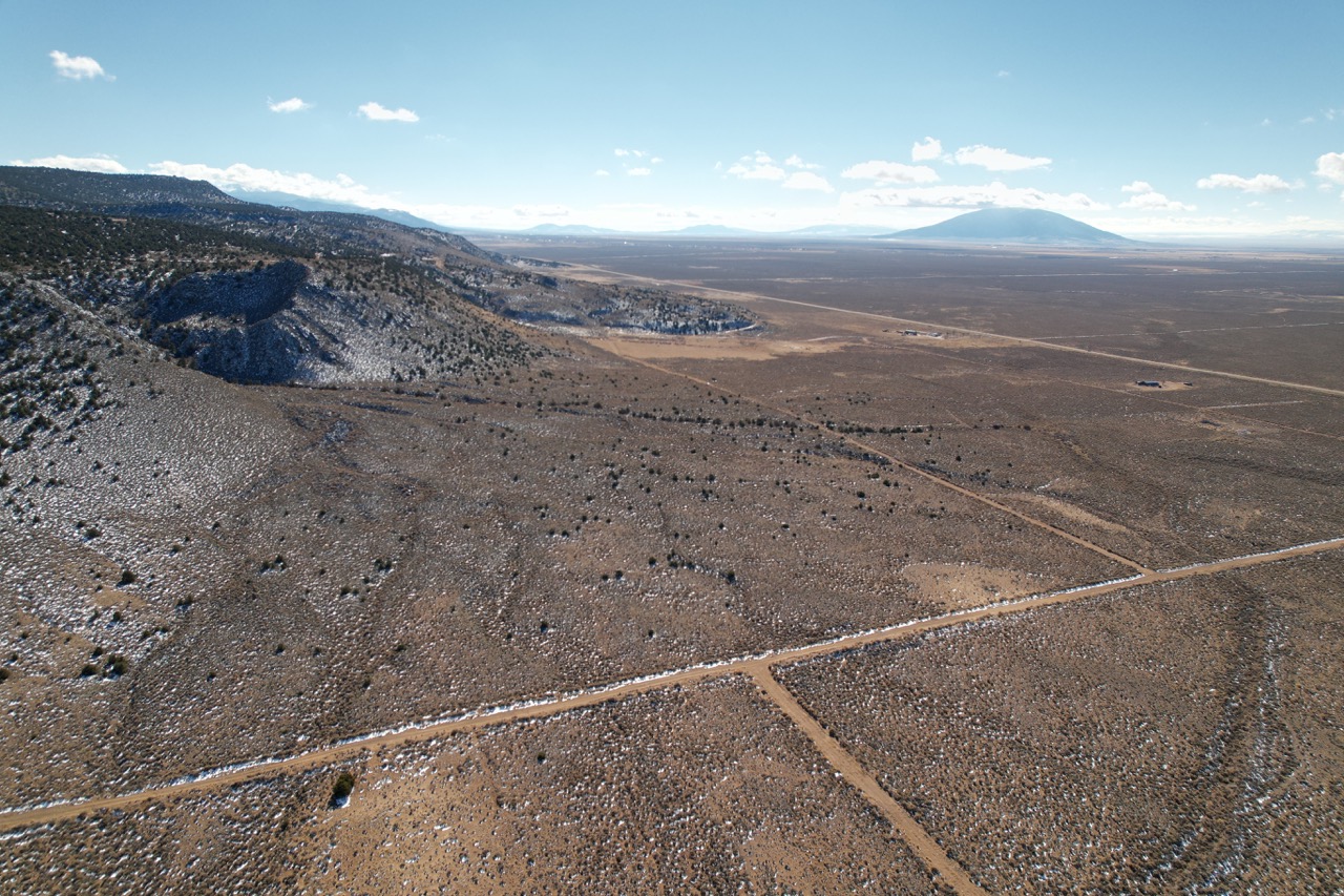
What are you waiting for? NOW IS THE TIME TO OWN YOUR SLICE OF SOUTHERN COLORADO LAND FOR JUST $49 DOWN (limited time offer)
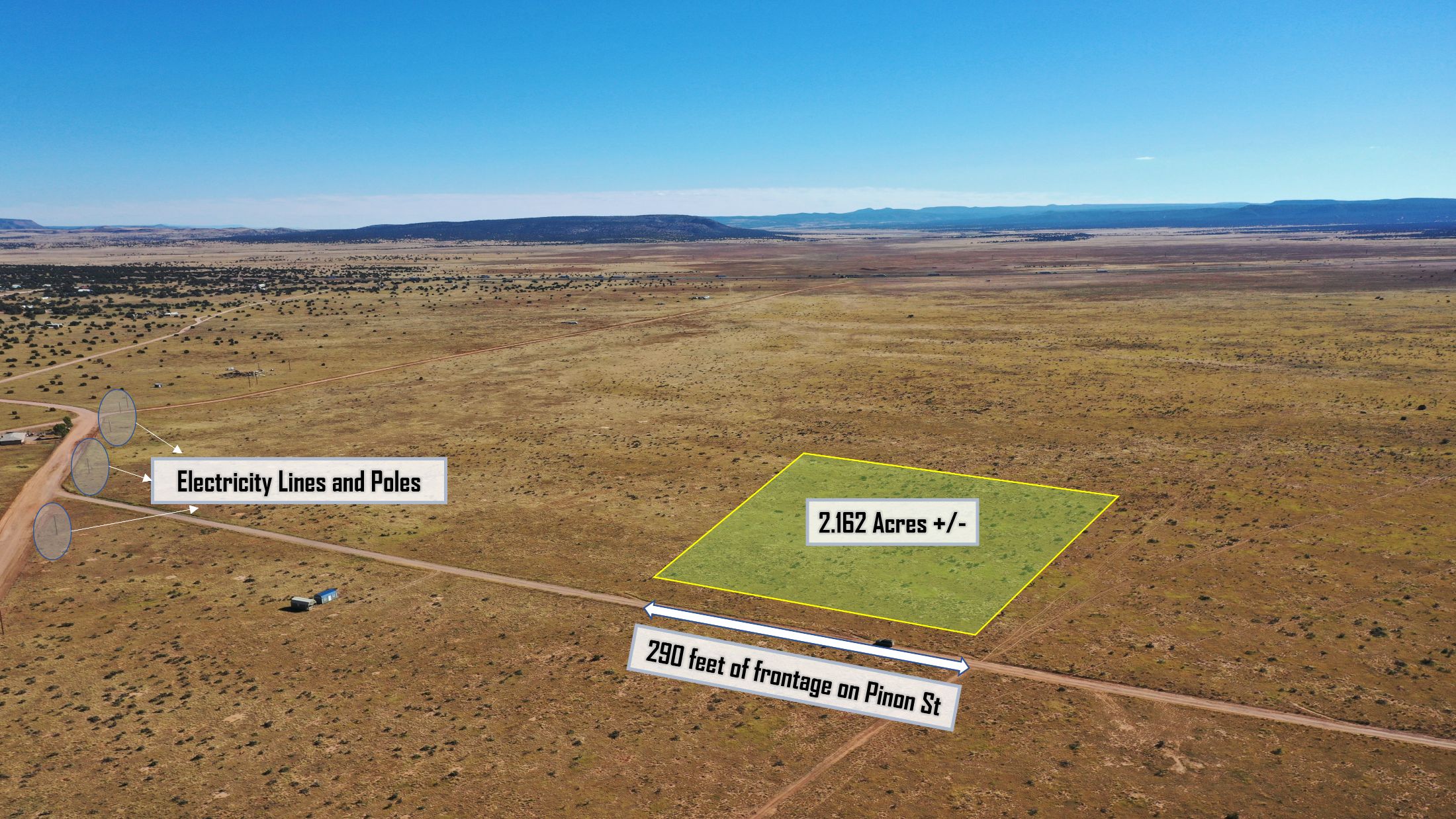
Minimally Restricted 2.162 Acres in Seligman, AZ (Just $49 Down) – Yavapai County
Go Off-Grid w/ this gorgeous 2.5-acre lot in Mohave County AZ for $49 down
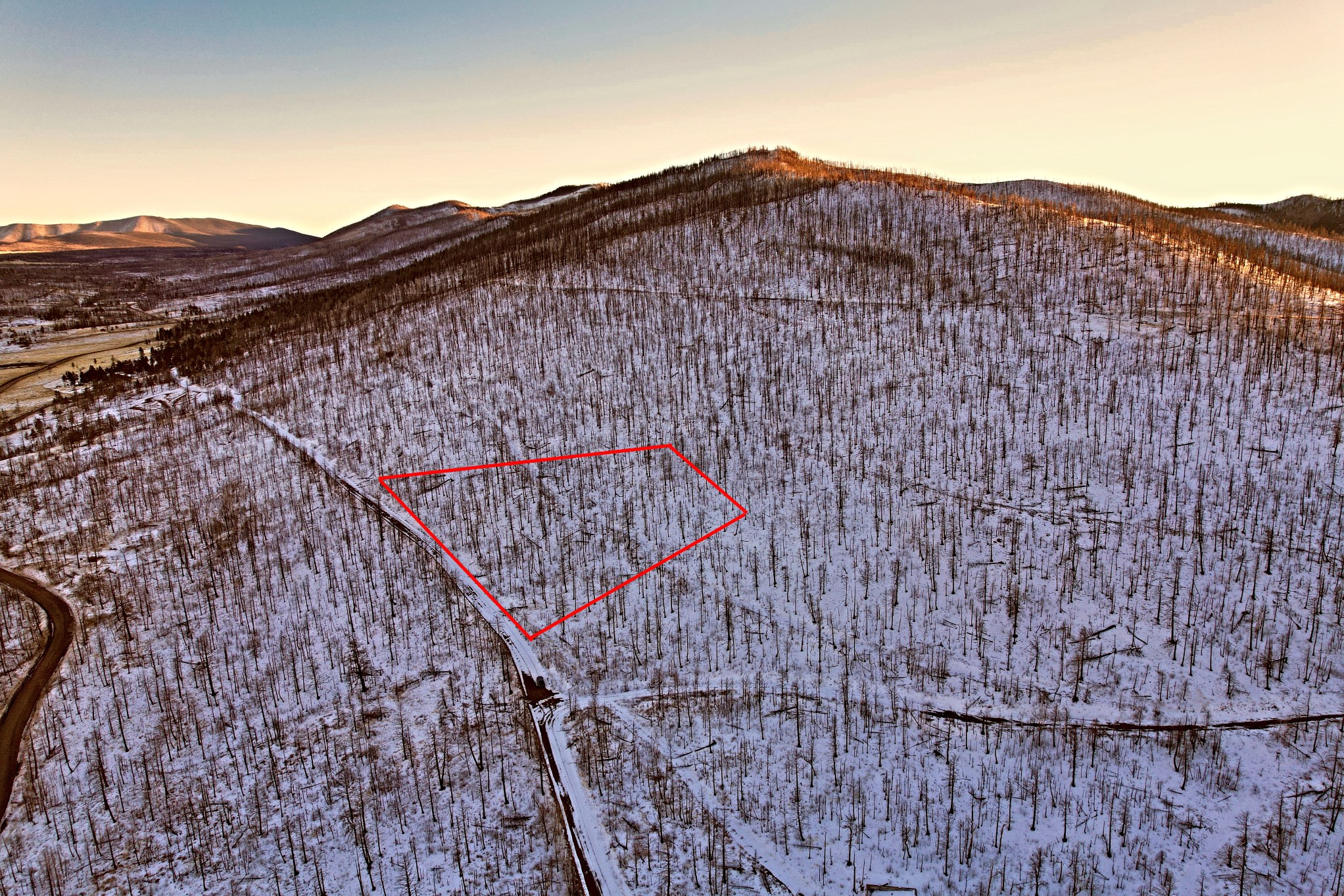
2.96 Acres in the world famous Sangre De Cristo Mountain Range… limited time offer for just $49 down
Minimally Restricted 1.31 Acres With The Best Views in Seligman – Yavapai County, Arizona for just $49 down!

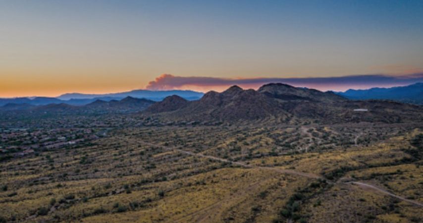
1.13 Acres in New River, AZ – Maricopa County
Own Land Near Taos, NM For Just $49 Down Grab while it lasts!