


Specification
Features
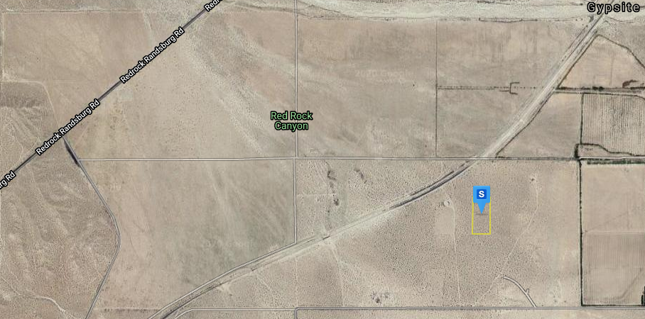
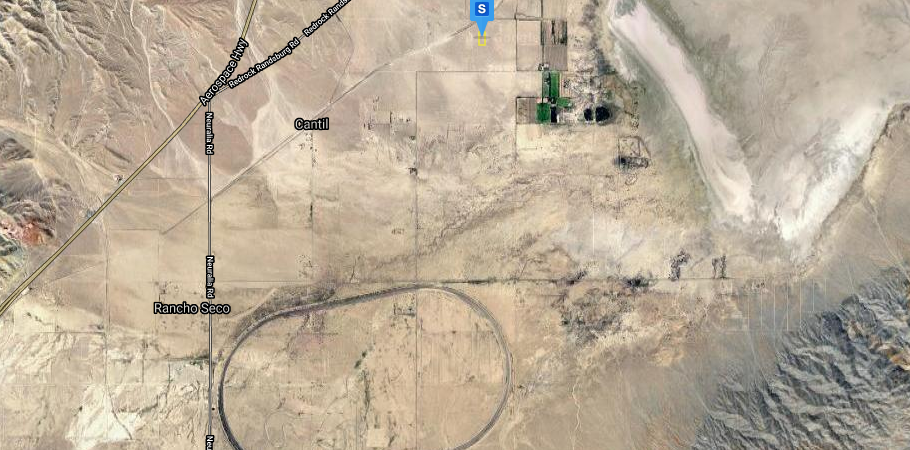
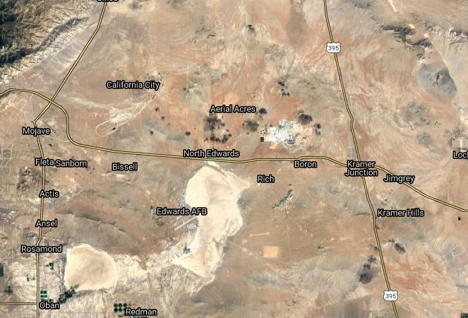
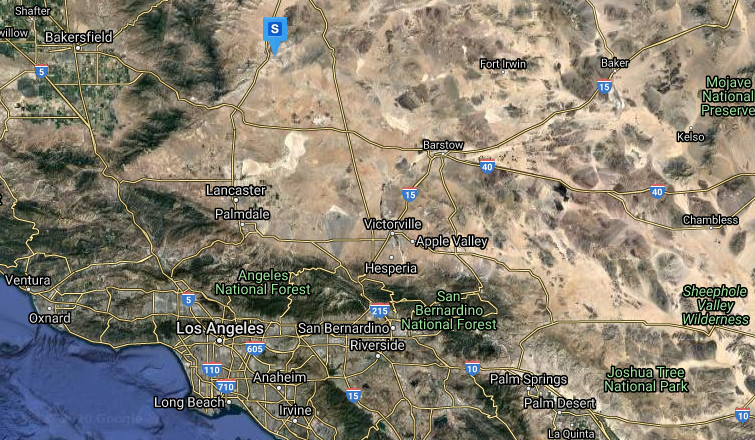
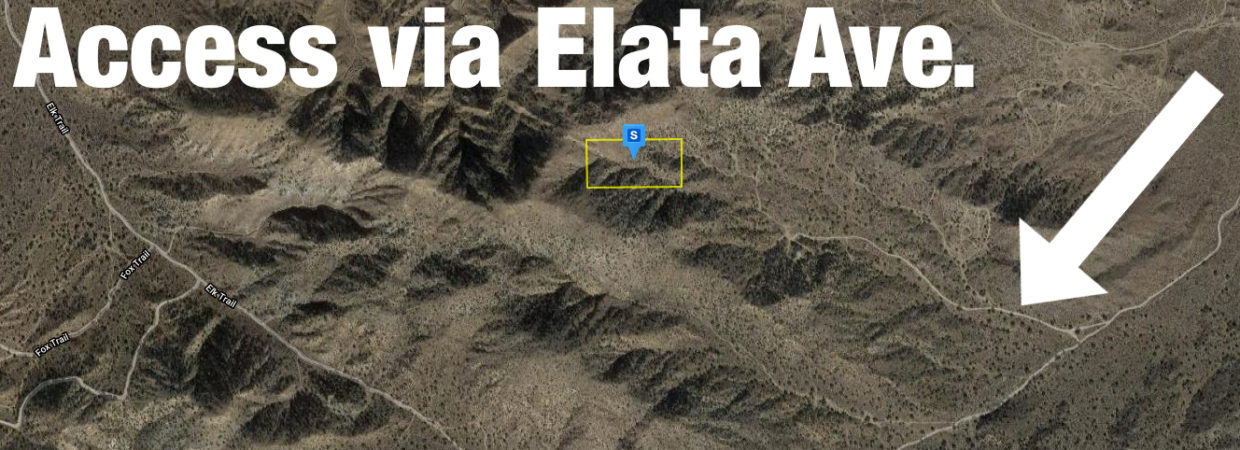
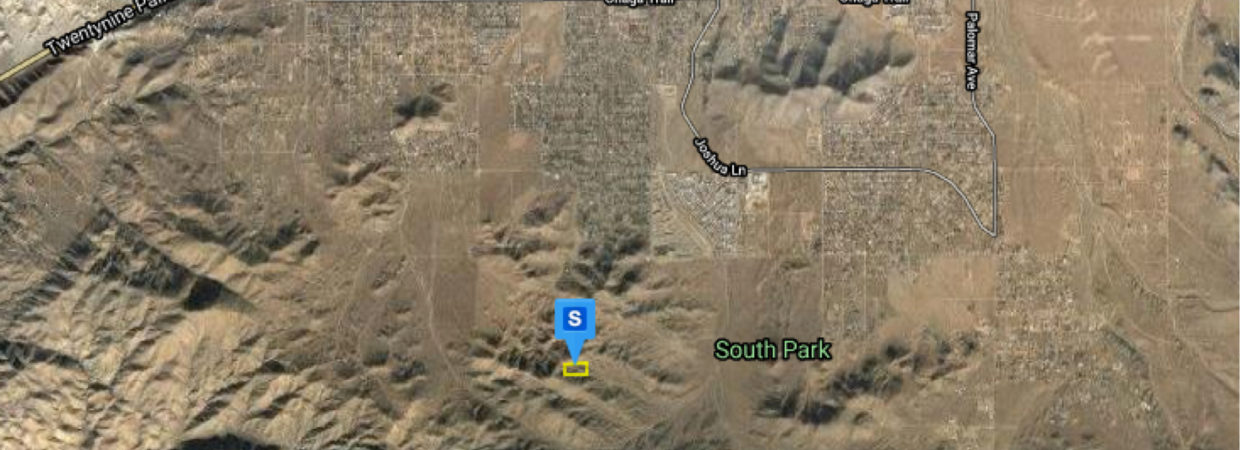
Location
Description
DESCRIPTION
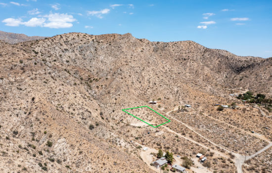
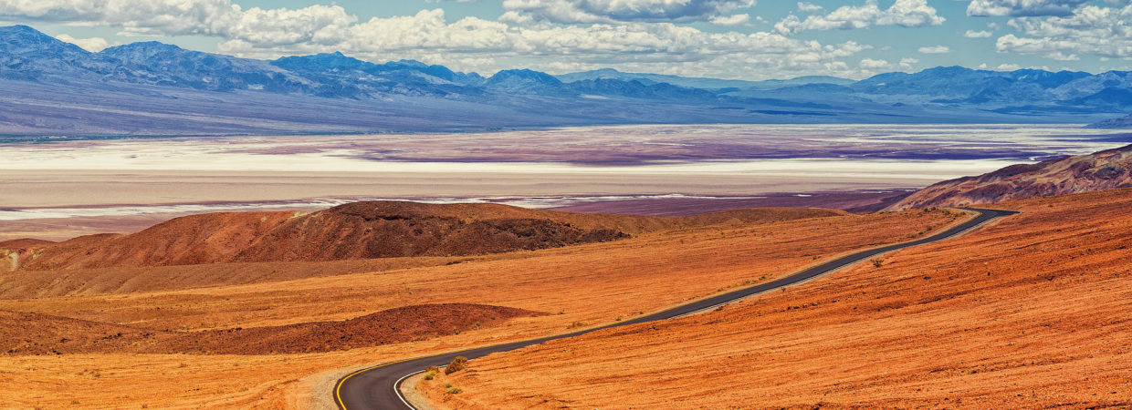
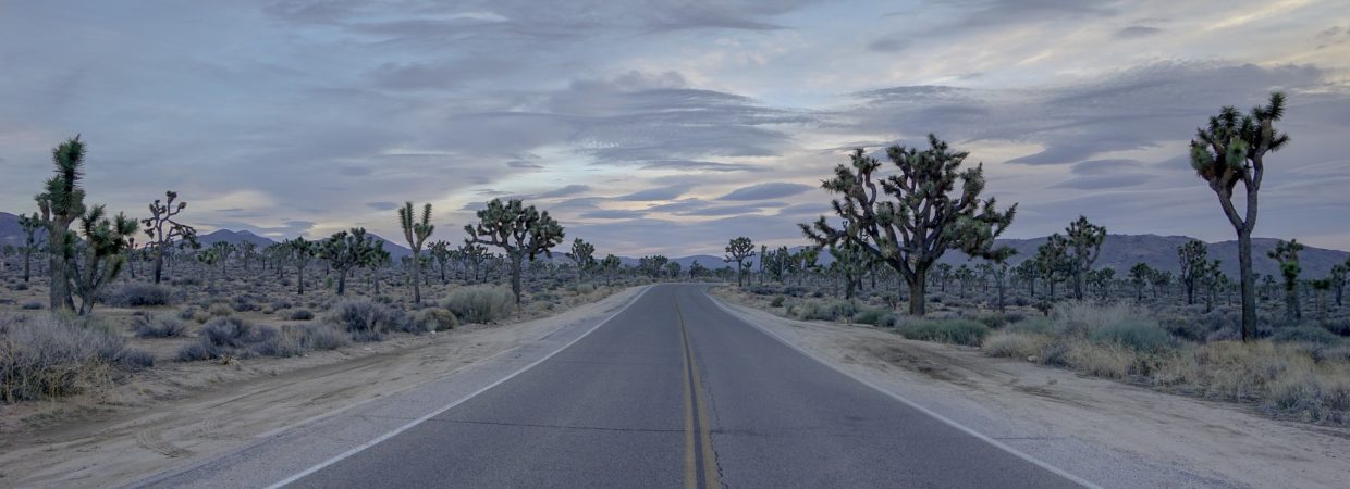
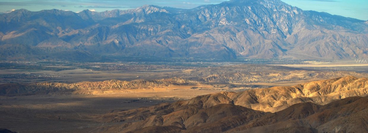
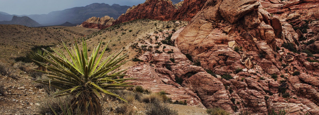
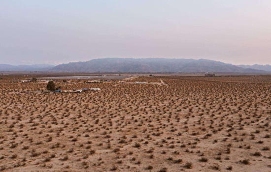
This parcel is nestled in the South Park Peak mountains. Amazing spot to hunt, hike, camp, and potentially to build a homestead cabin.
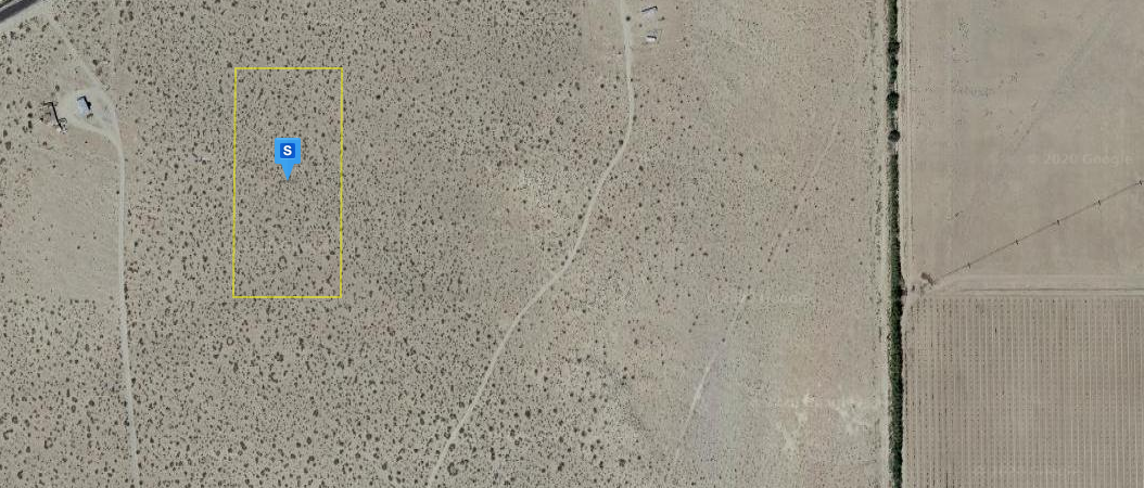
Want to go see this parcel in person? Give me a call at 831-392-7699 or simply plug in the coordinates into your GPS: 34.0801456,-116.4309499
Listed at just $4,700, this property will not last long. The most affordable 5 acre in the entire area.
SITE INFORMATION
Land Use:Vacant Land (NEC)
Lot Area: 217,800 Sq. Ft.
County Use:0000 – Vacant Land
Acres:5.0
Flood Zone Code:D
Flood Map #:06071C8860H
Flood Map Date:08/28/2008Community Name:
Town Of Yucca Valley
Flood Panel #:8860H
Inside SFHA:False
TAX INFORMATION
Assessed Year:2020:
Tax Year:2020
Tax Area:023-010
Property Tax:$191.62
LOCATION INFORMATION
Legal Description:N 1/2 Sw 1/4 Nw 1/4 Se 1/4 Sec 14 Tp 1S R 5E 5. Ac
County:San Bernardino, CA
APN:0585-042-02-0000
Alternate APN:0585-042-02-0000
Munic / Twnshp:Joshua Tree
Twnshp-Rng-Sec:01S-05E-14
Latitude:34.08101
Longitude:-116.43048
(Land is accessible with a 4×4 or high clearance vehicle, please do not use regular size cars)
NEARBY ATTRACTIONS/CITY
YUCCA VALLEY
Yucca Valley lies in the Little San Bernardino Mountains at an elevation of 3,300 feet. Crisp air, starry skies and the incomparable beauty of the high desert help to create its unique charm and friendly atmosphere.
Yucca Valley is conveniently situated on CA State Highway 62, intersected by State Highway 247 and easily accessible to all of Southern California.
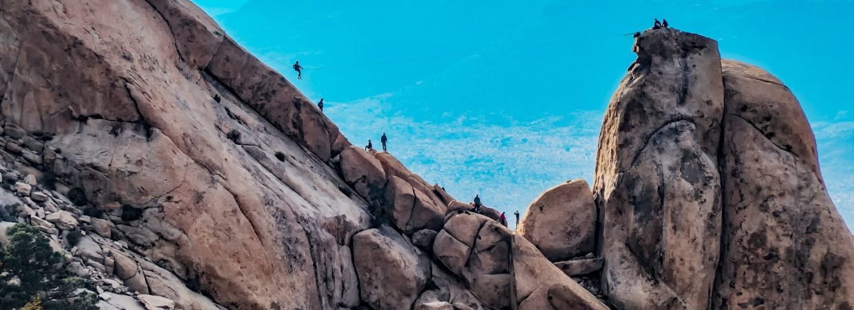
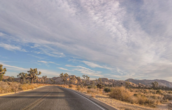
As the gateway to the Joshua Tree National Park and the economic hub of the Morongo basin, Yucca Valley is renowned for its outdoor recreational opportunities, regional attractions, and will this year inaugurate the Yucca Valley Film Festival.
From the days of the Wild West to incorporation in 1991 and well into the 21st Century, Yucca Valley has experienced significant growth, but retained its rich Western heritage. Today, residents, businesses and visitors alike find Yucca Valley a highly rewarding place to live, work and play.
EDUCATION
Public education in Yucca Valley is under the administration of the Morongo Unified School District. Yucca Valley has three neighborhood elementary schools (Onaga Elementary, Yucca Mesa Elementary, and Yucca Valley [Hope] Elementary), one middle school (La Contenta Middle School), and two high schools (Yucca Valley High School and Black Rock Continuation High School).
Private schools in Yucca Valley include Our Lady of the Desert, a Christian school for K–12; Valley Community Chapel School and Daycare offering Preschool, Kindergarten and before and after school Daycare; Joshua Springs Christian School, non-denominational affiliation for PK–12; Grace Christian School, Brethren affiliation for K–12; Hi-Desert SDA Elementary, a 1–6, Seventh Day Adventist affiliation school; and Yucca Valley Christian School, affiliated with The Assembly of God, for PK–12. Hope Academy lost its charter with the Morongo Unified School District in 2016 and was unable to find another charter and subsequently closed. Adult tutoring is also available in Yucca Valley, with tutoring information available at the Yucca Valley Public Library.
TRANSPORTATION
Yucca Valley has two major means of highway access; California State Route 62 (Twentynine Palms Highway) runs east-west and is the main thoroughfare through town and terminates at the south end at Interstate 10 and Parker Dam on the Arizona border at the east end. State Route 247 (Old Woman Springs Road) begins in Yucca Valley and extends north through Barstow and terminates at Interstate 15. The Morongo Basin Transit Authority (MBTA)[9] serves the area with scheduled bus service around town and the lower desert. The service connects passengers to the Palm Springs International Airport direct bus lines to Los Angeles. [10] The area is served locally by the Yucca Valley Airport.
GEOGRAPHY AND TERRAIN
Yucca Valley lies in the middle of the Morongo Basin at a base elevation of 3,300 feet. Joshua Tree National Park is adjacent to its southern border.Inland Empire storm tries to enter the High Desert‘s Yucca Valley, but is held back by the San Bernardino Mountains
According to the United States Census Bureau, the town has a total area of 40.0 square miles (104 km2). 40.0 square miles (104 km2) of it is land and none of it is covered in water. Yucca Valley is located north of the Joshua Tree National Park, while the Little San Bernardino Mountains and many hills cover a large percentage of city area.
This High Desert community has an elevation (city hall) at 3,224 feet (983 m) above sea level. Snowfall occurs almost annually whenever the snow level drops to elevations under 4,000 feet (1,200 m). The area’s terrain is prone to wildfires (such as the Pioneertown fire in July 2006), resulting from plant growth during the rainy seasons and flash floods. The plants within the town and among the chaparral in the mountains outside of the San Bernardino National Forest wilt and perish from the summer heat, providing ample fuel during a fire.
GEOLOGY
Yucca Valley has experienced high levels of seismic activity. Fault lines criss-cross the town and the Morongo basin.
CLIMATE
According to the Köppen Climate Classification system, Yucca Valley has a cold desert climate, abbreviated “BWk” on climate maps.[11]
| hideClimate data for Yucca Valley, CA | |||||||||||||
|---|---|---|---|---|---|---|---|---|---|---|---|---|---|
| Month | Jan | Feb | Mar | Apr | May | Jun | Jul | Aug | Sep | Oct | Nov | Dec | Year |
| Average high °F (°C) | 61.1 (16.2) |
61.1 (16.2) |
69.1 (20.6) |
74.4 (23.6) |
86.3 (30.2) |
92.3 (33.5) |
102.0 (38.9) |
99.0 (37.2) |
95.8 (35.4) |
80.1 (26.7) |
70.1 (21.2) |
58.3 (14.6) |
79.13 (26.18) |
| Average low °F (°C) | 38.5 (3.6) |
38.8 (3.8) |
40.2 (4.6) |
44.4 (6.9) |
54.1 (12.3) |
59.9 (15.5) |
71.6 (22.0) |
67.5 (19.7) |
64.1 (17.8) |
52.8 (11.6) |
43.9 (6.6) |
36.3 (2.4) |
51.01 (10.56) |
| Average precipitation inches (mm) | 0.7 (18) |
0.5 (13) |
0.4 (10) |
0.1 (2.5) |
0.2 (5.1) |
0 (0) |
0.3 (7.6) |
0.4 (10) |
0.4 (10) |
0.4 (10) |
0.6 (15) |
0.8 (20) |
4.8 (120) |
| Source: Weatherbase[12] |
HISTORY
| This section does not cite any sources. Please help improve this section by adding citations to reliable sources. Unsourced material may be challenged and removed. (May 2015) (Learn how and when to remove this template message) |
Norman J. Essig was a key player in the late 1950s in working toward establishing Yucca Valley as a place for entertainment celebrities to come and live in privacy. He personally acquired hundreds of acres of land during this time and owned and ran Glenn Realty. He helped to put in the main roads that are running throughout the town off of Hwy 62. He was personal friends with Jimmy Van Heusen the composer and gave him prime real estate in Yucca Valley to build his house which can still be seen atop the highest hill in the center of the town. He is survived by two daughters and seven grandchildren.
In 1992, three large earthquakes occurred near the city, the magnitude 6.1 Joshua Tree earthquake on April 22, and on June 28 the 7.3 Landers and 6.5 Big Bear earthquakes.
The 7.1 magnitude Hector Mine earthquake on October 16, 1999 had an epicenter 30 miles (48 km) north of town.
On July 11, 2006, a wildfire started by lightning raced through neighboring Pioneertown. The blaze, named the Sawtooth Complex fire, also burned into Yucca Valley and nearby Morongo Valley and destroyed roughly 64,000 acres (26,000 ha) of desert landscape.
Yucca Valley is home to the geoglyph “Atlatl” by artist Andrew Rogers.
DEMOGRAPHICS
| Historical population | |||
|---|---|---|---|
| Census | Pop. | %± | |
| 1970 | 3,893 | — | |
| 1980 | 8,294 | 113.0% | |
| 1990 | 13,701 | 65.2% | |
| 2000 | 16,865 | 23.1% | |
| 2010 | 20,700 | 22.7% | |
| 2019 (est.) | 21,777 | [5] | 5.2% |
| U.S. Decennial Census[13] |
2010
The 2010 United States Census[14] reported that Yucca Valley had a population of 20,700. The population density was 517.3 people per square mile (199.7/km2). The racial makeup of Yucca Valley was 17,280 (83.5%) White (73.7% Non-Hispanic White),[15] 666 (3.2%) African American, 232 (1.1%) Native American, 469 (2.3%) Asian, 44 (0.2%) Pacific Islander, 1,185 (5.7%) from other races, and 824 (4.0%) from two or more races. Hispanic or Latino of any race were 3,679 persons (17.8%).
The Census reported that 20,481 people (98.9% of the population) lived in households, 166 (0.8%) lived in non-institutionalized group quarters, and 53 (0.3%) were institutionalized.
There were 8,274 households, out of which 2,512 (30.4%) had children under the age of 18 living in them, 3,661 (44.2%) were opposite-sex married couples living together, 1,116 (13.5%) had a female householder with no husband present, 477 (5.8%) had a male householder with no wife present. There were 604 (7.3%) unmarried opposite-sex partnerships, and 83 (1.0%) same-sex married couples or partnerships. 2,387 households (28.8%) were made up of individuals, and 1,163 (14.1%) had someone living alone who was 65 years of age or older. The average household size was 2.48. There were 5,254 families (63.5% of all households); the average family size was 3.03.
The population was spread out, with 4,937 people (23.9%) under the age of 18, 1,772 people (8.6%) aged 18 to 24, 4,676 people (22.6%) aged 25 to 44, 5,495 people (26.5%) aged 45 to 64, and 3,820 people (18.5%) who were 65 years of age or older. The median age was 40.6 years. For every 100 females, there were 94.7 males. For every 100 females age 18 and over, there were 91.1 males.
There were 9,558 housing units at an average density of 238.9 per square mile (92.2/km2), of which 5,256 (63.5%) were owner-occupied, and 3,018 (36.5%) were occupied by renters. The homeowner vacancy rate was 4.6%; the rental vacancy rate was 9.6%. 12,220 people (59.0% of the population) lived in owner-occupied housing units and 8,261 people (39.9%) lived in rental housing units.
Virtual Tour
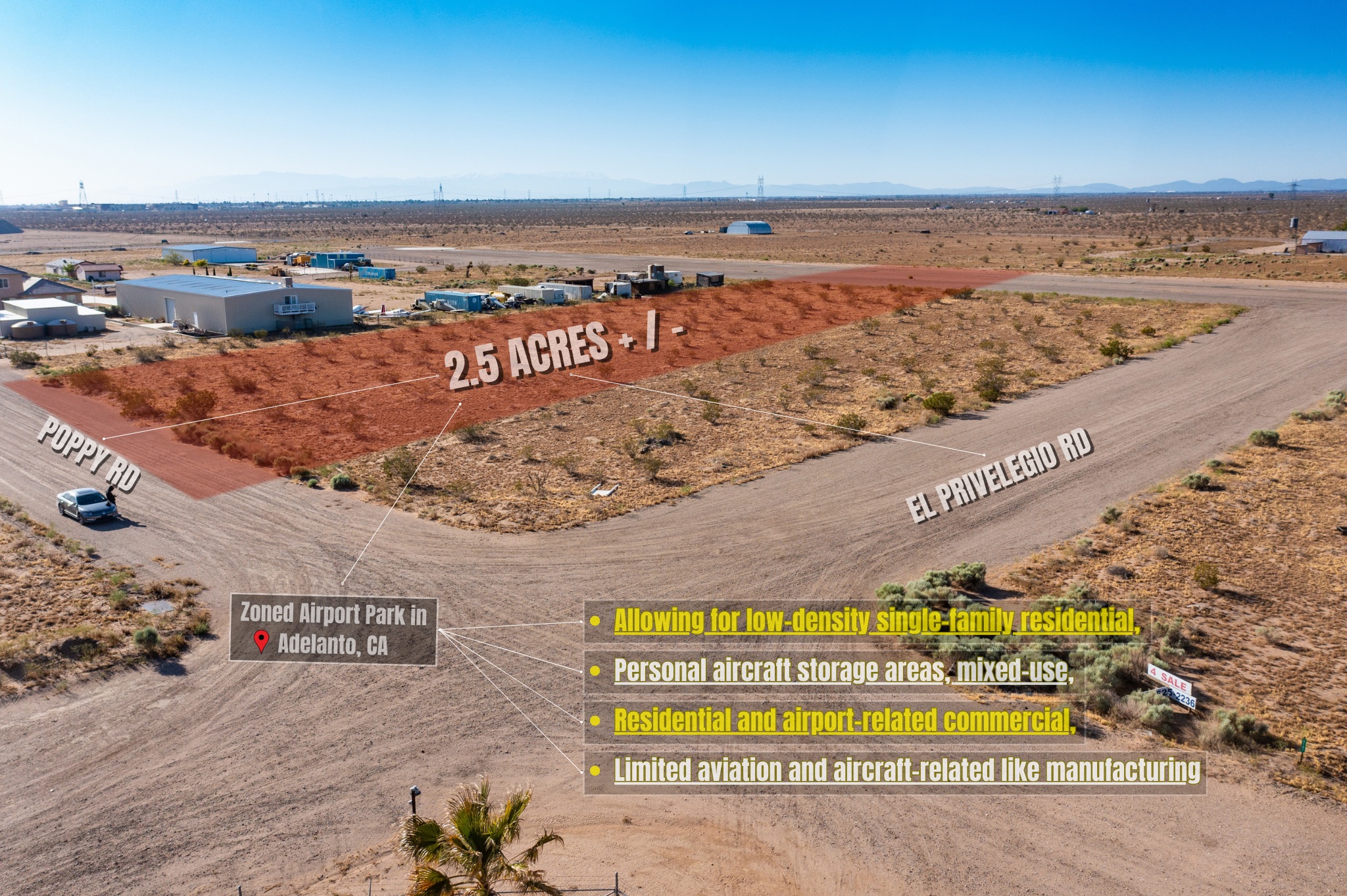
2.5 Acres Zoned Airport Park in Adelanto, CA
Stunning 20 Acre Parcel In Desert Heights W/ Owner Financing – Put $7,500 Down and finance the rest with 0% Interest!
Just $775 Down for This 2 Acre Lot In Sunfair Heights in San Bernardino, CA!