


Specification
Features
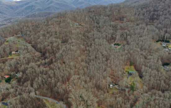
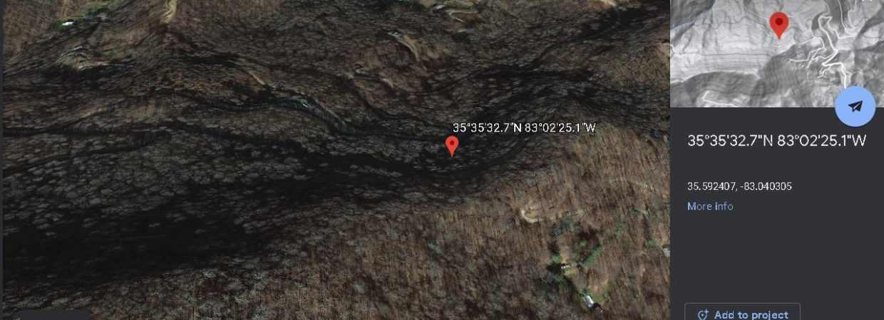
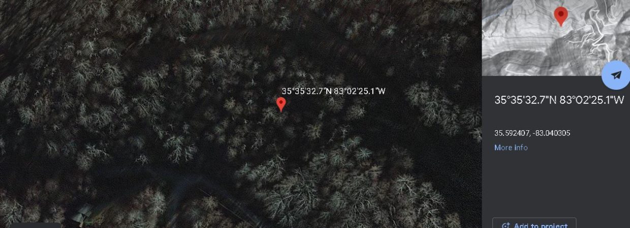
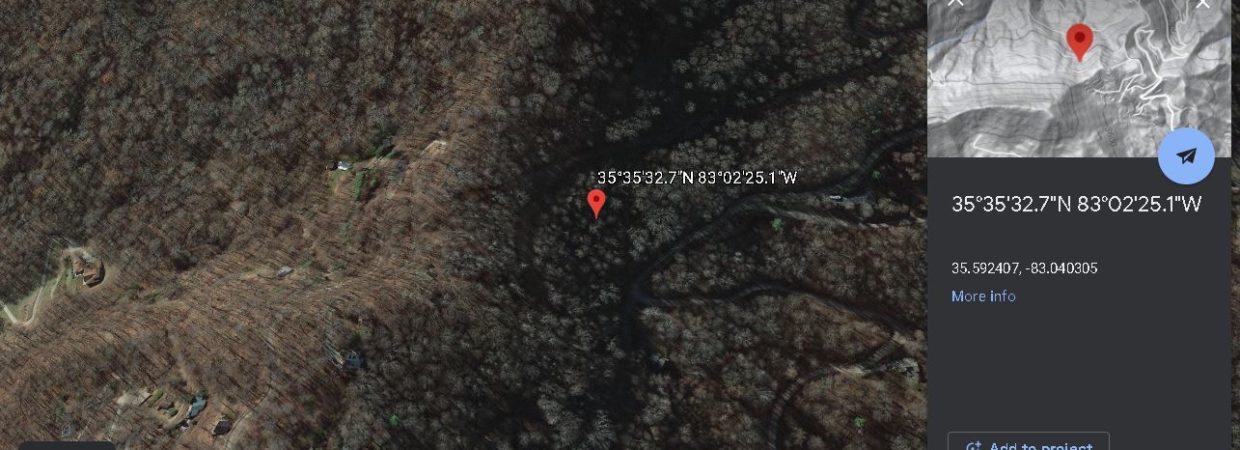
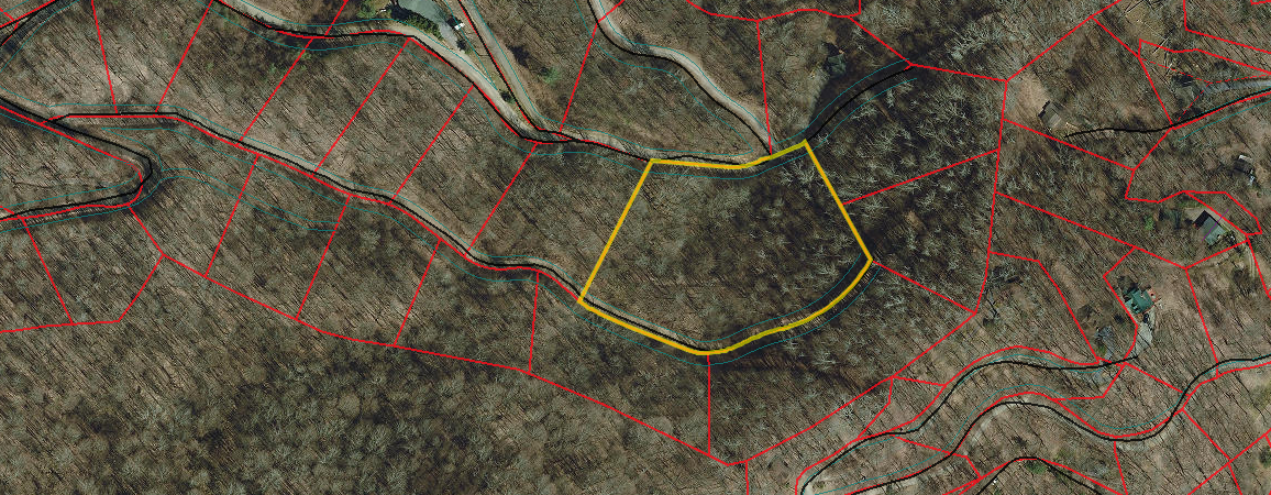
Location
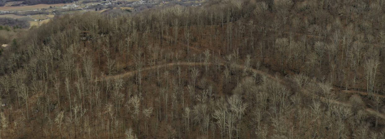
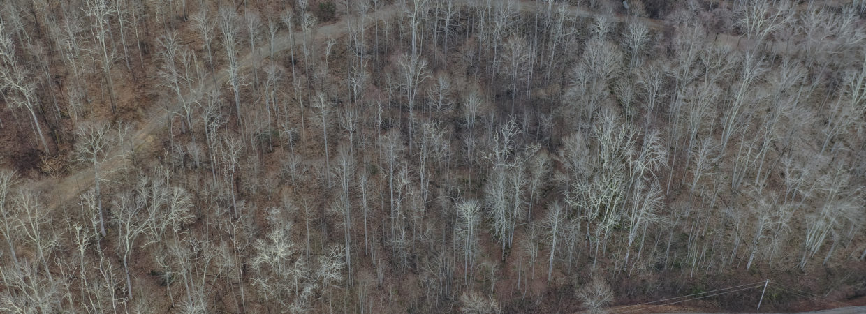
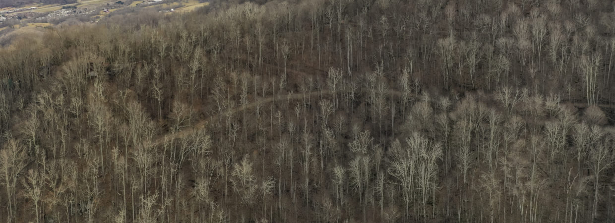
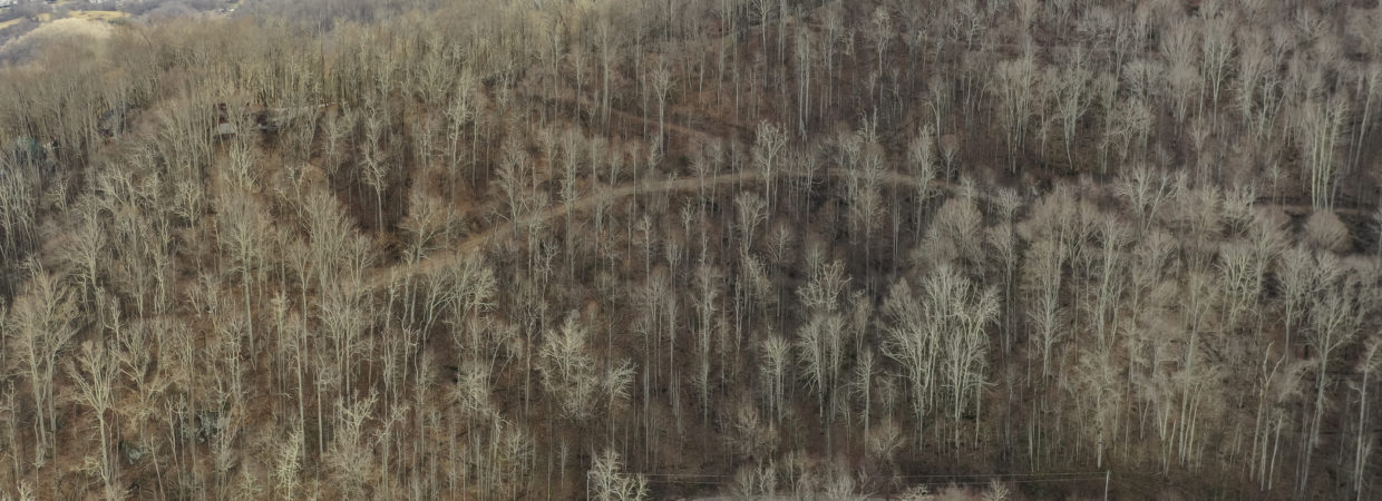
Description
List of fish
DESCRIPTION
This deal won’t last long, priced at just $36,700 (that’s over $7,700 in savings).
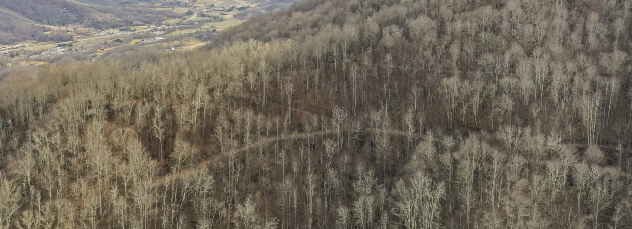
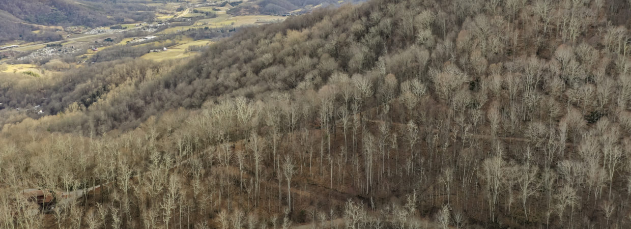
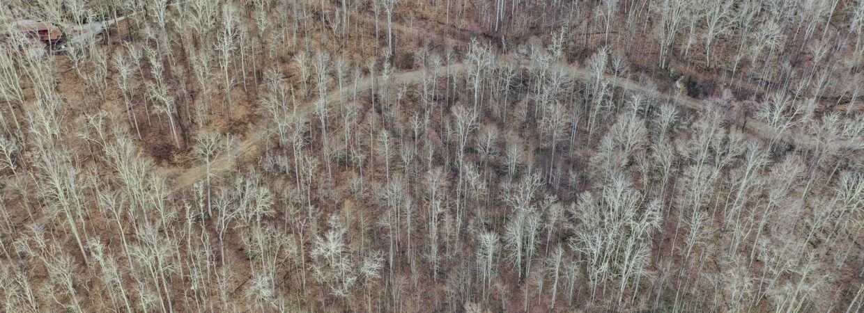
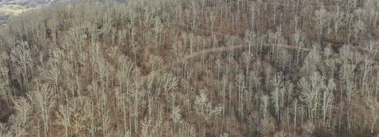
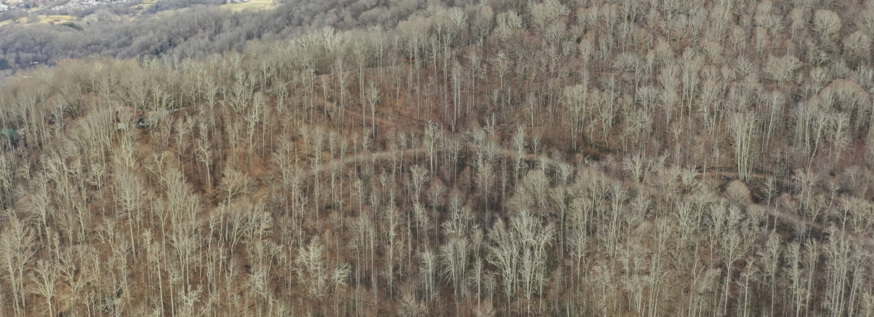
This stunning lot is located in the beautiful gated subdivision of Cataloochee Mountain Estates. Year round mountain views can be seen from the home build site. This lot allows 2 horses. Subdivision has a large common area and stocked pond for owners to enjoy. Shared well, and great maintained roads. A great piece of property to build your dream home to enjoy the mountains but yet still be close to town.
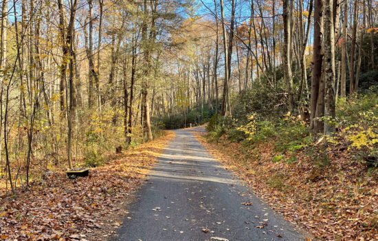
Just minutes to all the Great Smoky Mountains have to offer such as Golf, Skiing, Hiking, Rafting, Dining, Shopping, & the Great Smoky National Park. See Elk Herd Daily at Dusk. Just 25 Minutes to Harrahs Casino, 30 Mins to Asheville, 1 Hr 15 Mins to Gatlinburg Pigeon Forge Tenn.
Call me at 858-261-7788 with any questions.
NEARBY ATTRACTION
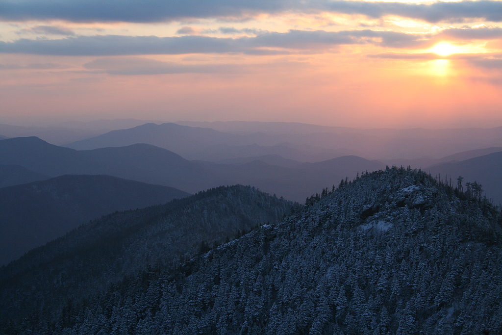
GREAT SMOKY MOUNTAINS NATIONAL PARK
HISTORY
For thousands of years, this region was occupied by successive cultures of indigenous peoples. The historic Cherokee had their homeland here, and occupied numerous towns in the river valleys on both sides of the Appalachian Mountains. Their first encounters with Europeans were as traders, mostly coming from colonial Virginia and the Carolinas.
European Americans did not begin to settle here until the late 18th and early 19th centuries.[11] Particularly because of their pressure to acquire land in the Deep South, in 1830 President Andrew Jackson signed the Indian Removal Act, beginning the process that eventually resulted in the forced removal of all Indian tribes east of the Mississippi River to Indian Territory (now Oklahoma).
Most of the Cherokee were also removed. For a period some, led by such warriors as Tsali, evaded removal by staying in the area now part of the Great Smoky Mountains National Park. A band on the Oconaluftee River acquired land and also remained. Their descendants make up most of the federally recognized Eastern Band of Cherokee Indians, based in Cherokee, North Carolina and their Qualla Boundary reserve to the south of the park.Clearcut logging in the Blue Ridge Mountains in Tennessee, 1936
As white settlers arrived, entrepreneurs developed logging as a major industry in the mountains. The Little River Railroad was constructed in the late-19th century to haul timber out of the remote regions of the area.
Because cut-and-run-style clearcutting was destroying the natural beauty of the area, by the 20th century visitors and locals banded together to raise money for preservation of the land. The U.S. National Park Service wanted a park in the eastern United States, but did not have much money to establish one. David Chapman, a Knoxville, Tennessee business leader, was appointed in 1925 to head a commission to establish a national park here. Congress authorized the park in 1926, but there was no nucleus of federally owned land around which to develop it. John D. Rockefeller, Jr. contributed $5 million, the U.S. government added $2 million, and private citizens from Tennessee and North Carolina pitched in to assemble the land for the park, piece by piece.
Slowly, mountain homesteaders, miners, and loggers were evicted from the land. Farms and timbering operations were abolished to establish the protected areas of the park. Travel writer Horace Kephart, for whom Mount Kephart was named, and photographers Jim Thompson and George Masa were instrumental in fostering the development of the park.[8][12] Former Governor Ben W. Hooper of Tennessee was the principal land purchasing agent for the park,[13] which was officially established on June 15, 1934. During the Great Depression, the Civilian Conservation Corps, the Works Progress Administration, and other federal organizations hired workers to build trails, fire watchtowers, and other infrastructure improvements to the park and Smoky Mountains.
IMPORTANCE IN CULTURE
The park was used for filming scenes of Disney‘s hit 1950s TV series, Davy Crockett, King of the Wild Frontier.
This park was designated an International Biosphere Reserve in 1976, was certified as a UNESCO World Heritage Site in 1983, and became a part of the Southern Appalachian Biosphere Reserve in 1988.[14]
A 75th anniversary re-dedication ceremony was held on 2 September 2009. Among those in attendance were the four US Senators from Tennessee and North Carolina, the three US Representatives whose districts include the park, the governors of both states, and Secretary of the Interior Ken Salazar. Dolly Parton, Tennessee native, singer, and actress also attended and performed.[15]
In late November and early December 2016, a series of wildfires engulfed a total of 17,900 acres (72 km2) in the park and surrounding areas. The wildfires killed at least 14, injured 190, and forced the evacuation of more than 14,000 people.[16] The fires also damaged or destroyed at least 2,000 structures. The fires, which were initially suspected to have been caused by arson, occurred during a period of unusual drought, which accelerated the fires. The wildfires were the deadliest in the Eastern United States since the Great Fires of 1947, and comprised one of the worst natural disasters in the history of Tennessee.[17][18][19][20]
In 2015 Cassius Cash was appointed as the first African-American superintendent of Great Smoky Mountains National Park. He is the 16th superintendent of the park.[21]
GEOLOGY
The majority of rocks in the Great Smoky Mountains National Park are Late Precambrian rocks that are part of the Ocoee Supergroup. This group consists of metamorphosed sandstones, phyllites, schists, and slate. Early Precambrian rocks are not only the oldest rocks in the park but also the dominant rock type in sites such as the Raven Fork Valley and upper Tuckasegee River between Cherokee and Bryson City. They primarily consist of metamorphic gneiss, granite, and schist. Cambrian sedimentary rocks can be found among the bottom of the Foothills to the northwest and in limestone coves such as Cades Cove.[22] One of the most visited attractions in the mountains is Cades Cove which is a window or an area where older rocks made out of sandstone surround the valley floor of younger rocks made out of limestone.
The oldest rocks in the Smokies are the Precambrian gneiss and schists which were formed over a billion years ago from the accumulation of marine sediments and igneous rock. In the Late Precambrian, the primordial ocean expanded and the more recent Ocoee Supergroup rocks formed from the accumulation of eroding land mass onto the continental shelf. In the Paleozoic Era, the ocean deposited a thick layer of marine sediments which left behind sedimentary rock. During the Ordovician Period, the collision of the North American and African tectonic plates initiated the Alleghenian orogeny that created the Appalachian range. During the Mesozoic Era rapid erosion of softer sedimentary rocks re-exposed the older Ocoee Supergroup formations.[23]
ENVIRONMENT
The observation tower at Clingmans Dome, the highest point in the national park
Elevations in the park range from about 875 feet (267 m) to 6,643 feet (2,025 m) at the summit of Clingmans Dome. Within the park a total of sixteen mountains reach higher than 5,000 feet (1,520 m).[24]
The wide range of elevations mimics the latitudinal changes found throughout the entire eastern United States. Ascending the mountains is comparable to a trip from Tennessee to Canada. Plants and animals common in the country’s Northeast have found suitable ecological niches in the park’s higher elevations, while southern species find homes in the balmier lower reaches.
CLIMATE
According to the Köppen climate classification system, Great Smoky Mountains National Park has two climate types: humid subtropical (Cfa) and temperate oceanic (Cfb).[citation needed] The plant hardiness zone at Clingmans Dome Visitor Center is 5b with an average annual extreme minimum temperature of -14.3 °F (-25.7 °C).[25]
| hideClimate data for Clingmans Dome Visitor Center, NC (1981 – 2010 averages). Elevation 6,348 feet (1,935 m). | |||||||||||||
|---|---|---|---|---|---|---|---|---|---|---|---|---|---|
| Month | Jan | Feb | Mar | Apr | May | Jun | Jul | Aug | Sep | Oct | Nov | Dec | Year |
| Average high °F (°C) | 40.5 (4.7) |
43.9 (6.6) |
51.5 (10.8) |
61.5 (16.4) |
67.5 (19.7) |
73.3 (22.9) |
75.6 (24.2) |
75.4 (24.1) |
71.4 (21.9) |
63.8 (17.7) |
52.5 (11.4) |
43.7 (6.5) |
60.1 (15.6) |
| Daily mean °F (°C) | 31.2 (−0.4) |
34.1 (1.2) |
40.5 (4.7) |
49.2 (9.6) |
56.4 (13.6) |
63.2 (17.3) |
66.2 (19.0) |
65.7 (18.7) |
60.7 (15.9) |
52.3 (11.3) |
42.3 (5.7) |
34.3 (1.3) |
49.7 (9.8) |
| Average low °F (°C) | 21.9 (−5.6) |
24.2 (−4.3) |
29.6 (−1.3) |
36.9 (2.7) |
45.3 (7.4) |
53.1 (11.7) |
56.7 (13.7) |
55.9 (13.3) |
50.0 (10.0) |
40.8 (4.9) |
32.1 (0.1) |
24.9 (−3.9) |
39.4 (4.1) |
| Average precipitation inches (mm) | 7.38 (187) |
6.56 (167) |
6.69 (170) |
5.65 (144) |
6.61 (168) |
6.75 (171) |
7.17 (182) |
5.72 (145) |
6.38 (162) |
4.89 (124) |
7.60 (193) |
6.48 (165) |
77.88 (1,978) |
| Average relative humidity (%) | 71.9 | 72.8 | 68.1 | 64.4 | 76.2 | 82.8 | 83.6 | 85.4 | 82.7 | 74.7 | 72.8 | 76.2 | 76.0 |
| Average dew point °F (°C) | 23.2 (−4.9) |
26.3 (−3.2) |
30.8 (−0.7) |
37.7 (3.2) |
49.0 (9.4) |
57.9 (14.4) |
61.1 (16.2) |
61.2 (16.2) |
55.4 (13.0) |
44.5 (6.9) |
34.2 (1.2) |
27.6 (−2.4) |
42.5 (5.8) |
| Source: PRISM Climate Group[26] |
The humid, subtropical air mass typically in place over the Smoky Mountains produces large amounts of precipitation. Annual precipitation amounts range from 50–80 in (1,300–2,000 mm),[27] with heavy winter snowfall in the higher elevations.[28] Flash flooding often occurs after heavy rain.[27]
The average temperature difference between the mountains, such as Newfound Gap at 5,048 ft (1,539 m) above MSL, and the valleys at about 1,600 ft (488 m), is between 10–13 °F (5.6–7.2 °C) for highs, and between 3–6 °F (1.7–3.3 °C) for lows. The difference between high temperatures is similar to the moist adiabatic lapse rate of 3.3 °F (1.8 °C) per 1,000 ft (300 m), while the smaller difference between low temperatures is the result of frequent temperature inversions developing in the morning, most often in autumn.[29]
Strong damaging winds of 80–100 mph (130–160 km/h) or higher occur a few times each year around the Smoky Mountains, mainly during the cool season from October to April, as a result of a phenomenon known as mountain waves.[30] Mountain waves are strongest in a narrow area along the foothills, and can create extensive areas of fallen trees and roof damage, especially around Cades Cove and Cove Mountain.[31] Strong winds created by mountain waves were a contributing factor in the devastating Gatlinburg fire on November 28, 2016 during the 2016 Great Smoky Mountains wildfires.[32]
AIR POLLUTION
In 2013, Colorado State University reported that, due to the passing of the United States Clean Air Act in 1970 and the subsequent implementation of the Acid Rain Program, there had been a “significant improvement” to the air quality in the Great Smoky Mountains from 1990 to 2010.[33][34]
But the park still suffers from air pollution because of increased development in the region. According to a 2004 report by the National Parks Conservation Association, Great Smoky Mountains National Park is considered the most polluted national park. From 1999 to 2003, the park recorded approximately 150 unhealthy air days, the equivalent of about one month of unhealthy air days per year.[35][36]
BIOLOGY AND ECOLOGY
The park is almost 95 percent forested, and almost 36 percent of it, 187,000 acres (76,000 ha), is estimated by the Park Service to be old growth forest with many trees that predate European settlement of the area.[37] It is one of the largest blocks of deciduous, temperate, old growth forest in North America.Colorful autumn leaves in October 2008
The variety of elevations, the abundant rainfall, and the presence of old growth forests give the park an unusual richness of biota. About 19,000 species of organisms are known to live in the park, and estimates as high as an additional 100,000 undocumented species may also be present.
Park officials count more than 200 species of birds, 50 species of fish, 39 species of reptiles, and 43 species of amphibians, including many lungless salamanders. The park has a noteworthy black bear population, numbering about 1,500.[38] Elk (wapiti) were reintroduced to the park in 2001. Elk are most abundant in the Cataloochee area in the southeastern section of the park.[39]
It is also home to species of mammals such as the raccoon, bobcat, two species of fox, river otter, woodchuck, beaver, two species of squirrel, opossum, coyote, white-tailed deer, chipmunk, two species of skunk, and various species of bats.
Over 100 species of trees grow in the park. The lower region forests are dominated by deciduous leafy trees. At higher altitudes, deciduous forests give way to coniferous trees like Fraser fir. In addition, the park has over 1,400 flowering plant species and over 4,000 species of non-flowering plants.
FISH
There have been hundreds of known species of fish living in the area.
List of fish
ATTRACTIONS AND ACTIVITIES
The Alum Cave Bluffs trail to the summit of Mount LeConte provides numerous views of the Great Smoky Mountains.
The Great Smoky Mountains National Park is a major tourist attraction in the region. It was the most visited national park in 2019, with over 12.5 million recreational visitors (tourists).[41] The recreational figure represents nearly twice as many tourists as the Grand Canyon, which received nearly 6 million visitors the same year. Surrounding towns, notably Gatlinburg, Pigeon Forge, Sevierville, and Townsend, Tennessee, and Cherokee, Sylva, Maggie Valley, and Bryson City, North Carolina, receive a significant portion of their income from tourism associated with the park.
The two main visitors’ centers inside the park are Sugarlands Visitors’ Center near the Gatlinburg entrance to the park and Oconaluftee Visitor Center near Cherokee, North Carolina, at the eastern entrance to the park. These ranger stations provide exhibits on wildlife, geology, and the history of the park. They also sell books, maps, and souvenirs.
U.S. Highway 441 (known in the park as Newfound Gap Road) bisects the park, providing automobile access to many trailheads and overlooks, most notably that of Newfound Gap. At an elevation of 5,048 feet (1,539 m), it is the lowest gap in the mountains and is situated near the center of the park, on the Tennessee/North Carolina state line, halfway between the border towns of Gatlinburg and Cherokee. It was here that in 1940, from the Rockefeller Memorial, Franklin Delano Roosevelt dedicated the national park. On clear days Newfound Gap offers arguably the most spectacular scenes accessible via highway in the park.
The park has a number of historical attractions. The most well-preserved of these (and most popular) is Cades Cove, a valley with a number of preserved historic buildings including log cabins, barns, and churches. Cades Cove is the single most frequented destination in the national park. Self-guided automobile and bicycle tours offer the many sightseers a glimpse into the way of life of old-time southern Appalachia. Other historical areas within the park include Roaring Fork, Cataloochee, Elkmont, and the Mountain Farm Museum and Mingus Mill on the Oconaluftee River.
HIKING
Main article: Hiking in the Great Smoky Mountains National Park
There are 850 miles (1,370 km) of trails and unpaved roads in the park for hiking, including 70 miles (110 km) of the Appalachian Trail.[42] Mount Le Conte is one of the most frequented destinations in the park. Its elevation is 6,593 feet (2,010 m), the third highest summit in the park and, measured from its base to its highest peak, the tallest mountain east of the Mississippi River. Alum Cave Trail is the most heavily used of the five paths en route to the summit. It provides many scenic overlooks and unique natural attractions such as Alum Cave Bluffs and Arch Rock. Hikers may spend a night at the LeConte Lodge, located near the summit, which provides cabins and rooms for rent (except during the winter season). Accessible solely by trail, it is the only private lodging available inside the park.The Chimney Tops was a popular destination for hikers until access was closed due to wildfire damage in 2016.
Another popular hiking trail led to the pinnacle of the Chimney Tops, so named because of its unique dual-humped peaktops. This short but strenuous trek rewarded nature enthusiasts with a spectacular panorama of the surrounding mountain peaks. It was the flashpoint for the 2016 wildfires and therefore sustained extensive damage, evident still today in clearly visible burn scars. The peak has been closed to tourists ever since.
Both the Laurel Falls and Clingmans Dome trails offer relatively easy, short, paved paths to their respective destinations. The Laurel Falls Trail leads to a powerful 80-foot (24 m) waterfall, and the Clingmans Dome Trail takes visitors on an uphill climb to a 50 feet (15 m) tall observation deck, which on a clear day offers views for many miles over the Tennessee, North Carolina, and Georgia mountains.
In addition to day hiking, the national park offers opportunities for backpacking and camping. Camping is allowed only in designated camping areas and shelters. Most of the park’s trail shelters are located along the Appalachian Trail or a short distance away on side trails. In addition to the Appalachian Trail shelters used mostly for extended backpacking trips there are three shelters in the park that are not located on the Appalachian Trail. The Mt. LeConte Shelter is located a short distance east of LeConte Lodge on The Boulevard Trail. It can accommodate 12 people per night, and is the only backcountry site in the entire park that has a permanent ban on campfires. The Kephart Shelter is located at the terminus of the Kephart Prong Trail which begins upstream of the Collins Creek Picnic Area. The shelter, situated along a tributary of the Oconaluftee River can accommodate 14 people. Laurel Gap Shelter is one of the more remote shelters in the park. Situated in a Beech forest swag between Balsam High Top and Big Cataloochee Mountain, the Laurel Gap Shelter can accommodate up to 14 people per night. This shelter is a popular base camp for peakbaggers exploring the heart of the Smokies wilderness.
Designated backcountry campsites are scattered throughout the park. A permit, available at ranger stations and via the Park website, is required for all backcountry camping. Additionally, reservations are required for all of the shelters and backcountry campsites. A maximum stay of one night, in the case of shelters, or three nights, in the case of campsites, may limit the traveler’s itinerary.
OTHER ACTIVITIES
After hiking and simple sightseeing, fishing (especially fly fishing) is the most popular activity in the national park. The park’s waters have long had a reputation for healthy trout activity as well as challenging fishing terrain. Brook trout are native to the waters, while both brown and rainbow were introduced to the area. Partially due to the fact of recent droughts killing off the native fish, there are strict regulations regarding how fishing may be conducted. Horseback riding (offered by the national park and on limited trails), bicycling (available for rent in Cades Cove) and water tubing are all also practiced within the park.
From late May to early June, the Elkmont area of the park hosts the peak display period for synchronous fireflies (Photinus carolinus), one of at least 19 species of fireflies that live in Great Smoky Mountains National Park.[43] They are the only species in America whose individuals can synchronize their flashing light patterns.[44]Cades Cove panorama
HISTORIC AREAS WITHIN THE NATIONAL PARK
See also: List of historical structures maintained by the Great Smoky Mountains National ParkThe Becky Cable house in the Cades Cove Historic District was built in 1879.
The park service maintains four historic districts and one archaeological district within park boundaries, as well as nine individual listings on the National Register of Historic Places. Notable structures not listed include the Mountain Farm Museum buildings at Oconaluftee and buildings in the Cataloochee area. The Mingus Mill (in Oconaluftee) and Smoky Mountain Hiking Club cabin in Greenbrier have been deemed eligible for listing.
HISTORIC DISTRICTS
- Cades Cove Historic District
- Elkmont Historic District
- Oconaluftee Archaeological District
- Noah Ogle Place
- Roaring Fork Historic District
INDIVIDUAL LISTINGS
The John Ownby Cabin in The Sugarlands valley was built in 1860.
- Alex Cole Cabin
- Clingmans Dome Observation Tower
- Hall Cabin (in Hazel Creek area)
- John Messer Barn
- John Ownby Cabin
- Oconaluftee Baptist Church (also called Smokemont Baptist Church)
- Tyson McCarter Place
- Mayna Treanor Avent Studio
- Little Greenbrier School
- Walker Sisters Place
ELECTRIC VEHICLES
The National Park Service (NPS) announced in late 2001 that it would use electric vehicles (EVs) provided by the Tennessee Valley Authority (TVA) for a research project in the Great Smoky Mountains National Park to evaluate the vehicles’ performance in mountainous terrain. The NPS said the EVs will be on loan from TVA for two years and will be used by park service staff at Cades Cove and the Great Smoky Mountains Institute at Tremont to determine the benefits provided by these vehicles versus standard gasoline-fueled vehicles.[45]
Virtual Tour
1.6 Acre Mountain Estate Outside of Iron Duff, North Carolina in Haywood County