


Specification
Features
Location
Description
DESCRIPTION
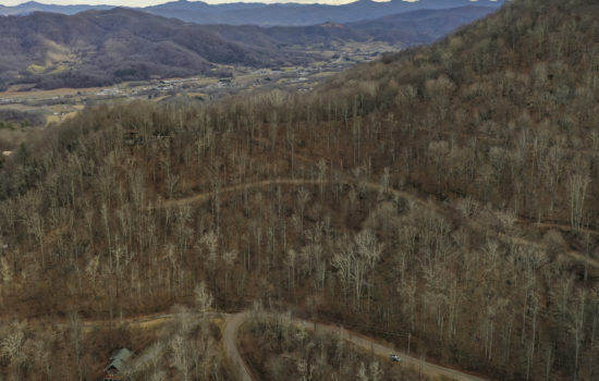
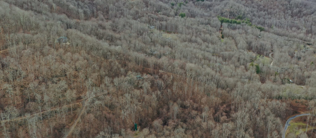
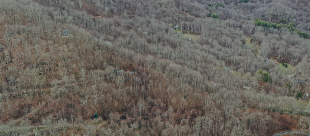
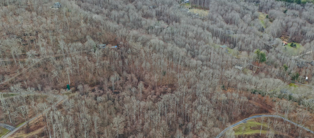
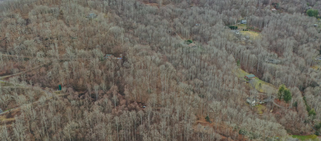
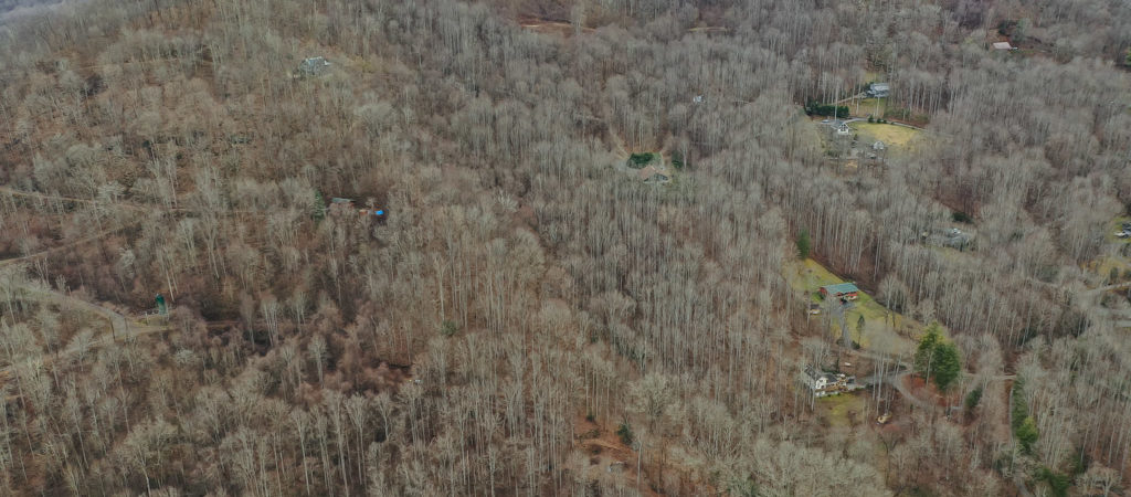
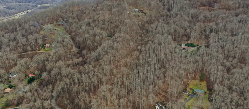
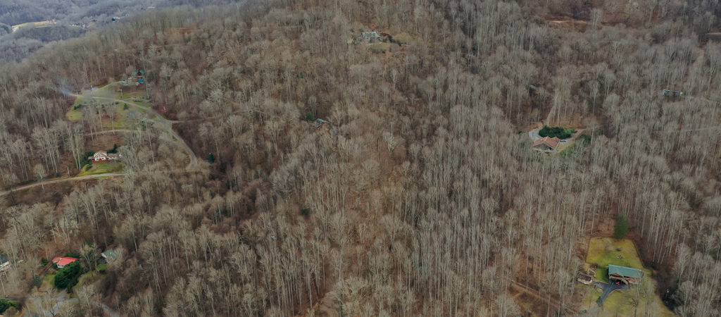
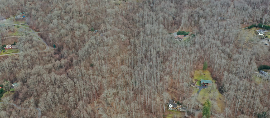
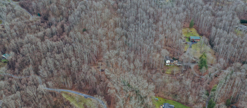
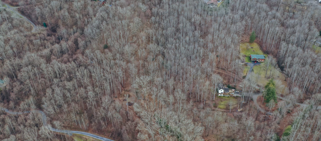
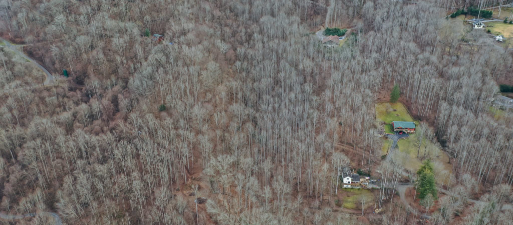
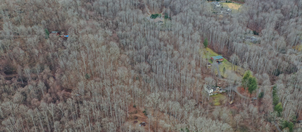
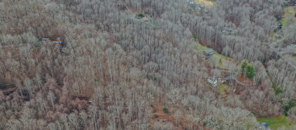
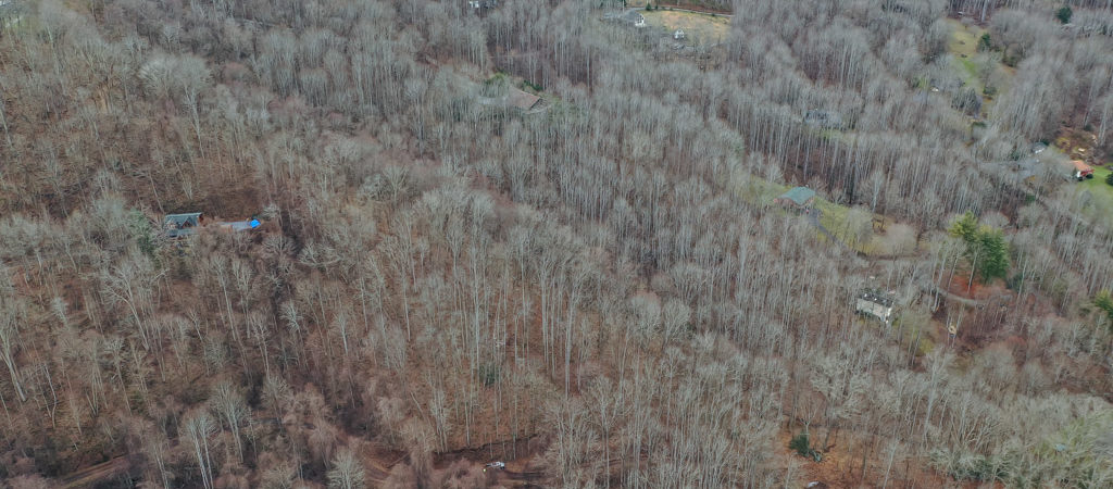
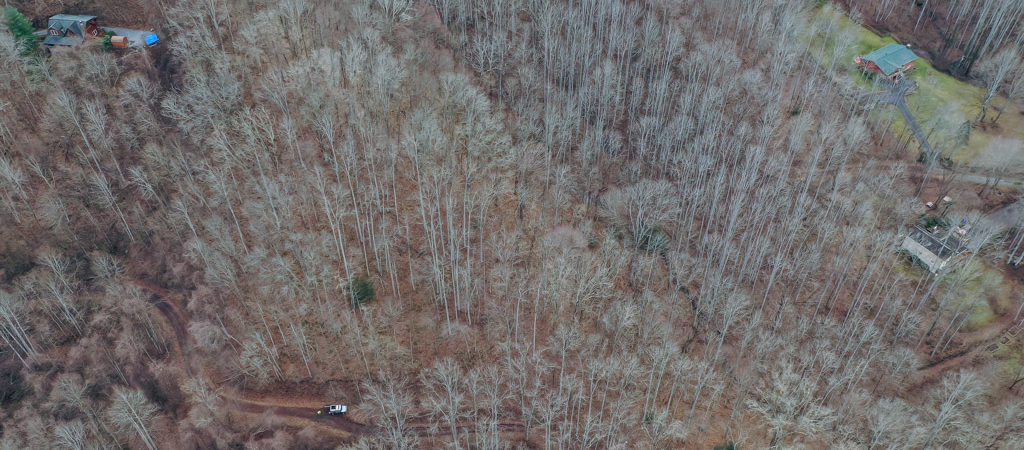
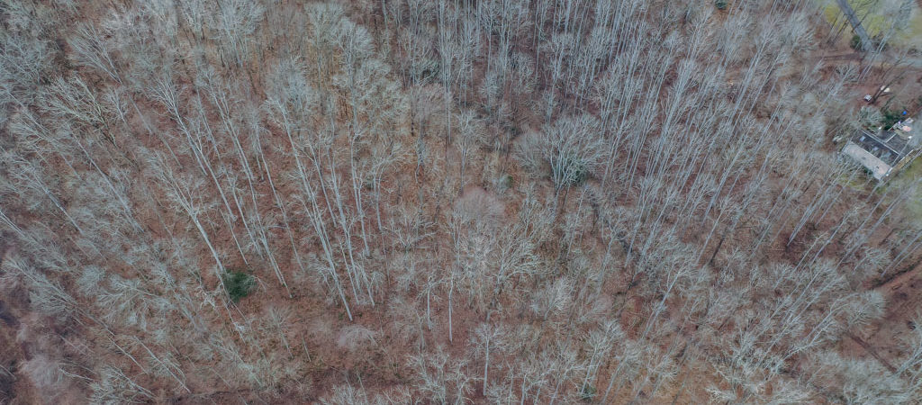
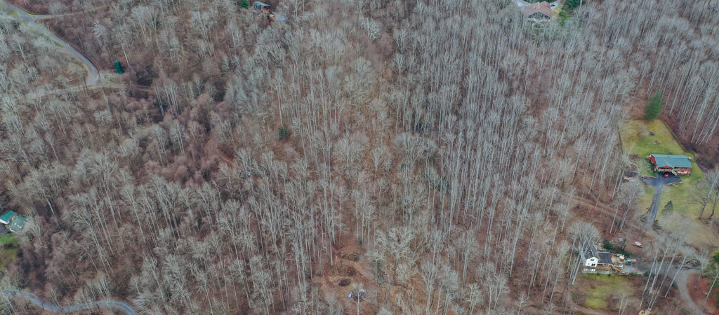
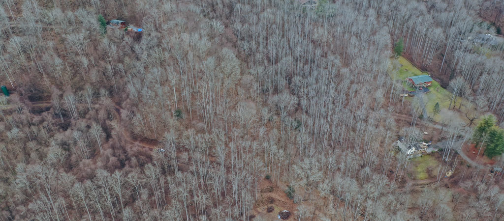
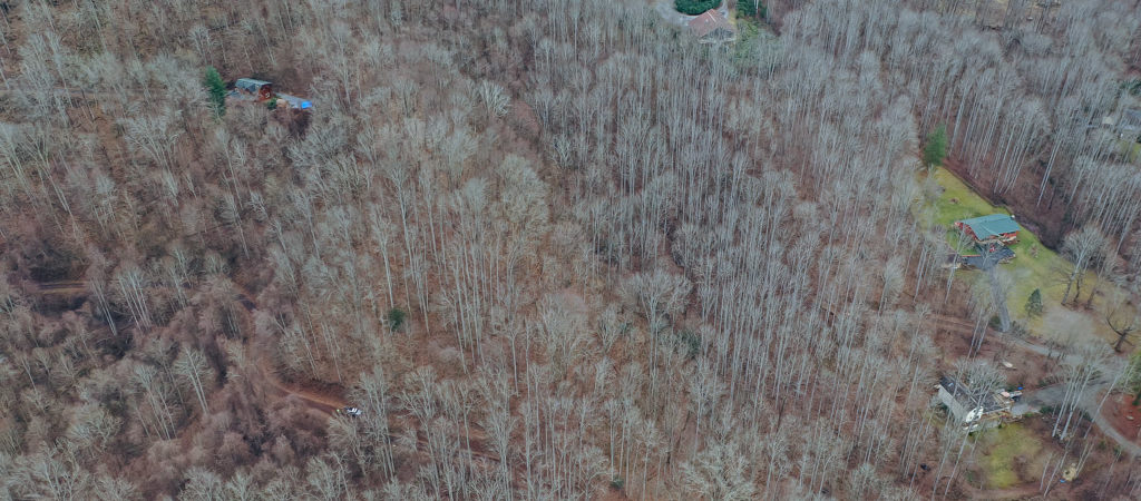
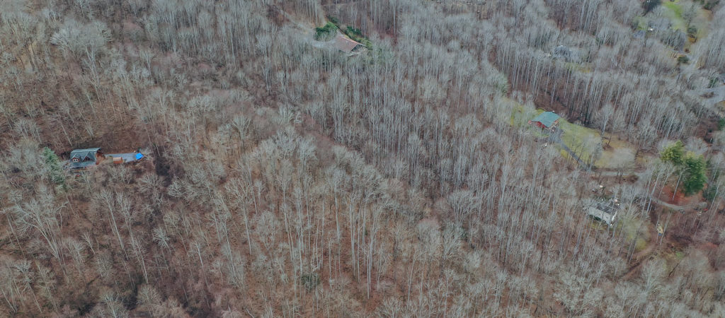
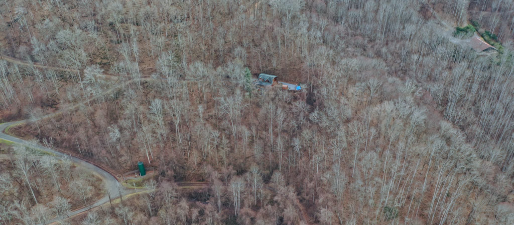
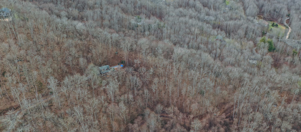
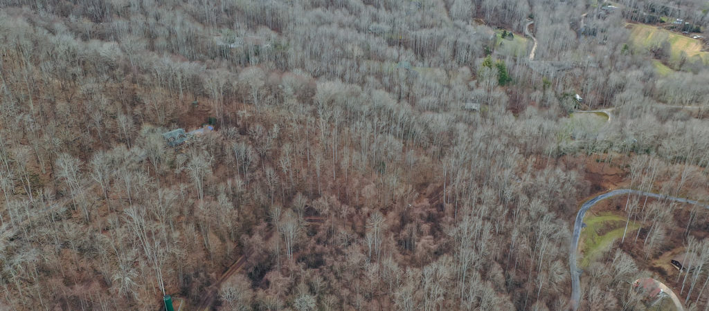
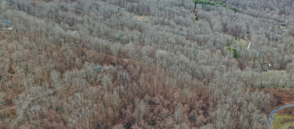
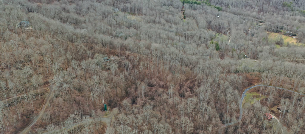
Welcome to your new homesite! This property at a glance:
Acreage: 1.57 acres
Assessed: $28,300.00
Priced: $22,500 ($5,800 below assessed value!)
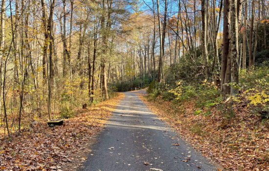
Nestled at the end of a private road in Mountain Lake Forest, this lot is ready for you to build your new mountain home while still having plenty of privacy and acreage. Get peace, privacy and serenity while not having to sacrifice being close to dining, shopping and amenities. Hop in your car and you’ll be a quick 15 minutes to downtown Waynesville. Only 45 minutes to find yourself in the heart of Asheville.
Do not hesitate to make this incredible 1.57 acre yours today, listed to sell at just $22,500. Call me at 858-261-7788 with any questions.
If you want to see this parcel in person, you can plug in the coordinates into your map Latitude: 35.5450726 Longitude: -83.0427444
NEARBY ATTRACTIONS/CITY
WAYNESVILLE, NORTH CAROLINA
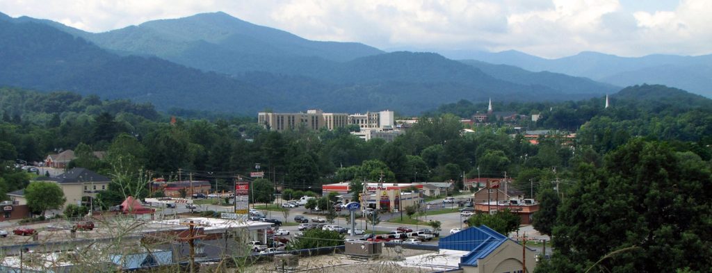
Waynesville is a town in and the county seat of Haywood County, North Carolina, United States.[5] It is the largest town in Haywood County and the largest in western North Carolina west of Asheville. Waynesville is located about 30 miles (50 km) southwest of Asheville between the Great Smoky and Blue Ridge mountains.
As of the 2010 census, Waynesville had a population of 9,869.[6] The town is located just outside the Pisgah National Forest and is close to the Great Smoky Mountains National Park and the Blue Ridge Parkway. Waynesville and Haywood County are part of the four-county Asheville Metropolitan Statistical Area, currently the fifth largest metropolitan area in North Carolina. It is the third largest town in the MSA behind the cities of Asheville and Hendersonville.
GEOGRAPHY
Waynesville is located southwest of the center of Haywood County at 35°29′00″N 82°59′40″W (35.483226, −82.994511),[7] in the valley of Richland Creek, a tributary of the Pigeon River. U.S. Routes 23 and 74 (the Great Smoky Mountains Expressway) form a bypass along the northwest side of the town, with access from Exits 98 through 102. The highways lead northeast to Asheville and southwest 18 miles (29 km) to Sylva. U.S. Route 276 passes through the center of Waynesville, following (from north to south) Russ Avenue, Walnut Street, Main Street, and Pigeon Street. US-276 leads north 5 miles (8 km) to Dellwood and southeast over Wagon Road Gap 39 miles (63 km) to Brevard
According to the United States Census Bureau, the town has a total area of 8.9 square miles (23.1 km2), all of it recorded as land.[6]
Most of the town of Waynesville lies between 2,600 and 3,000 feet (790 and 910 m) above sea level, in a valley among 5,000-to-6,410-foot (1,520 to 1,950 m) mountain peaks. With the high Great Balsam Mountains to the WSW, and the Plott Balsams to the WNW, a handful of peaks over 6000′ in elevation are clearly visible from town. A USGS survey marker at the old Haywood County Courthouse in downtown Waynesville lists the elevation as 2,752 feet (839 m) above sea level.
GOVERNMENT AND PUBLIC SAFETY
MUNICIPAL GOVERNMENT
The Town of Waynesville Mayor and the Board of Aldermen are elected to serve four year concurrent terms. The Board determines policy and budget direction, and the Town Manager,appointed by the Board, oversees and directs the day-to-day operations of the Town and all of its departments.[8]
PUBLIC SAFETY
The Waynesville police department has three divisions: Patrol, Criminal Investigations, Special Operations.
DEMOGRAPHICS
| Historical population | |||
|---|---|---|---|
| Census | Pop. | %± | |
| 1880 | 225 | — | |
| 1890 | 455 | 102.2% | |
| 1900 | 1,307 | 187.3% | |
| 1910 | 2,008 | 53.6% | |
| 1920 | 1,942 | −3.3% | |
| 1930 | 2,414 | 24.3% | |
| 1940 | 2,940 | 21.8% | |
| 1950 | 5,295 | 80.1% | |
| 1960 | 6,159 | 16.3% | |
| 1970 | 6,488 | 5.3% | |
| 1980 | 6,765 | 4.3% | |
| 1990 | 6,758 | −0.1% | |
| 2000 | 9,232 | 36.6% | |
| 2010 | 9,869 | 6.9% | |
| 2019 (est.) | 10,141 | [2] | 2.8% |
| U.S. Decennial Census[9] |
As of the census[3] of 2000, there were 9,232 people, 4,106 households, and 2,545 families residing in the town. The population density was 1,191.8 people per square mile (459.9/km2). There were 4,761 housing units at an average density of 614.6 per square mile (237.2/km2). The racial makeup of the town was 94.42% White, 3.31% African American, 0.54% Native American, 0.16% Asian, 0.08% Pacific Islander, 0.76% from other races, and 0.73% from two or more races. Hispanic or Latino of any race were 2.01% of the population.
There were 4,106 households, out of which 23.2% had children under the age of 18 living with them, 45.0% were married couples living together, 13.1% had a female householder with no husband present, and 38.0% were non-families. 34.0% of all households were made up of individuals, and 16.0% had someone living alone who was 65 years or older. The average household size was 2.16 and the average family size was 2.71.
In the town, the population was spread out, with 19.9% under the age of 18, 6.1% from 18 to 24, 25.5% from 25 to 44, 25.8% from 45 to 64, and 22.7% who were 65 years of age or older. The median age was 44 years. For every 100 females, there were 87.2 males. For every 100 females age 18 and over, there were 82.9 males.
The median income for a household in the town was $28,296, and the median income for a family was $36,404. Males had a median income of $26,374 versus $21,159 for females. The per capita income for the town was $17,821. 15.5% of the population and 12.6% of families were below the poverty line. Out of the total population, 24.3% of those under the age of 18 and 10.7% of those 65 and older were living below the poverty line.
As of late 2006 the town of Waynesville government estimated the population at 10,000.
CLIMATE
Waynesville has an oceanic climate under the Köppen climate classification (Köppen Cfb).
| hideClimate data for Waynesville, North Carolina, 2,658 ft (810 m) amsl (1981−2010 normals, extremes 1894−present) | |||||||||||||
|---|---|---|---|---|---|---|---|---|---|---|---|---|---|
| Month | Jan | Feb | Mar | Apr | May | Jun | Jul | Aug | Sep | Oct | Nov | Dec | Year |
| Record high °F (°C) | 78 (26) |
79 (26) |
89 (32) |
89 (32) |
92 (33) |
98 (37) |
98 (37) |
96 (36) |
92 (33) |
90 (32) |
83 (28) |
78 (26) |
98 (37) |
| Average high °F (°C) | 46.7 (8.2) |
50.1 (10.1) |
57.2 (14.0) |
65.5 (18.6) |
73.0 (22.8) |
79.2 (26.2) |
81.9 (27.7) |
81.1 (27.3) |
75.3 (24.1) |
67.1 (19.5) |
58.3 (14.6) |
49.0 (9.4) |
65.4 (18.6) |
| Average low °F (°C) | 22.0 (−5.6) |
25.0 (−3.9) |
30.8 (−0.7) |
38.4 (3.6) |
47.0 (8.3) |
55.2 (12.9) |
59.1 (15.1) |
58.5 (14.7) |
51.4 (10.8) |
39.7 (4.3) |
30.8 (−0.7) |
24.2 (−4.3) |
40.2 (4.6) |
| Record low °F (°C) | −22 (−30) |
−16 (−27) |
−8 (−22) |
15 (−9) |
24 (−4) |
31 (−1) |
40 (4) |
38 (3) |
27 (−3) |
12 (−11) |
0 (−18) |
−8 (−22) |
−22 (−30) |
| Average precipitation inches (mm) | 4.31 (109) |
4.48 (114) |
4.40 (112) |
3.76 (96) |
4.34 (110) |
4.07 (103) |
3.70 (94) |
4.20 (107) |
3.94 (100) |
2.65 (67) |
3.78 (96) |
4.09 (104) |
47.72 (1,212) |
| Average snowfall inches (cm) | 3.5 (8.9) |
2.3 (5.8) |
2.6 (6.6) |
1.2 (3.0) |
0.2 (0.51) |
0 (0) |
0 (0) |
0 (0) |
0 (0) |
trace | 0.4 (1.0) |
1.7 (4.3) |
11.9 (30) |
| Average precipitation days (≥ 0.01 in) | 10.7 | 10.8 | 11.7 | 11.5 | 12.6 | 13.0 | 14.1 | 12.6 | 10.1 | 8.4 | 10.1 | 11.0 | 136.6 |
| Average snowy days (≥ 0.1 in) | 2.1 | 2.1 | 1.3 | 0.3 | 0 | 0 | 0 | 0 | 0 | 0 | 0.4 | 1.4 | 7.6 |
| Source: NOAA[10][11] |
HISTORY
The town of Waynesville was founded in 1810 by Colonel Robert Love, a Revolutionary War soldier. He donated land for the courthouse, jail, and public square, and named the town after his former commander in the war, General “Mad” Anthony Wayne.
The Boone-Withers House, Citizens Bank and Trust Company Building, Former, Francis Grist Mill, Frog Level Historic District, Haywood County Courthouse, Alden and Thomasene Howell House, Masonic Hall, Charles and Annie Quinlan House, Clyde H. Ray Sr. House, Frank Smathers House, Spread Out Historic District, Waynesville Municipal Building, Dr. J. Howell Way House, and Waynesville Main Street Historic District are listed on the National Register of Historic Places.[12][13][14]
Waynesville was incorporated as a town in 1871. In July 1995, the towns of Hazelwood and Waynesville merged into one community and continued to grow with a population today of almost 10,000.
THE “BATTLE” OF WAYNESVILLE
Waynesville was the scene of the last and perhaps most unusual skirmish in the eastern theater of the American Civil War. On May 6, 1865, Union Colonel William C. Bartlett’s 2nd North Carolina (Federal) Mounted Infantry were attacked at White Sulphur Springs (east of Waynesville) by a detachment of rebels from Thomas’ Legion of Highlanders, who had been summoned by locals.
East of the Mississippi, Thomas’ Legion fired “The Last Shot” of the Civil War in White Sulphur Springs, North Carolina. The Legion consisted of Cherokee and White soldiers. Some of these soldiers had served under Jubal A. Early during the Shenandoah Valley Campaigns of 1864, but had been sent back to their native North Carolina mountains to engage in guerrilla warfare against the remaining Union forces.
The disoriented Union soldiers retreated into Waynesville, and on the evening of May 6 remaining elements of Thomas’ Legion surrounded the town. The soldiers lit numerous bonfires on the ridges above the town and engaged in war chants in an effort to intimidate the Federals. The following day the Confederate commanders Gen. James Green Martin and Col. William Holland Thomas (for whom the Legion was named) negotiated a surrender. These commanders had been made aware that Generals Robert E. Lee and Joseph E. Johnston had already surrendered and that continued hostilities would prove pointless.
FROG LEVEL
Waynesville Train Depot in Frog Level, c. 1890s
Waynesville began to see development after arrival of the railroad in 1884. The agricultural, lumber and tourism industries in Waynesville and Haywood County began to thrive as access to the west was opened up.
The area of Waynesville located along Richland Creek, northwest and downhill from Main Street, was where the railroad tracks were laid. Until this time the area had been essentially a swampland, with a few scattered buildings but no major development. Once the depot was built and the train arrived this section was developed. It was given the name of “Frog Level” by the local community because of its low-lying location along Richland Creek, the “frog level” when the area flooded.
Downtown and the nearby Frog Level commercial centers of Waynesville continued to be the central focus for social life, transportation, and wholesale and retail businesses through the 1940s. Businesses in the Frog Level area in the 1930s and 1940s included hardware stores, farm supplies, coal sales, auto dealers and garages, furniture stores, wholesale groceries, and warehouses and lumber companies, all of which were businesses dependent on the railroad.
As the automobile became the primary mode of transportation for most residents, the railroad declined in importance. This in turn led to a shift of business away from Frog Level. The last passenger train arrived in Waynesville in 1949, and freight trains pass through Frog Level twice daily, with most trains continuing on to Sylva.
By the 1980s the railroad in Waynesville had been integrated into the Southern Railway Company system. The first depot burned in 1900, but it was soon replaced with another depot that remained standing until 1987.
NEIGHBORHOODS
Downtown Waynesville in 2012
- Downtown – Once the primary retail business center of the town, downtown Waynesville is now home to art galleries, cafes, restaurants, shops, banks, doctors offices, and town and county government administration buildings.
- Frog Level – The historic district whose name came about because of frequent flooding of Richland Creek. As transportation shifted from railway to cars in the 1940s, business shifted up the hill to higher ground. By the ’70s and ’80s, Frog Level became known as a seedy part of downtown, mainly due to a now-closed bar called The Tap Room. In recent years, the revitalization of Main Street has spread down into this area. In 2003, the Frog Level Historic District was placed in the National Register of Historic Places. The local merchants association presents The Whole Bloomin’ Thing Spring Festival every year just before the last frost date, marking the start of planting season for the locals. The festival draws approximately 8,000 attendees to the area and features nature-related themes. The historic Murphy Branch of the old Western North Carolina Railroad runs through Frog Level and still carries freight rail traffic twice daily from the Blue Ridge Southern Railway, which now owns the line.
- Hazelwood – Due to financial troubles, this once independent town ceased to exist and was annexed by Waynesville in 1995. Its ZIP code is 28738.
- Laurel Ridge – The Laurel Ridge neighborhood is connected to a country club of the same name and features a golf course, pool, tennis courts, and upscale mountain homes.
- West Waynesville – Once the industrial part of town, West Waynesville is now home to Waynesville Commons, a large retail shopping center which sits on the site of an old Dayco rubber hose factory. The center includes retailers Walmart, Best Buy, Belk, PetSmart, Michaels, Rack Room Shoes, GameStop, Sally Beauty Supply, Verizon Wireless, US Cellular, Super Clips, Mattress Firm, and OneMain Financial.
- Russ Avenue – A newer business district featuring restaurants, retail stores, auto dealerships, banks, and grocery stores. Russ Avenue is the most traveled surface street in Haywood County and is slated for a major makeover by the NCDOT in 2020.
TRANSPORTATION
Waynesville calls itself the “Gateway to the Smokies”
Waynesville is connected to Interstate 40 and the rest of southwestern North Carolina via the Great Smoky Mountains Expressway, giving it easy access to Knoxville, Tennessee and Asheville. There is no airport in Haywood County mostly due to its close proximity to the Asheville Regional Airport and Knoxville’s McGhee Tyson Airport. Asheville is about a 40-minute drive east, Knoxville is an hour and a half to the northwest. The Great Smoky Mountains Expressway is a four-lane divided highway between Sylva and Exit 98 near West Waynesville. Then it is a four-lane freeway to Interstate 40 near Canton. It has exits for Hazelwood, West Waynesville and Russ Avenue through the town.
In 2014, Watco Companies purchased all of the railroad track running through Waynesville from Norfolk Southern for its Blue Ridge Southern Railroad short line. The line connects Waynesville by railroad to Sylva to the west, as well as to the interchange with Norfolk Southern at Asheville to the east. [15]
SCHOOLS
- Tuscola High School
- Waynesville Middle School
- Central Elementary School (formerly)
- Junaluska Elementary
- Hazelwood Elementary
WAYNESVILLE WATERSHED
Waynesville’s water supply is located south of the town, with a watershed that covers an area of 8,400 acres (34 km2) of town-owned land on the headwaters of Allens Creek. Tributary streams within the watershed flow into the Waynesville Reservoir, a 50-acre (200,000 m2) lake created by a dam on Allens Creek. The reservoir and surrounding watershed are classified by the state of North Carolina as WS-1. This classification is the state’s most stringent and forbids development within the watershed boundary.
FILM AND CULTURAL REFERENCES
Masterminds, a 2016 film based on the October 1997 Loomis Fargo Robbery in North Carolina features scenes in Waynesville such as the engagement scene of David and Jandice.
Cold Mountain, located 15 miles (24 km) southeast of Waynesville within the Pisgah National Forest, was made famous by the novel Cold Mountain by Charles Frazier. A major motion picture based on the novel was produced by Miramax Films in 2003.
Some scenes of the 1996 movie My Fellow Americans were filmed in western North Carolina. The scene where Jack Lemmon and James Garner are chased from a fast food restaurant parking lot in a car and a giant clown sign crashes through their windshield was filmed at the former Long John Silver’s, now a CellularSales.com Verizon wireless franchise location, on Russ Avenue in Waynesville. Over the Summer, a B movie filmed in the late 1980s, was produced by Haywood County native Buffy Queen and shot entirely in Frog Level.
Actor Gig Young, whose real name was Byron Elsworth Barr, is buried in the Green Hill Cemetery.
Riley Howell, a student who attended UNC Charlotte, was from Waynesville. He is remembered as a hero who sacrificed his life by tackling a gunman who opened fire on a classroom of students on April 30, 2019. Authorities were able to quickly detain the suspect due to his heroic actions.
Virtual Tour
1.6 Acre Mountain Estate Outside of Iron Duff, North Carolina in Haywood County